Chest opened
+${chestReward.xp} XP
Explorer
NOUVEAU ×${chestReward.collectible.quantity}
tapez pour fermer
Chest locked

Open chests in the app

Around Us is built for your phone — chests unlock when you walk, explore and capture nearby places.

Enable Location

We need your location to show you interesting places around you

Discover nearby places

Find interesting locations and hidden gems around you

Precise directions

Get accurate directions and distances to places

Your location is never shared with other users. It's only used when you tap the location button.

Matagorda Island

Log in to your account

Start exploring — it's free

Trusted by 72,972 travelers worldwide

Continue with Google
Continue with Apple
or

We will send you a code to connect

By continuing, you accept our Terms and Conditions and our Privacy Policy

Check your inbox

We've sent a pincode in your inbox. Please enter the code below.

Matagorda Island
Discussion Reviews 1 Photos
10.3k Popularity

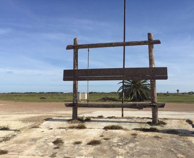
Matagorda Island, Barrier island in Calhoun County, Texas, US.

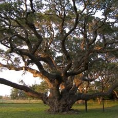
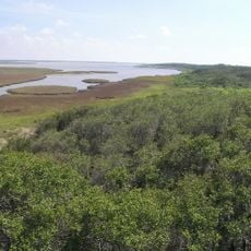
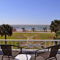
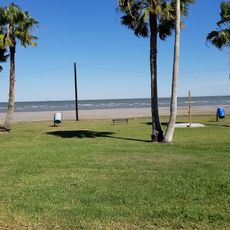
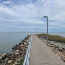
Matagorda Island is a barrier island stretching along the Texas Gulf Coast, with salt marshes, sandy beaches, and flat coastal terrain. The landscape reveals itself in different ways depending on tides and seasons, showing patterns of water channels, dunes, and open shoreline.

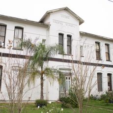
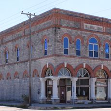
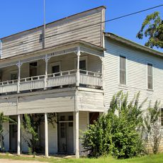
The island was acquired in 1940 through federal action for military training during World War II, establishing infrastructure that shaped its development. After the war, the land remained largely undeveloped and has retained its remote character ever since.

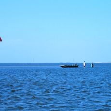
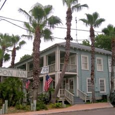
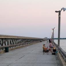
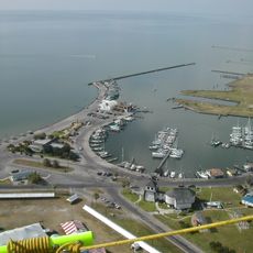
The local fishing heritage shapes how people use the waterways here, with generations relying on the surrounding bay for their livelihood. Visitors can still see boats anchoring near the island and catch glimpses of the traditional practices that continue to define life along this stretch of coast.

Access is only by boat from Port O'Connor, so visitors should bring all supplies they need for their stay. With no electricity, drinking water, or stores on the island, self-sufficiency and careful planning are essential.

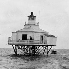
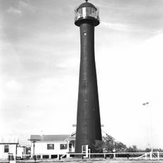
An 1852 lighthouse still stands at the northern end, a rare surviving structure from the island's maritime past. Few visitors expect to find such a historic marker in this remote location, making it a memorable discovery for those who explore.

The community of curious travelers

AroundUs brings together thousands of curated places, local tips, and hidden gems, enriched daily by 60,000 contributors worldwide.

Start exploring
Location
GPS coordinates
28.22720,-96.64030
Latest update
December 10, 2025 15:55
Around this place
The Big Tree
United States of America

The Big Tree

34 km
Texas Coastal Bend
United States of America

Texas Coastal Bend

30.4 km
Goose Island State Park
United States of America

Goose Island State Park

35.6 km
Aransas National Wildlife Refuge
United States of America

Aransas National Wildlife Refuge

23 km
George W. Fulton Mansion
United States of America

George W. Fulton Mansion

43.1 km
Tarpon Inn
United States of America

Tarpon Inn

59.9 km
Port Aransas Light Station
United States of America

Port Aransas Light Station

57.5 km
Copano Bay Fishing Pier
United States of America

Copano Bay Fishing Pier

39.1 km
Victoria Colored School
United States of America

Victoria Colored School

72.3 km
Halfmoon Reef Lighthouse
United States of America

Halfmoon Reef Lighthouse

45.7 km
Matagorda Island Lighthouse
United States of America

Matagorda Island Lighthouse

24.5 km
Rockport beach park
United States of America

Rockport beach park

45.3 km
Luther Hotel
United States of America

Luther Hotel

66.9 km
D. H. Regan House
United States of America

D. H. Regan House

72.5 km
John Howland Wood House
United States of America

John Howland Wood House

58.1 km
Hurricane Harvey
United States of America

Hurricane Harvey

46.9 km
T. H. Mathis House
United States of America

T. H. Mathis House

46.8 km
King Fisher Beach
United States of America

King Fisher Beach

34.1 km
Hoopes-Smith House
United States of America

Hoopes-Smith House

46 km
Refugio County Courthouse
United States of America

Refugio County Courthouse

62.8 km
Webster Chapel United Methodist Church
United States of America

Webster Chapel United Methodist Church

72.5 km
Max Bettin House
United States of America

Max Bettin House

72.5 km
R. J. Hill Building
United States of America

R. J. Hill Building

67.2 km
Lighthouse Beach
United States of America

Lighthouse Beach

45.9 km
McCabe Building
United States of America

McCabe Building

72.5 km
Texas Maritime Museum Light
United States of America

Texas Maritime Museum Light

45.8 km
Tarpon Inn
United States of America

Tarpon Inn

59.9 km
Rene Robert Cavaelier de La Salle Monument
United States of America

Rene Robert Cavaelier de La Salle Monument

37.6 km
Show the full map
Reviews
Share your experience

No review yet

Discussions
Start a discussion...

No discussion yet

« Matagorda Island - Barrier island in Calhoun County, Texas, US » is provided by Around Us (aroundus.com). Images and texts are derived from Wikimedia project under a Creative Commons license. You are allowed to copy, distribute, and modify copies of this page, under the conditions set by the license, as long as this note is clearly visible.

Discover hidden gems everywhere you go!

From secret cafés to breathtaking viewpoints, skip the crowded tourist spots and find places that match your style. Our app makes it easy with voice search, smart filtering, route optimization, and insider tips from travelers worldwide. Download now for the complete mobile experience.

Around Us App Screenshot

A unique approach to discovering new places

Le Figaro

All the places worth exploring

France Info

A tailor-made excursion in just a few clicks

20 Minutes

Around Us
Travel Guide & Maps
Download

Send to your phone

QR Code
1

Open the camera app on your mobile.

2

Point at the QR code with your camera. A notification will appear.

3

Tap the notification to open the link.