Enable Location

We need your location to show you interesting places around you

Discover nearby places

Find interesting locations and hidden gems around you

Precise directions

Get accurate directions and distances to places

Your location is never shared with other users. It's only used when you tap the location button.

Bailey County

Log in to your account

Start exploring — it's free

Trusted by 62,490 travelers worldwide

Continue with Google
Continue with Apple
or

We will send you a code to connect

By continuing, you accept our Terms and Conditions and our Privacy Policy

Check your inbox

We've sent a pincode in your inbox. Please enter the code below.

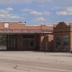
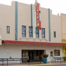
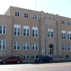
Bailey County, County in Texas, United States.

Bailey County is an administrative division in West Texas covering approximately 827 square miles (2,142 square kilometers), with Muleshoe as its county seat. Three major highways—U.S. 70, U.S. 84, and State Highway 214—cross through the area and link it to neighboring regions.

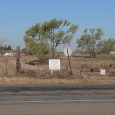
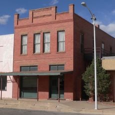
The county was established in 1876 from parts of Bexar County and named after Peter James Bailey, who fought at the Alamo. This founding shaped how this Texas High Plains region developed in the decades that followed.

The Muleshoe Heritage Center displays regional artifacts that show how this Texas High Plains community developed and grew over time. These collections reflect what residents value about their local past.

The area is relatively flat and spread out, so a car is essential for exploring. Visitors should plan extra time for travel since distances between destinations are larger than in more populated regions.

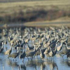
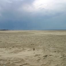
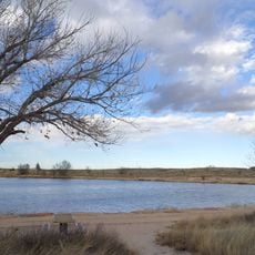
The Muleshoe National Wildlife Refuge, established in 1935, was the first of its kind in Texas. It remains an important stopover for migratory birds and offers visitors chances to spot species that pass through seasonally.

The community of curious travelers

AroundUs brings together thousands of curated places, local tips, and hidden gems, enriched daily by 60,000 contributors worldwide.

Start exploring
GPS coordinates
34.03492,-102.81494
Latest update
December 7, 2025 20:49
Around this place
Jones AT&T Stadium
United States of America

Jones AT&T Stadium

100.2 km
Lubbock Lake Landmark
United States of America

Lubbock Lake Landmark

97.1 km
Dan Law Field at Rip Griffin Park
United States of America

Dan Law Field at Rip Griffin Park

100 km
Reese Technology Center
United States of America

Reese Technology Center

86.5 km
Silent Wings Museum
United States of America

Silent Wings Museum

100.1 km
Hotel Clovis
United States of America

Hotel Clovis

54.2 km
Museum of Texas Tech University
United States of America

Museum of Texas Tech University

99.2 km
Blackwater Draw archaeological site
United States of America

Blackwater Draw archaeological site

54.2 km
Muleshoe National Wildlife Refuge
United States of America

Muleshoe National Wildlife Refuge

10.3 km
Grulla National Wildlife Refuge
United States of America

Grulla National Wildlife Refuge

24.2 km
Lubbock Texas Temple
United States of America

Lubbock Texas Temple

98.5 km
Oasis State Park
United States of America

Oasis State Park

55.1 km
State Theater
United States of America

State Theater

54.5 km
First Methodist Church of Clovis
United States of America

First Methodist Church of Clovis

55.5 km
Roosevelt County Courthouse
United States of America

Roosevelt County Courthouse

50.9 km
Tubbs-Carlisle House
United States of America

Tubbs-Carlisle House

94.4 km
Midway Service Station
United States of America

Midway Service Station

91 km
Lyceum Theatre
United States of America

Lyceum Theatre

54.4 km
1908 Clovis City Hall and Fire Station
United States of America

1908 Clovis City Hall and Fire Station

54.1 km
Curry County Courthouse
United States of America

Curry County Courthouse

54.7 km
Lubbock Water Rampage
United States of America

Lubbock Water Rampage

96.1 km
Bank of Portales
United States of America

Bank of Portales

51 km
Clovis Central Fire Station
United States of America

Clovis Central Fire Station

54.4 km
Administration Building
United States of America

Administration Building

51.7 km
Holden Properties Historic District
United States of America

Holden Properties Historic District

100.3 km
Deaf Smith County Historical Museum
United States of America

Deaf Smith County Historical Museum

95.2 km
Carlile Theater
United States of America

Carlile Theater

73.7 km
Anton Tin Man Water Tower
United States of America

Anton Tin Man Water Tower

65 km
Show the full map
« Bailey County - County in Texas, United States » is provided by Around Us (aroundus.com). Images and texts are derived from Wikimedia project under a Creative Commons license. You are allowed to copy, distribute, and modify copies of this page, under the conditions set by the license, as long as this note is clearly visible.

Discover hidden gems everywhere you go!

From secret cafés to breathtaking viewpoints, skip the crowded tourist spots and find places that match your style. Our app makes it easy with voice search, smart filtering, route optimization, and insider tips from travelers worldwide. Download now for the complete mobile experience.

Around Us App Screenshot

A unique approach to discovering new places

Le Figaro

All the places worth exploring

France Info

A tailor-made excursion in just a few clicks

20 Minutes

Around Us
Travel Guide & Maps
Download

Send to your phone

QR Code
1

Open the camera app on your mobile.

2

Point at the QR code with your camera. A notification will appear.

3

Tap the notification to open the link.