Enable Location

We need your location to show you interesting places around you

Discover nearby places

Find interesting locations and hidden gems around you

Precise directions

Get accurate directions and distances to places

Your location is never shared with other users. It's only used when you tap the location button.

Bryan–College Station metropolitan area

Log in to your account

Start exploring — it's free

Trusted by 67,526 travelers worldwide

Continue with Google
Continue with Apple
or

We will send you a code to connect

By continuing, you accept our Terms and Conditions and our Privacy Policy

Check your inbox

We've sent a pincode in your inbox. Please enter the code below.

Bryan–College Station metropolitan area
Discussion Reviews 1 Photos
15.1k Popularity

Bryan–College Station metropolitan area, Metropolitan area in East-Central Texas, United States.

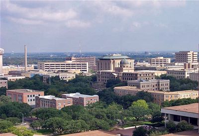
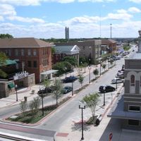
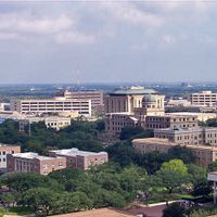
The Bryan-College Station metropolitan area encompasses three counties in the Brazos Valley covering about 2,100 square miles, with Texas A&M University forming its geographic and cultural center. The two main cities are closely connected through roads and transit systems.

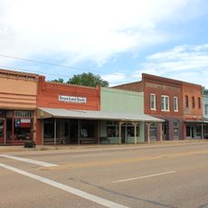
The region developed following the completion of the Houston and Texas Central Railway in 1860, which encouraged settlement. The founding of Texas A&M University in 1876 marked a turning point for the area's growth.

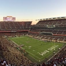
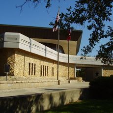
The region is deeply tied to Texas A&M University, where students and residents participate together in sporting events and academic activities. University life shapes daily routines and community identity.

The area is served by Brazos Transit District with buses connecting residential areas, the campus, and shopping centers. Car travel is common for most trips, making a vehicle helpful for exploring the broader region.

The median age is around 29 years, well below the national average, because of the large student population that shapes the area. This makes the region one of the youngest in the country.

The community of curious travelers

AroundUs brings together thousands of curated places, local tips, and hidden gems, enriched daily by 60,000 contributors worldwide.

Start exploring
Location
GPS coordinates
30.63350,-96.34060
Latest update
March 5, 2026 16:38
Around this place
Kyle Field
United States of America

Kyle Field

2.6 km
George Bush Presidential Library
United States of America

George Bush Presidential Library

4.3 km
Olsen Field at Blue Bell Park
United States of America

Olsen Field at Blue Bell Park

3.1 km
Santa's Wonderland
United States of America

Santa's Wonderland

17.2 km
Gibbons Creek Reservoir
United States of America

Gibbons Creek Reservoir

26.5 km
Fanthorp Inn State Historic Site
United States of America

Fanthorp Inn State Historic Site

38.1 km
Aggie Doppler Radar
United States of America

Aggie Doppler Radar

2.6 km
Seward Plantation
United States of America

Seward Plantation

34.8 km
Mrs. Sam Houston House
United States of America

Mrs. Sam Houston House

35 km
LaSalle Hotel
United States of America

LaSalle Hotel

5.4 km
Saint Anthony's Catholic Church
United States of America

Saint Anthony's Catholic Church

5.4 km
Star of the Republic Museum
United States of America

Star of the Republic Museum

38.9 km
Calvert Historic District
United States of America

Calvert Historic District

49.9 km
Brazos Valley Museum of Natural History
United States of America

Brazos Valley Museum of Natural History

4.2 km
Temple Freda
United States of America

Temple Freda

5.5 km
R. Q. Astin House
United States of America

R. Q. Astin House

5.8 km
Franklin Carnegie Library
United States of America

Franklin Carnegie Library

45.9 km
Chapelton Vineyards

Chapelton Vineyards

41.4 km
Hammond House
United States of America

Hammond House

49.9 km
Thomas, Jr., and Mary Kraitchar House
United States of America

Thomas, Jr., and Mary Kraitchar House

35.4 km
Museum of the American G. I.
United States of America

Museum of the American G. I.

17.6 km
Old Baylor Park
United States of America

Old Baylor Park

35.1 km
The Children's Museum of the Brazos Valley
United States of America

The Children's Museum of the Brazos Valley

5.3 km
Robertson County Courthouse
United States of America

Robertson County Courthouse

46 km
The Grand Stafford Theater
United States of America

The Grand Stafford Theater

5.5 km
Bryan Ice House
United States of America

Bryan Ice House

6 km
Children's Museum
United States of America

Children's Museum

5.3 km
Minnie Zulch Zimmerman House
United States of America

Minnie Zulch Zimmerman House

5.6 km
Show the full map
Reviews
Share your experience

No review yet

Discussions
Start a discussion...

No discussion yet

Administrative divisions
« Bryan–College Station metropolitan area - Metropolitan area in East-Central Texas, United States » is provided by Around Us (aroundus.com). Images and texts are derived from Wikimedia project under a Creative Commons license. You are allowed to copy, distribute, and modify copies of this page, under the conditions set by the license, as long as this note is clearly visible.

Discover hidden gems everywhere you go!

From secret cafés to breathtaking viewpoints, skip the crowded tourist spots and find places that match your style. Our app makes it easy with voice search, smart filtering, route optimization, and insider tips from travelers worldwide. Download now for the complete mobile experience.

Around Us App Screenshot

A unique approach to discovering new places

Le Figaro

All the places worth exploring

France Info

A tailor-made excursion in just a few clicks

20 Minutes

Around Us
Travel Guide & Maps
Download

Send to your phone

QR Code
1

Open the camera app on your mobile.

2

Point at the QR code with your camera. A notification will appear.

3

Tap the notification to open the link.