Enable Location

We need your location to show you interesting places around you

Discover nearby places

Find interesting locations and hidden gems around you

Precise directions

Get accurate directions and distances to places

Your location is never shared with other users. It's only used when you tap the location button.

Confederate Reunion Grounds State Historic Site

Log in to your account

Start exploring — it's free

Trusted by 61,895 travelers worldwide

Continue with Google
Continue with Apple
or

We will send you a code to connect

By continuing, you accept our Terms and Conditions and our Privacy Policy

Check your inbox

We've sent a pincode in your inbox. Please enter the code below.

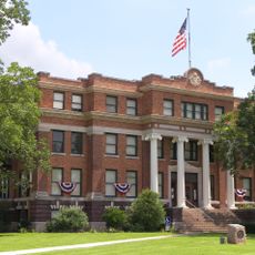
Confederate Reunion Grounds State Historic Site, Historic site in Limestone County, United States

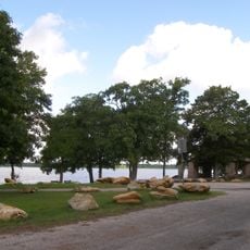
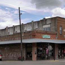
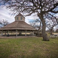
Confederate Reunion Grounds is a historic site in Limestone County featuring Victorian-era buildings and structures from the late 1800s. The property includes a dance pavilion, mature oak trees, and sits along natural waterways with springs.

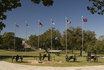
The site was established in 1889 to serve as an annual gathering place for Civil War veterans through 1946. A cannon preserved there was captured from Union forces during the Battle of Mansfield, marking a significant moment from the conflict.

The name reflects the annual veterans gatherings that took place here, where former soldiers came together to reminisce and support one another. Visitors today can sense how this assembly point shaped the local community through its architecture and open spaces designed for congregation and shared memory.

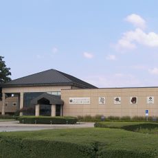
The site is managed by the Texas Historical Commission and welcomes visitors with guided tours and educational programs available. The grounds include mature trees and natural waterways, so comfortable walking shoes are recommended for exploring the property.

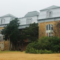
The grounds preserve records from the Mexia Oil Boom spanning from 1920 through 1996, showing how petroleum shaped the region's economic development. These documents offer visitors insight into a lesser-known chapter of the area's transformation.

The community of curious travelers

AroundUs brings together thousands of curated places, local tips, and hidden gems, enriched daily by 60,000 contributors worldwide.

Start exploring
Location
Architectural style
Victorian architecture
Address
4 mi. W of Mexia on SR 1633
GPS coordinates
31.63300,-96.55900
Latest update
December 13, 2025 11:42
Around this place
Mount Carmel Center
United States of America

Mount Carmel Center

40.9 km
Magnolia Market
United States of America

Magnolia Market

54.9 km
ALICO Building
United States of America

ALICO Building

55 km
Texas Ranger Hall of Fame and Museum
United States of America

Texas Ranger Hall of Fame and Museum

53.8 km
Waco Suspension Bridge
United States of America

Waco Suspension Bridge

54.5 km
Ferrell Center
United States of America

Ferrell Center

52.7 km
Fort Parker State Park
United States of America

Fort Parker State Park

3.4 km
Texas Sports Hall of Fame
United States of America

Texas Sports Hall of Fame

53.7 km
Dr. Pepper Museum building
United States of America

Dr. Pepper Museum building

54.8 km
Baylor Ballpark
United States of America

Baylor Ballpark

52.8 km
Fairfield Lake State Park
United States of America

Fairfield Lake State Park

49.1 km
Mayborn Museum Complex
United States of America

Mayborn Museum Complex

53.5 km
Temple Beth-El
United States of America

Temple Beth-El

51.5 km
Washington Avenue Bridge
United States of America

Washington Avenue Bridge

54.6 km
Texas Hall
United States of America

Texas Hall

12.4 km
Navarro County Courthouse
United States of America

Navarro County Courthouse

52.2 km
Trinity and Brazos Valley Railroad Depot and Office Building
United States of America

Trinity and Brazos Valley Railroad Depot and Office Building

26 km
Groppe Building
United States of America

Groppe Building

53.9 km
Texas Sports Hall of Fame
United States of America

Texas Sports Hall of Fame

53.7 km
Texas Ranger Research Center
United States of America

Texas Ranger Research Center

53.8 km
Confederate Reunion Grounds State Historic Site
United States of America

Confederate Reunion Grounds State Historic Site

191 m
Falls County Courthouse
United States of America

Falls County Courthouse

48.6 km
Palace Theater
United States of America

Palace Theater

51.9 km
Palace Theatre
United States of America

Palace Theatre

48.3 km
Freestone County Courthouse
United States of America

Freestone County Courthouse

39.2 km
Best Theater
United States of America

Best Theater

53.9 km
Mills Place Historic District
United States of America

Mills Place Historic District

51.8 km
Best Theatre Building
United States of America

Best Theatre Building

53.9 km
Show the full map
« Confederate Reunion Grounds State Historic Site - Historic site in Limestone County, United States » is provided by Around Us (aroundus.com). Images and texts are derived from Wikimedia project under a Creative Commons license. You are allowed to copy, distribute, and modify copies of this page, under the conditions set by the license, as long as this note is clearly visible.

Discover hidden gems everywhere you go!

From secret cafés to breathtaking viewpoints, skip the crowded tourist spots and find places that match your style. Our app makes it easy with voice search, smart filtering, route optimization, and insider tips from travelers worldwide. Download now for the complete mobile experience.

Around Us App Screenshot

A unique approach to discovering new places

Le Figaro

All the places worth exploring

France Info

A tailor-made excursion in just a few clicks

20 Minutes

Around Us
Travel Guide & Maps
Download

Send to your phone

QR Code
1

Open the camera app on your mobile.

2

Point at the QR code with your camera. A notification will appear.

3

Tap the notification to open the link.