Enable Location

We need your location to show you interesting places around you

Discover nearby places

Find interesting locations and hidden gems around you

Precise directions

Get accurate directions and distances to places

Your location is never shared with other users. It's only used when you tap the location button.

Grayson County

Log in to your account

Start exploring — it's free

Trusted by 62,487 travelers worldwide

Continue with Google
Continue with Apple
or

We will send you a code to connect

By continuing, you accept our Terms and Conditions and our Privacy Policy

Check your inbox

We've sent a pincode in your inbox. Please enter the code below.

Grayson County, Administrative division in North Texas, United States.

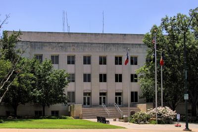
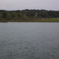
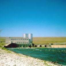
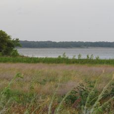
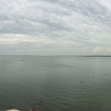
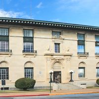
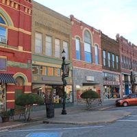
Grayson County is an administrative division in North Texas along the Texas-Oklahoma border that spans a large expanse of land. The Red River and Lake Texoma shape the landscape, while Sherman-Denison serves as the hub for business and government functions.

The Peters Colony Initiative of the 1840s brought settlers to the area near the Red River and led to the establishment of Grayson County in 1846. This early settlement shaped the region's development and its importance in North Texas.

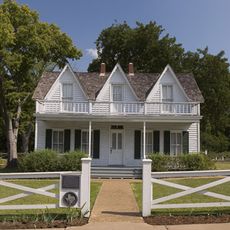
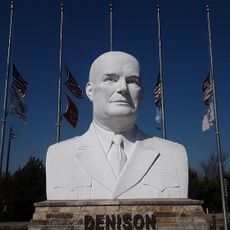
The Eisenhower Birthplace State Historic Site preserves the house where President Dwight D. Eisenhower was born and lets visitors explore his early life through tours and displays. The location holds special meaning for the local community as a connection to American presidential history.

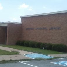
The North Texas Regional Airport provides flight connections for the region. Visitors should allow adequate time to explore different areas since the county is spread across considerable distances.

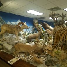
The area is known for a special hunting regulation that permits deer hunting exclusively with bow and arrow during all hunting seasons. This rule sets it apart from other regions and has roots in the local hunting tradition.

The community of curious travelers

AroundUs brings together thousands of curated places, local tips, and hidden gems, enriched daily by 60,000 contributors worldwide.

Start exploring
Location
Inception
March 17, 1846
Capital city
Sherman
Shares border with
Marshall County, Bryan County, Fannin County, Collin County, Denton County, Cooke County, Love County
GPS coordinates
33.62000,-96.68000
Latest update
December 20, 2025 00:25
Around this place
Lake Texoma
United States of America

Lake Texoma

25.7 km
Choctaw Casino Resort
United States of America

Choctaw Casino Resort

44.4 km
Eisenhower Birthplace State Historic Site
United States of America

Eisenhower Birthplace State Historic Site

19.7 km
Denison Dam
United States of America

Denison Dam

24.2 km
Hagerman National Wildlife Refuge
United States of America

Hagerman National Wildlife Refuge

14.6 km
Eisenhower State Park
United States of America

Eisenhower State Park

23.1 km
United States of America

Bloomfield Academy

33.9 km
Sherman Municipal Airport
United States of America

Sherman Municipal Airport

8.6 km
Paul Brown Federal Building and United States Courthouse
United States of America

Paul Brown Federal Building and United States Courthouse

6.9 km
Harber Wildlife Museum
United States of America

Harber Wildlife Museum

11.6 km
Eisenhower Veterans Monument
United States of America

Eisenhower Veterans Monument

14.9 km
United States of America

Big Mineral Public Use Area

14.3 km
United States of America

Island View Public Use Area

26.9 km
United States of America

Randell Lake

21.3 km
United States of America

Roberts House

6.7 km
United States of America

Walnut Street Church of Christ

6.9 km
United States of America

Gunter Lake

20.7 km
United States of America

Denison Commercial Historic District

20 km
United States of America

Samuel E. and Mary C. Marshall House

28.8 km
United States of America

St. Mary's Catholic Church

6.9 km
United States of America

Soil Conservation Service Site 6 Reservoir

25.2 km
United States of America

Soil Conservation Service Site 17 Reservoir

15.3 km
United States of America

Hall Furniture Building

6.7 km
United States of America

Masonic Temple 1924

6.9 km
United States of America

Soil Conservation Service Site 18 Reservoir

13.2 km
United States of America

Barron-Veazey House

24.9 km
United States of America

Edward Metz House

6.7 km
United States of America

Old Kirkpatrick Home

30.3 km
Show the full map
Administrative divisions
« Grayson County - Administrative division in North Texas, United States » is provided by Around Us (aroundus.com). Images and texts are derived from Wikimedia project under a Creative Commons license. You are allowed to copy, distribute, and modify copies of this page, under the conditions set by the license, as long as this note is clearly visible.

Discover hidden gems everywhere you go!

From secret cafés to breathtaking viewpoints, skip the crowded tourist spots and find places that match your style. Our app makes it easy with voice search, smart filtering, route optimization, and insider tips from travelers worldwide. Download now for the complete mobile experience.

Around Us App Screenshot

A unique approach to discovering new places

Le Figaro

All the places worth exploring

France Info

A tailor-made excursion in just a few clicks

20 Minutes

Around Us
Travel Guide & Maps
Download

Send to your phone

QR Code
1

Open the camera app on your mobile.

2

Point at the QR code with your camera. A notification will appear.

3

Tap the notification to open the link.