Chest opened
+${chestReward.xp} XP
Explorer
NOUVEAU ×${chestReward.collectible.quantity}
tapez pour fermer
Chest locked

Open chests in the app

Around Us is built for your phone — chests unlock when you walk, explore and capture nearby places.

Enable Location

We need your location to show you interesting places around you

Discover nearby places

Find interesting locations and hidden gems around you

Precise directions

Get accurate directions and distances to places

Your location is never shared with other users. It's only used when you tap the location button.

Log in to your account

Start exploring — it's free

Trusted by 72,883 travelers worldwide

Continue with Google
Continue with Apple
or

We will send you a code to connect

By continuing, you accept our Terms and Conditions and our Privacy Policy

Check your inbox

We've sent a pincode in your inbox. Please enter the code below.

Discussion Reviews Photo
21.8k Popularity

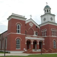
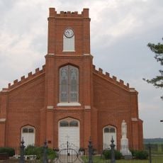
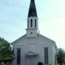
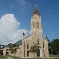
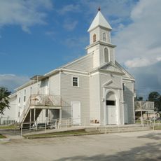
Pierre Part, Census-designated place in Assumption Parish, Louisiana, United States.

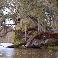
Pierre Part is a small settlement near Lake Verret where waterways flow through residential neighborhoods and local fishing spots. The community sits along Louisiana Highway 70, connecting it to surrounding areas.

Acadian settlers founded this place after their expulsion from Canada in 1755, establishing a new community in Louisiana territory. This settlement became part of a broader wave of people building new lives in the southern French colonies.

French language remains woven into daily life here, with residents speaking it at home and maintaining this rare linguistic tradition across generations in the United States. The language shapes how people interact and connect within the community.

Access to the area is mainly by vehicle via Louisiana Highway 70, while waterways allow for boating and recreational activities. Visitors should expect wet conditions and seasonal water levels that may affect accessibility to certain areas.

The area remained cut off by water until the mid-1900s, which allowed traditional fishing practices and local customs to survive unchanged. This geographic isolation meant the community kept its own ways for generations before modern roads connected it to the outside.

The community of curious travelers

AroundUs brings together thousands of curated places, local tips, and hidden gems, enriched daily by 60,000 contributors worldwide.

Start exploring
GPS coordinates
29.96110,-91.20670
Latest update
March 4, 2026 16:16
Around this place
Bayou Corne sinkhole
United States of America

Bayou Corne sinkhole

8.2 km
Nottoway Plantation
United States of America

Nottoway Plantation

25.3 km
Madewood Plantation House
United States of America

Madewood Plantation House

20.9 km
United States of America

National Hansen's Disease Museum

27.6 km
Carville Historic District
United States of America

Carville Historic District

27.4 km
Belle Alliance Plantation
United States of America

Belle Alliance Plantation

19.8 km
Evan Hall
United States of America

Evan Hall

23.4 km
Oaklawn Manor
United States of America

Oaklawn Manor

28.1 km
St. Emma Plantation
United States of America

St. Emma Plantation

21.8 km
River Road African American Museum
United States of America

River Road African American Museum

26.1 km
Palo Alto Plantation
United States of America

Palo Alto Plantation

22.3 km
Tally-Ho Plantation House
United States of America

Tally-Ho Plantation House

28.1 km
Long-Allen Bridge
United States of America

Long-Allen Bridge

29.4 km
St. Elizabeth Catholic Church
United States of America

St. Elizabeth Catholic Church

14.7 km
St. Anne Catholic Church
United States of America

St. Anne Catholic Church

17.6 km
United States of America

Attakapas Wildlife Management Area

24.8 km
United States of America

Elm Hall Wildlife Management Area

9 km
Church of the Assumption of the Blessed Virgin Mary
United States of America

Church of the Assumption of the Blessed Virgin Mary

18 km
United States of America

E. J. "Lionel" Grizzaffi Bridge

29.6 km
Landry Tomb
United States of America

Landry Tomb

26.3 km
Christ Episcopal Church and Cemetery
United States of America

Christ Episcopal Church and Cemetery

17.6 km
Pharr Chapel United Methodist Church
United States of America

Pharr Chapel United Methodist Church

29.5 km
St. Philomene Catholic Church and Rectory
United States of America

St. Philomene Catholic Church and Rectory

27.9 km
St. John Baptist Church
United States of America

St. John Baptist Church

24.4 km
LaBarre House
United States of America

LaBarre House

20.3 km
United States of America

Harlem Theatre

25.9 km
United States of America

Morgan City Historic District

29.6 km
United States of America

Bayou Side Golf Course

16.8 km
Show the full map
Reviews
Share your experience

No review yet

Discussions
Start a discussion...

No discussion yet

« Pierre Part - Census-designated place in Assumption Parish, Louisiana, United States » is provided by Around Us (aroundus.com). Images and texts are derived from Wikimedia project under a Creative Commons license. You are allowed to copy, distribute, and modify copies of this page, under the conditions set by the license, as long as this note is clearly visible.

Discover hidden gems everywhere you go!

From secret cafés to breathtaking viewpoints, skip the crowded tourist spots and find places that match your style. Our app makes it easy with voice search, smart filtering, route optimization, and insider tips from travelers worldwide. Download now for the complete mobile experience.

Around Us App Screenshot

A unique approach to discovering new places

Le Figaro

All the places worth exploring

France Info

A tailor-made excursion in just a few clicks

20 Minutes

Around Us
Travel Guide & Maps
Download

Send to your phone

QR Code
1

Open the camera app on your mobile.

2

Point at the QR code with your camera. A notification will appear.

3

Tap the notification to open the link.