Carville Historic District

Log in to your account

AroundUs is a community-driven map of interesting places, built by curious explorers like you. It grows with every review, story, and photo you share.
Connect to save your favorite spots, contribute locations, and create personalized routes.
Continue with Google
Continue with Apple
Continue with X
Continue with Facebook
Continue with email
By continuing, you accept our Terms and Conditions and our Privacy Policy
Create an account
Add to collection
Map
Suggest a change
Share

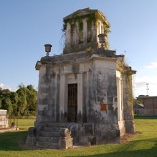
Carville Historic District, Medical historic district in Iberville Parish, US.

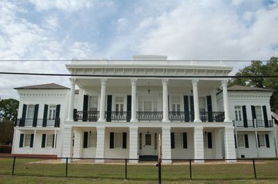
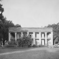
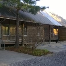
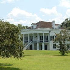
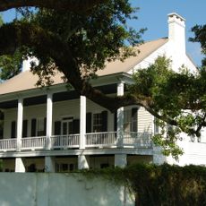
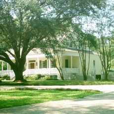
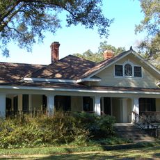
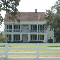
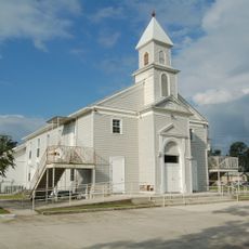
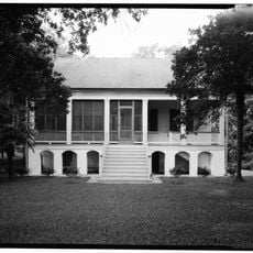
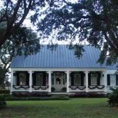
Carville Historic District is a medical heritage area in Iberville Parish spanning 60 acres along the Mississippi River. The property features Classical Revival and Italianate architecture, with 26 contributing structures arranged as an integrated complex centered on the Indian Camp Plantation House.

The district originated as a sugar plantation in 1859 and became the Louisiana Leper Home from 1894 onward, eventually serving as the nation's treatment facility for Hansen's disease. The shift from agricultural production to medical care shaped how the buildings and grounds were developed and organized.

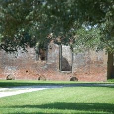
The district takes its name from the Cary family who owned the original plantation estate. Visitors can see how the buildings are arranged around central green spaces that reflect the daily life and sense of community that developed here.

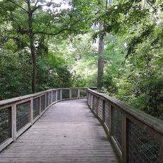
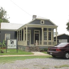
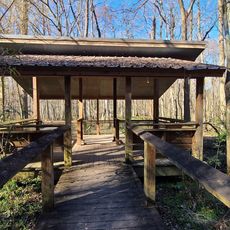
The grounds are walkable, with pathways connecting the individual buildings and green spaces throughout the property. An on-site museum displays exhibits about the facility's medical history and maintains archives that provide deeper context for visitors interested in learning more.

Stanley Stein, a former patient at the facility, started The STAR newsletter in 1931 from within the complex and it continues to be published today. This publication has become a recognized source of information for people affected by Hansen's disease and demonstrates how patients found their voice within these walls.

Location: Iberville Parish

Address: 5445 Point Clair Road

GPS coordinates: 30.19694,-91.12667

Latest update: December 11, 2025 11:04

Photos
Around this place
Bayou Corne sinkhole
United States of America

Bayou Corne sinkhole

20.8 km
Sunshine Bridge
United States of America

Sunshine Bridge

23.4 km
Ashland Plantation
United States of America

Ashland Plantation

12.6 km
Bluebonnet Swamp Nature Center
United States of America

Bluebonnet Swamp Nature Center

19.4 km
LSU Hilltop Arboretum
United States of America

LSU Hilltop Arboretum

18 km
Evan Hall
United States of America

Evan Hall

11.8 km
Baton Rouge Louisiana Temple
United States of America

Baton Rouge Louisiana Temple

18.5 km
St. Gabriel Roman Catholic Church
United States of America

St. Gabriel Roman Catholic Church

6.8 km
St. Emma Plantation
United States of America

St. Emma Plantation

15.6 km
Plaquemine Lock State Historic Site
United States of America

Plaquemine Lock State Historic Site

14.8 km
Highland Road Community Park
United States of America

Highland Road Community Park

23 km
Blue Bayou Water Park
United States of America

Blue Bayou Water Park

19.1 km
River Road African American Museum
United States of America

River Road African American Museum

16.9 km
Palo Alto Plantation
United States of America

Palo Alto Plantation

14.9 km
Tally-Ho Plantation House
United States of America

Tally-Ho Plantation House

4.5 km
Mount Hope Plantation House
United States of America

Mount Hope Plantation House

19.5 km
St. Elizabeth Catholic Church
United States of America

St. Elizabeth Catholic Church

23.4 km
Robert Penn Warren House
United States of America

Robert Penn Warren House

19.2 km
Mulberry Grove
United States of America

Mulberry Grove

8.7 km
Landry Tomb
United States of America

Landry Tomb

17.4 km
Iberville Parish Courthouse
United States of America

Iberville Parish Courthouse

14.7 km
Plaquemine Historic District
United States of America

Plaquemine Historic District

14.8 km
BREC's Bluebonnet Swamp Nature Center
United States of America

BREC's Bluebonnet Swamp Nature Center

19.4 km
St. John Baptist Church
United States of America

St. John Baptist Church

4 km
Bank of Addis
United States of America

Bank of Addis

22.1 km
Santa Maria Plantation
United States of America

Santa Maria Plantation

19.4 km
Red Stick Farmers Market
United States of America

Red Stick Farmers Market

22.5 km
Lucky Plantation
United States of America

Lucky Plantation

12.4 km
Show the full map
Reviews

Visited this place? Tap the stars to rate it and share your experience / photos with the community! Try now! You can cancel it anytime.

« Carville Historic District - Medical historic district in Iberville Parish, US » is provided by Around Us (aroundus.com). Images and texts are derived from Wikimedia project under a Creative Commons license. You are allowed to copy, distribute, and modify copies of this page, under the conditions set by the license, as long as this note is clearly visible.

Discover hidden gems everywhere you go!

From secret cafés to breathtaking viewpoints, skip the crowded tourist spots and find places that match your style. Our app makes it easy with voice search, smart filtering, route optimization, and insider tips from travelers worldwide. Download now for the complete mobile experience.

Around Us App Screenshot

A unique approach to discovering new places

Le Figaro

All the places worth exploring

France Info

A tailor-made excursion in just a few clicks

20 Minutes