Enable Location

We need your location to show you interesting places around you

Discover nearby places

Find interesting locations and hidden gems around you

Precise directions

Get accurate directions and distances to places

Your location is never shared with other users. It's only used when you tap the location button.

Belle Alliance Plantation

Log in to your account

Start exploring — it's free

Trusted by 62,475 travelers worldwide

Continue with Google
Continue with Apple
or

We will send you a code to connect

By continuing, you accept our Terms and Conditions and our Privacy Policy

Check your inbox

We've sent a pincode in your inbox. Please enter the code below.

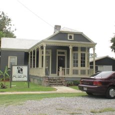
Belle Alliance Plantation, human settlement in Louisiana, United States of America

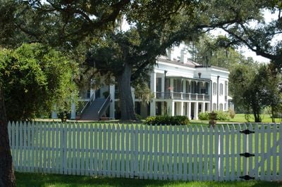
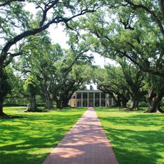
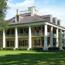
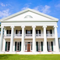
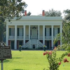
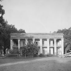
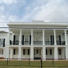
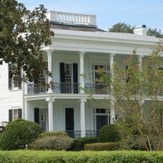
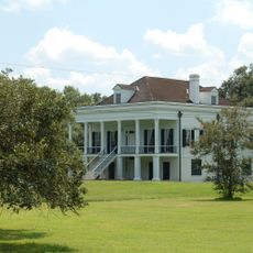
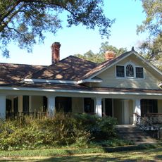
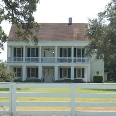
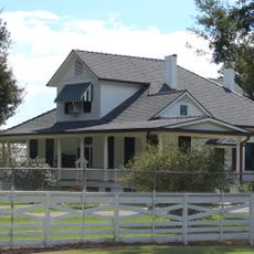
Belle Alliance Plantation is a large house located on Bayou Lafourche in Louisiana, originally built around 1846 in Greek Revival style and expanded in 1889 with a significant addition designed by architect Paul Andry. The structure sits on approximately 7000 acres of land and features a five-section gallery with tall rectangular pillars, high windows with ornamental frames, and prominent decorative moldings throughout its rooms.

The original house was constructed in 1846 after Charles Kock, a German immigrant, consolidated three smaller farms and a fire destroyed the initial structure on the property. The estate remained under Kock family ownership until 1915 and became a wealthy sugar plantation operation that enslaved 176 people by 1860.

The main house is privately owned and interior access may be limited, but the exterior provides a clear view of the architectural details and craftsmanship from the 1800s. The property is located near Donaldsonville, making it easily reachable for visitors traveling through southern Louisiana.

The elaborate dining room added in 1889 is considered one of the finest interior spaces in the region, featuring a detailed mantelpiece with columns, arches, and elaborate carvings. This room was designed by architect Paul Andry and showcases the wealth and refinement of the Kock family during their peak prosperity.

The community of curious travelers

AroundUs brings together thousands of curated places, local tips, and hidden gems, enriched daily by 60,000 contributors worldwide.

Start exploring
Location
Architectural style
Renaissance Revival architecture
GPS coordinates
30.05556,-91.03306
Latest update
February 7, 2026 11:40
Around this place
Oak Alley Plantation
United States of America

Oak Alley Plantation

25.4 km
Bayou Corne sinkhole
United States of America

Bayou Corne sinkhole

11.7 km
The Houmas
United States of America

The Houmas

13.5 km
Sunshine Bridge
United States of America

Sunshine Bridge

12.6 km
Madewood Plantation House
United States of America

Madewood Plantation House

14.9 km
Bocage Plantation
United States of America

Bocage Plantation

10.7 km
Ashland Plantation
United States of America

Ashland Plantation

13.8 km
St. Joseph Plantation
United States of America

St. Joseph Plantation

25.7 km
Carville Historic District
United States of America

Carville Historic District

18.1 km
Evan Hall
United States of America

Evan Hall

7 km
St. Gabriel Roman Catholic Church
United States of America

St. Gabriel Roman Catholic Church

23.1 km
St. Louis Plantation
United States of America

St. Louis Plantation

29.8 km
Laura Plantation
United States of America

Laura Plantation

30.1 km
St. Emma Plantation
United States of America

St. Emma Plantation

3.2 km
River Road African American Museum
United States of America

River Road African American Museum

6.6 km
Palo Alto Plantation
United States of America

Palo Alto Plantation

4 km
Tally-Ho Plantation House
United States of America

Tally-Ho Plantation House

21.8 km
St. Elizabeth Catholic Church
United States of America

St. Elizabeth Catholic Church

7.2 km
St. Anne Catholic Church
United States of America

St. Anne Catholic Church

13.1 km
Robert Penn Warren House
United States of America

Robert Penn Warren House

28.7 km
Church of the Assumption of the Blessed Virgin Mary
United States of America

Church of the Assumption of the Blessed Virgin Mary

7.4 km
Mulberry Grove
United States of America

Mulberry Grove

15.3 km
Landry Tomb
United States of America

Landry Tomb

6.7 km
Mather House
United States of America

Mather House

22.2 km
Christ Episcopal Church and Cemetery
United States of America

Christ Episcopal Church and Cemetery

12.7 km
St. Philomene Catholic Church and Rectory
United States of America

St. Philomene Catholic Church and Rectory

25.3 km
St. John Baptist Church
United States of America

St. John Baptist Church

18.3 km
LaBarre House
United States of America

LaBarre House

14.7 km
Show the full map
« Belle Alliance Plantation - human settlement in Louisiana, United States of America » is provided by Around Us (aroundus.com). Images and texts are derived from Wikimedia project under a Creative Commons license. You are allowed to copy, distribute, and modify copies of this page, under the conditions set by the license, as long as this note is clearly visible.

Discover hidden gems everywhere you go!

From secret cafés to breathtaking viewpoints, skip the crowded tourist spots and find places that match your style. Our app makes it easy with voice search, smart filtering, route optimization, and insider tips from travelers worldwide. Download now for the complete mobile experience.

Around Us App Screenshot

A unique approach to discovering new places

Le Figaro

All the places worth exploring

France Info

A tailor-made excursion in just a few clicks

20 Minutes

Around Us
Travel Guide & Maps
Download

Send to your phone

QR Code
1

Open the camera app on your mobile.

2

Point at the QR code with your camera. A notification will appear.

3

Tap the notification to open the link.