Chest opened
+${chestReward.xp} XP
Explorer
NOUVEAU ×${chestReward.collectible.quantity}
tapez pour fermer
Chest locked

Open chests in the app

Around Us is built for your phone — chests unlock when you walk, explore and capture nearby places.

Enable Location

We need your location to show you interesting places around you

Discover nearby places

Find interesting locations and hidden gems around you

Precise directions

Get accurate directions and distances to places

Your location is never shared with other users. It's only used when you tap the location button.

Bayou Teche

Log in to your account

Start exploring — it's free

Trusted by 72,934 travelers worldwide

Continue with Google
Continue with Apple
or

We will send you a code to connect

By continuing, you accept our Terms and Conditions and our Privacy Policy

Check your inbox

We've sent a pincode in your inbox. Please enter the code below.

Bayou Teche
Discussion Reviews 1 Photos
25.6k Popularity

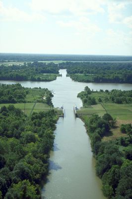
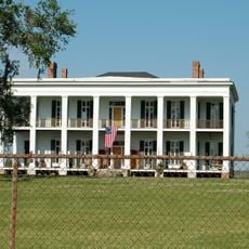
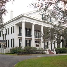
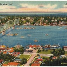
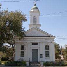
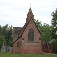
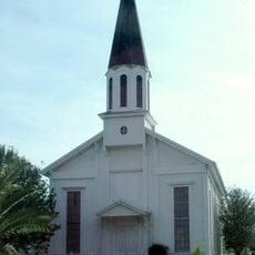
Bayou Teche, Natural waterway in south central Louisiana, United States

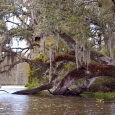
Bayou Teche is a natural waterway in south central Louisiana that winds through cypress swamps and hardwood forests. The waterway flows past several towns and connects different ecological zones along its path.

Between 3,000 and 4,000 years ago, this waterway was the main channel of the Mississippi River before natural forces reshaped it. During the Civil War, it became a site of naval conflict between Union and Confederate forces.

The name comes from the Chitimacha word "tenche," which describes the waterway's winding shape. This connection reflects how indigenous peoples understood and named the landscape around them.

The bayou is accessible year-round and popular for kayaking and fishing. Spring and fall are the most pleasant times to visit, with milder weather and fewer insects.

Two naval battles took place here in 1862 and 1863, with the Confederate ironclad CSS J. A. Cotton fighting against Union gunboats. These local clashes show how the Civil War extended into the swamps and waterways of the region.

The community of curious travelers

AroundUs brings together thousands of curated places, local tips, and hidden gems, enriched daily by 60,000 contributors worldwide.

Start exploring
Location
GPS coordinates
29.72167,-91.29917
Latest update
December 7, 2025 09:27
Around this place
Bayou Corne sinkhole
United States of America

Bayou Corne sinkhole

35.5 km
Madewood Plantation House
United States of America

Madewood Plantation House

37.2 km
Albania Plantation House
United States of America

Albania Plantation House

39.4 km
Belle Alliance Plantation
United States of America

Belle Alliance Plantation

45.2 km
Arlington Plantation House
United States of America

Arlington Plantation House

19.8 km
Ducros Plantation
United States of America

Ducros Plantation

46.6 km
Oaklawn Manor
United States of America

Oaklawn Manor

21.6 km
Long-Allen Bridge
United States of America

Long-Allen Bridge

8.7 km
St. Elizabeth Catholic Church
United States of America

St. Elizabeth Catholic Church

38.2 km
St. Anne Catholic Church
United States of America

St. Anne Catholic Church

35.7 km
Alice C Plantation House
United States of America

Alice C Plantation House

18 km
Calumet Plantation House
United States of America

Calumet Plantation House

4.5 km
Church of the Assumption of the Blessed Virgin Mary
United States of America

Church of the Assumption of the Blessed Virgin Mary

40 km
Gibson Methodist Episcopal Church
United States of America

Gibson Methodist Episcopal Church

30.4 km
Point Au Fer Reef Light
United States of America

Point Au Fer Reef Light

39.8 km
Southwest Reef Light
United States of America

Southwest Reef Light

8.6 km
St. Mary's Episcopal Church
United States of America

St. Mary's Episcopal Church

25 km
St. John's Episcopal Church and Cemetery
United States of America

St. John's Episcopal Church and Cemetery

46.7 km
Christ Episcopal Church and Cemetery
United States of America

Christ Episcopal Church and Cemetery

36 km
Pharr Chapel United Methodist Church
United States of America

Pharr Chapel United Methodist Church

9.5 km
Louisiana State Museum – Patterson
United States of America

Louisiana State Museum – Patterson

4.9 km
816 Jackson Street
United States of America

816 Jackson Street

46.7 km
Atkinson Memorial Presbyterian Church
United States of America

Atkinson Memorial Presbyterian Church

10 km
St. Philomene Catholic Church and Rectory
United States of America

St. Philomene Catholic Church and Rectory

35.8 km
Frost House
United States of America

Frost House

46.9 km
Berwick Bay Bridge
United States of America

Berwick Bay Bridge

9 km
Grevemberg House
United States of America

Grevemberg House

21.1 km
Vives House
United States of America

Vives House

46.7 km
Show the full map
Reviews
Share your experience

No review yet

Discussions
Start a discussion...

No discussion yet

« Bayou Teche - Natural waterway in south central Louisiana, United States » is provided by Around Us (aroundus.com). Images and texts are derived from Wikimedia project under a Creative Commons license. You are allowed to copy, distribute, and modify copies of this page, under the conditions set by the license, as long as this note is clearly visible.

Discover hidden gems everywhere you go!

From secret cafés to breathtaking viewpoints, skip the crowded tourist spots and find places that match your style. Our app makes it easy with voice search, smart filtering, route optimization, and insider tips from travelers worldwide. Download now for the complete mobile experience.

Around Us App Screenshot

A unique approach to discovering new places

Le Figaro

All the places worth exploring

France Info

A tailor-made excursion in just a few clicks

20 Minutes

Around Us
Travel Guide & Maps
Download

Send to your phone

QR Code
1

Open the camera app on your mobile.

2

Point at the QR code with your camera. A notification will appear.

3

Tap the notification to open the link.