Enable Location

We need your location to show you interesting places around you

Discover nearby places

Find interesting locations and hidden gems around you

Precise directions

Get accurate directions and distances to places

Your location is never shared with other users. It's only used when you tap the location button.

Issaquena County

Log in to your account

Start exploring — it's free

Trusted by 62,430 travelers worldwide

Continue with Google
Continue with Apple
or

We will send you a code to connect

By continuing, you accept our Terms and Conditions and our Privacy Policy

Check your inbox

We've sent a pincode in your inbox. Please enter the code below.

Issaquena County, Administrative county in Mississippi Delta, United States.

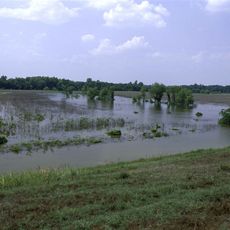
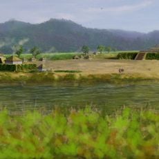
Issaquena County sits in the Mississippi Delta with bottomlands and hardwood forests along the river. The landscape is flat and fertile, with Mayersville serving as the administrative center on land devoted mostly to farming.

Established in 1844 from the southern portion of Washington County, the seat of government moved twice before settling in Mayersville in 1871. These relocations reflected changing population centers and administrative needs over the 19th century.

The name comes from the Choctaw language meaning Deer River, connecting the place to its original inhabitants. This linguistic heritage remains visible in how locals speak about their land and its waterways.

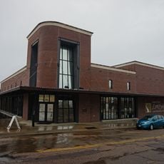
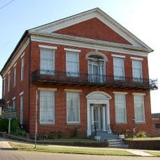
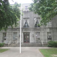
The county office in Mayersville is where administrative matters are handled, accessible to visitors during business hours. A car is essential for getting around this rural area, as distances between settlements are significant.

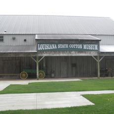
Despite its small population, the county maintains active farmland and plays a role in regional agriculture that belies its size. Its remote location has kept it largely removed from rapid modern development, preserving a slower rhythm of life.

The community of curious travelers

AroundUs brings together thousands of curated places, local tips, and hidden gems, enriched daily by 60,000 contributors worldwide.

Start exploring
Location
Inception
1844
Capital city
Mayersville
Shares border with
Washington County, Warren County, Sharkey County, Yazoo County, Chicot County, East Carroll Parish
GPS coordinates
32.74000,-90.99000
Latest update
December 20, 2025 00:48
Around this place
Holly Bluff Site
United States of America

Holly Bluff Site

29.9 km
Delta National Forest
United States of America

Delta National Forest

19.5 km
United States of America

Fort St. Pierre Site

32.6 km
Anchuca
United States of America

Anchuca

44.2 km
Panther Swamp National Wildlife Refuge
United States of America

Panther Swamp National Wildlife Refuge

40.8 km
United States of America

Transylvania Mounds

20.9 km
United States of America

Julice Mound

22 km
United States of America

Theodore Roosevelt National Wildlife Refuge

34.6 km
United States of America

Linden

34.6 km
Lower Mississippi River Museum
United States of America

Lower Mississippi River Museum

44.2 km
Hermione
United States of America

Hermione

41.1 km
United States of America

Aden Site

18.4 km
United States of America

Crippen Point site

28.8 km
United States of America

Bloom's Arcade

41.4 km
United States of America

Buckmeadow Plantation House

26.5 km
Louisiana State Cotton Museum
United States of America

Louisiana State Cotton Museum

22.3 km
Madison Parish Courthouse
United States of America

Madison Parish Courthouse

41.4 km
Planters Hall
United States of America

Planters Hall

44.2 km
United States of America

Tallulah Men's Club Building

41.3 km
United States of America

Byerley House

18.8 km
United States of America

Lake Providence Residential Historic District

18.9 km
United States of America

Old Courthouse Square

18.6 km
United States of America

Bear Lake Club, Ltd., Clubhouse

40 km
United States of America

Fischer House

19.9 km
United States of America

Nelson House

18.7 km
Lake Providence Commercial Historic District
United States of America

Lake Providence Commercial Historic District

18.3 km
United States of America

Kell House

40.9 km
Kings Crossing Site
United States of America

Kings Crossing Site

40.9 km
Show the full map
Administrative divisions
« Issaquena County - Administrative county in Mississippi Delta, United States » is provided by Around Us (aroundus.com). Images and texts are derived from Wikimedia project under a Creative Commons license. You are allowed to copy, distribute, and modify copies of this page, under the conditions set by the license, as long as this note is clearly visible.

Discover hidden gems everywhere you go!

From secret cafés to breathtaking viewpoints, skip the crowded tourist spots and find places that match your style. Our app makes it easy with voice search, smart filtering, route optimization, and insider tips from travelers worldwide. Download now for the complete mobile experience.

Around Us App Screenshot

A unique approach to discovering new places

Le Figaro

All the places worth exploring

France Info

A tailor-made excursion in just a few clicks

20 Minutes

Around Us
Travel Guide & Maps
Download

Send to your phone

QR Code
1

Open the camera app on your mobile.

2

Point at the QR code with your camera. A notification will appear.

3

Tap the notification to open the link.