Hinds County

Log in to your account

AroundUs is a community-driven map of interesting places, built by curious explorers like you. It grows with every review, story, and photo you share.
Connect to save your favorite spots, contribute locations, and create personalized routes.
Continue with Google
Continue with Apple
Continue with X
Continue with Facebook
Continue with email
By continuing, you accept our Terms and Conditions and our Privacy Policy
Create an account
Add to collection
Map
Suggest a change
Share

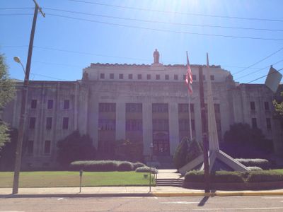
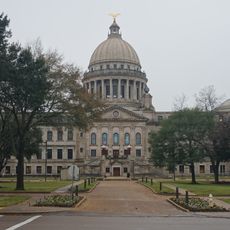
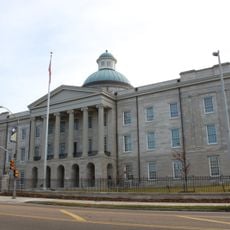
Hinds County, Administrative division in central Mississippi, United States

Hinds County is an administrative division in central Mississippi with two county seats: Jackson, the state capital, and the town of Raymond. The area encompasses both urban neighborhoods and surrounding rural communities within its boundaries.

The area was established in 1821 on land formerly inhabited by the Choctaw people and named after General Thomas Hinds, who gained recognition at the Battle of New Orleans. This founding reflected the broader territorial expansion of that era.

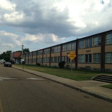
The area is home to major universities and colleges that shape the intellectual and social life of residents, with students and faculty contributing to local conversations and events. Educational institutions here are woven into how people experience daily life and community traditions.

Public records and administrative information can be accessed online through the county's official website for various services and inquiries. The two county seats allow visitors to access local services from either location depending on their needs.

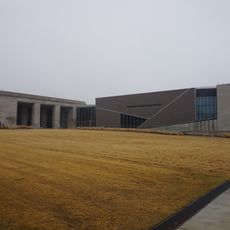
The University of Mississippi Medical Center in Jackson performed the first human lung transplant in 1963, a landmark moment in surgical history. This achievement made the area a center of medical advancement and research.

Location: Mississippi

Inception: February 12, 1821

Capital city: Jackson

Shares border with: Yazoo County, Copiah County, Rankin County, Madison County, Warren County, Claiborne County, Simpson County

Website: http://hindscountyms.com

GPS coordinates: 32.26000,-90.44000

Latest update: December 17, 2025 08:58

Photos
Around this place
Tougaloo College
United States of America

Tougaloo College

30.7 km
Mississippi Veterans Memorial Stadium
United States of America

Mississippi Veterans Memorial Stadium

25.7 km
Jackson Volcano
United States of America

Jackson Volcano

25.6 km
Mississippi River Basin Model
United States of America

Mississippi River Basin Model

12.8 km
Mississippi State Capitol
United States of America

Mississippi State Capitol

24.7 km
Mississippi Governor's Mansion
United States of America

Mississippi Governor's Mansion

24.6 km
Lanier High School
United States of America

Lanier High School

23.2 km
Mississippi Petrified Forest
United States of America

Mississippi Petrified Forest

31 km
Old Mississippi State Capitol
United States of America

Old Mississippi State Capitol

24.9 km
Mississippi Civil Rights Museum
United States of America

Mississippi Civil Rights Museum

25.1 km
United States of America

Mississippi Musicians Hall of Fame

34 km
Jackson Zoo
United States of America

Jackson Zoo

21.8 km
King Edward Hotel
United States of America

King Edward Hotel

23.9 km
Fountainhead
United States of America

Fountainhead

26.9 km
Eudora Welty House
United States of America

Eudora Welty House

26.2 km
LeFleur's Bluff State Park
United States of America

LeFleur's Bluff State Park

28.2 km
Mississippi Department of Archives and History
United States of America

Mississippi Department of Archives and History

25 km
United States of America

Mississippi Museum of Natural Science

27.6 km
Lamar Life Building
United States of America

Lamar Life Building

24.5 km
Chapel of the Cross
United States of America

Chapel of the Cross

37.4 km
United States of America

Lake Hico

25.3 km
Mississippi Museum of Art
United States of America

Mississippi Museum of Art

24.3 km
Pocahontas Mounds
United States of America

Pocahontas Mounds

27.3 km
Farish Street Neighborhood Historic District
United States of America

Farish Street Neighborhood Historic District

24.2 km
United States of America

WLBT Tower

7.5 km
Boyd Mounds Site
United States of America

Boyd Mounds Site

41.1 km
Manship House
United States of America

Manship House

25 km
The Oaks House Museum
United States of America

The Oaks House Museum

25.4 km
Show the full map
Reviews

Visited this place? Tap the stars to rate it and share your experience / photos with the community! Try now! You can cancel it anytime.

Administrative divisions
« Hinds County - Administrative division in central Mississippi, United States » is provided by Around Us (aroundus.com). Images and texts are derived from Wikimedia project under a Creative Commons license. You are allowed to copy, distribute, and modify copies of this page, under the conditions set by the license, as long as this note is clearly visible.

Discover hidden gems everywhere you go!

From secret cafés to breathtaking viewpoints, skip the crowded tourist spots and find places that match your style. Our app makes it easy with voice search, smart filtering, route optimization, and insider tips from travelers worldwide. Download now for the complete mobile experience.

Around Us App Screenshot

A unique approach to discovering new places

Le Figaro

All the places worth exploring

France Info

A tailor-made excursion in just a few clicks

20 Minutes