Enable Location

We need your location to show you interesting places around you

Discover nearby places

Find interesting locations and hidden gems around you

Precise directions

Get accurate directions and distances to places

Your location is never shared with other users. It's only used when you tap the location button.

National Weather Service New Orleans/Baton Rouge, Louisiana

Log in to your account

Start exploring — it's free

Trusted by 62,441 travelers worldwide

Continue with Google
Continue with Apple
or

We will send you a code to connect

By continuing, you accept our Terms and Conditions and our Privacy Policy

Check your inbox

We've sent a pincode in your inbox. Please enter the code below.

National Weather Service New Orleans/Baton Rouge, Louisiana

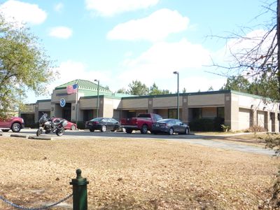
National Weather Service New Orleans/Baton Rouge, Louisiana, Weather monitoring station in Slidell, United States

The National Weather Service office in Slidell is a weather monitoring station serving the New Orleans and Baton Rouge regions. It performs daily observation and forecasting operations, collecting data on temperature, humidity, wind conditions, and atmospheric pressure.

The office originated from a U.S. Army Signal office established in downtown New Orleans in 1870. It relocated to Slidell in 1979 following a merger with a radar facility.

The office organizes SKYWARN Spotter Training Classes where local residents learn to identify and report severe weather conditions. These trainings help the community respond more effectively when dangerous weather approaches.

Visitors can access current weather measurements and forecasts through the office's website and local media channels. The information is updated regularly and covers conditions affecting the broader region.

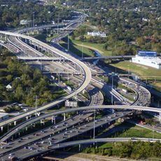
The office operates specialized radar systems that track hurricanes and tornadoes across southeastern Louisiana. This technology allows warnings to be issued quickly when dangerous storms approach the region.

The community of curious travelers

AroundUs brings together thousands of curated places, local tips, and hidden gems, enriched daily by 60,000 contributors worldwide.

Start exploring
Location
GPS coordinates
30.33671,-89.82566
Latest update
December 14, 2025 18:05
Around this place
Interstate 10
United States of America

Interstate 10

17.3 km
I-10 Twin Span Bridge
United States of America

I-10 Twin Span Bridge

17.2 km
John C. Stennis Space Center
United States of America

John C. Stennis Space Center

21.9 km
Seven Sisters Oak
United States of America

Seven Sisters Oak

26.5 km
Fort Pike
United States of America

Fort Pike

20.8 km
Fontainebleau State Park
United States of America

Fontainebleau State Park

19 km
Maestri Bridge
United States of America

Maestri Bridge

16.7 km
Fort Pike Bridge
United States of America

Fort Pike Bridge

20.4 km
Big Branch Marsh National Wildlife Refuge
United States of America

Big Branch Marsh National Wildlife Refuge

14.8 km
Abita Mystery House
United States of America

Abita Mystery House

25.5 km
Crosby Arboretum
United States of America

Crosby Arboretum

24.1 km
Francois Cousin House
United States of America

Francois Cousin House

7.4 km
CSX Rigolets Pass Bridge
United States of America

CSX Rigolets Pass Bridge

27.5 km
Camp Salmen House
United States of America

Camp Salmen House

5.1 km
West Rigolets Light
United States of America

West Rigolets Light

19.6 km
East Rigolets Light
United States of America

East Rigolets Light

26.4 km
Francois Cousin House
United States of America

Francois Cousin House

10.9 km
Dew Drop Social and Benevolent Hall
United States of America

Dew Drop Social and Benevolent Hall

22.8 km
Abita Springs Historic District
United States of America

Abita Springs Historic District

25.6 km
Abita Springs Pavilion
United States of America

Abita Springs Pavilion

26.1 km
Johnson House
United States of America

Johnson House

23.4 km
Bertus-Ducatel House
United States of America

Bertus-Ducatel House

23 km
Abita Springs Trailhead Museum
United States of America

Abita Springs Trailhead Museum

25.9 km
Arcade Theatre
United States of America

Arcade Theatre

8.1 km
Rocket Propulsion Test Complex
United States of America

Rocket Propulsion Test Complex

23.1 km
Rigolets Bridge
United States of America

Rigolets Bridge

20.4 km
INFINITY Science Center
United States of America

INFINITY Science Center

21.4 km
East Pearl River Bridge
United States of America

East Pearl River Bridge

18.7 km
Show the full map
« National Weather Service New Orleans/Baton Rouge, Louisiana - Weather monitoring station in Slidell, United States » is provided by Around Us (aroundus.com). Images and texts are derived from Wikimedia project under a Creative Commons license. You are allowed to copy, distribute, and modify copies of this page, under the conditions set by the license, as long as this note is clearly visible.

Discover hidden gems everywhere you go!

From secret cafés to breathtaking viewpoints, skip the crowded tourist spots and find places that match your style. Our app makes it easy with voice search, smart filtering, route optimization, and insider tips from travelers worldwide. Download now for the complete mobile experience.

Around Us App Screenshot

A unique approach to discovering new places

Le Figaro

All the places worth exploring

France Info

A tailor-made excursion in just a few clicks

20 Minutes

Around Us
Travel Guide & Maps
Download

Send to your phone

QR Code
1

Open the camera app on your mobile.

2

Point at the QR code with your camera. A notification will appear.

3

Tap the notification to open the link.