Leflore County

Log in to your account

AroundUs is a community-driven map of interesting places, built by curious explorers like you. It grows with every review, story, and photo you share.
Connect to save your favorite spots, contribute locations, and create personalized routes.
Continue with Google
Continue with Apple
Continue with X
Continue with Facebook
Continue with email
By continuing, you accept our Terms and Conditions and our Privacy Policy
Create an account
Add to collection
Map
Suggest a change
Share

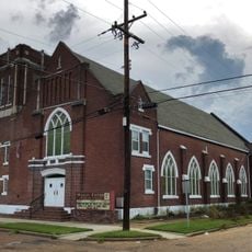
Leflore County, County administrative division in Mississippi, United States

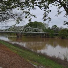
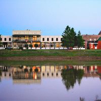
Leflore County is located in the Mississippi Delta region with the Yazoo River marking its southern boundary and Greenwood serving as the county seat. The area spans fertile plains shaped by the river's influence on local geography.

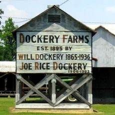
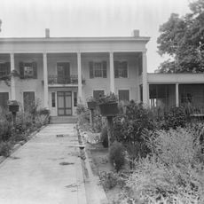
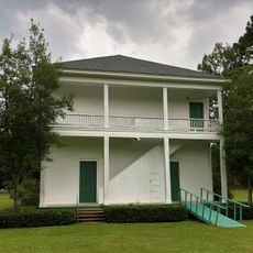
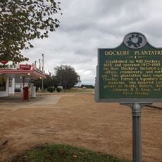
Established in 1871, the county is named for Choctaw leader Greenwood LeFlore who negotiated land treaties between Native Americans and the United States. These agreements opened the area to European settlement and agricultural development.

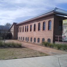
Mississippi Valley State University shapes educational opportunities in the region and contributes to academic development across the Mississippi Delta. It remains a key institution for students from surrounding communities.

The county administration office in Greenwood offers public access to land records and searchable property databases. Visiting during regular weekday business hours will ensure you can access these resources without difficulty.

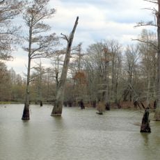
The Yazoo River served as a vital transportation route for goods moving through the region and shaped economic patterns across generations. Its impact on trade networks and settlement remains visible in how the landscape developed.

Location: Mississippi

Inception: 1871

Capital city: Greenwood

Shares border with: Tallahatchie County, Grenada County, Carroll County, Holmes County, Humphreys County, Sunflower County

Website: http://leflorecounty.org

GPS coordinates: 33.55000,-90.30000

Latest update: December 23, 2025 06:48

Photos
Around this place
Dockery Plantation
United States of America

Dockery Plantation

35.2 km
B.B. King Museum and Delta Interpretive Center
United States of America

B.B. King Museum and Delta Interpretive Center

34 km
Rice–Totten Field
United States of America

Rice–Totten Field

6 km
Jaketown Site
United States of America

Jaketown Site

38.9 km
United States of America

Florewood State Park

5.4 km
Tallahatchie National Wildlife Refuge
United States of America

Tallahatchie National Wildlife Refuge

33.4 km
United States of America

Mathews Brake National Wildlife Refuge

19.6 km
United States of America

Morgan Brake National Wildlife Refuge

35.3 km
Cotesworth
United States of America

Cotesworth

36.3 km
Acona Church, Cemetery, and School
United States of America

Acona Church, Cemetery, and School

40.8 km
Indianola Historic District
United States of America

Indianola Historic District

34.5 km
First Methodist Church of Greenwood
United States of America

First Methodist Church of Greenwood

11.3 km
Charley's Trace
United States of America

Charley's Trace

19.3 km
Southworth House
United States of America

Southworth House

11.4 km
Wesley Memorial Methodist Episcopal
United States of America

Wesley Memorial Methodist Episcopal

11.8 km
Emmett Till Historic Intrepid Center - ETHIC
United States of America

Emmett Till Historic Intrepid Center - ETHIC

31 km
United States of America

Greentree State Waterfowl Production Area

34.9 km
Keesler Bridge
United States of America

Keesler Bridge

11.2 km
United States of America

Murdock Lake

42 km
United States of America

Morgan Lake

35.6 km
United States of America

Sanders Lake

40 km
Wesley Methodist Church Historic District
United States of America

Wesley Methodist Church Historic District

11.8 km
Dockery Farms
United States of America

Dockery Farms

35.5 km
United States of America

Greenwood Country Club Golf Course

14.3 km
United States of America

Leflore County County Club

3.3 km
United States of America

Indianola Country Club

36.2 km
United States of America

Brindley Theater

34 km
United States of America

Work of art, statue

34 km
Show the full map
Reviews

Visited this place? Tap the stars to rate it and share your experience / photos with the community! Try now! You can cancel it anytime.

Administrative divisions
« Leflore County - County administrative division in Mississippi, United States » is provided by Around Us (aroundus.com). Images and texts are derived from Wikimedia project under a Creative Commons license. You are allowed to copy, distribute, and modify copies of this page, under the conditions set by the license, as long as this note is clearly visible.

Discover hidden gems everywhere you go!

From secret cafés to breathtaking viewpoints, skip the crowded tourist spots and find places that match your style. Our app makes it easy with voice search, smart filtering, route optimization, and insider tips from travelers worldwide. Download now for the complete mobile experience.

Around Us App Screenshot

A unique approach to discovering new places

Le Figaro

All the places worth exploring

France Info

A tailor-made excursion in just a few clicks

20 Minutes