Chest opened
+${chestReward.xp} XP
Explorer
NOUVEAU ×${chestReward.collectible.quantity}
tapez pour fermer
Chest locked

Open chests in the app

Around Us is built for your phone — chests unlock when you walk, explore and capture nearby places.

Enable Location

We need your location to show you interesting places around you

Discover nearby places

Find interesting locations and hidden gems around you

Precise directions

Get accurate directions and distances to places

Your location is never shared with other users. It's only used when you tap the location button.

Rosemary Beach

Log in to your account

Start exploring — it's free

Trusted by 72,894 travelers worldwide

Continue with Google
Continue with Apple
or

We will send you a code to connect

By continuing, you accept our Terms and Conditions and our Privacy Policy

Check your inbox

We've sent a pincode in your inbox. Please enter the code below.

Discussion Reviews 1 Photos
65k Popularity

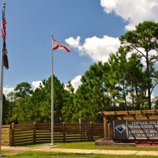
Rosemary Beach, Planned beach community in Walton County, Florida, United States.

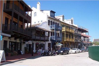
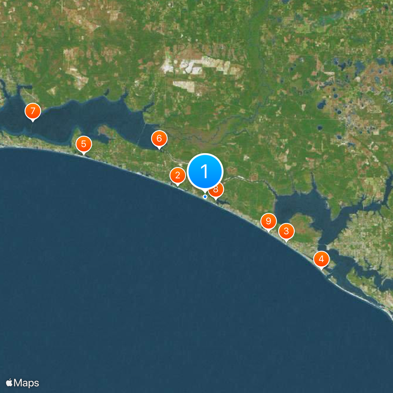
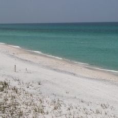
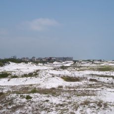
Rosemary Beach is a planned residential seaside community in Walton County, Florida, spanning roughly 105 acres (42 hectares) connected by sandy paths and wooden boardwalks. The development includes a central district with shops and restaurants, plus several shared pools for residents and guests.

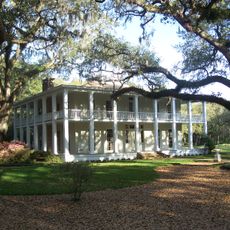
The settlement began in 1995 on land previously owned by Rosemary Milligan, who had lived in this area since 1974. Developers purchased the property and started building a residential compound designed to merge European and American building styles.

Buildings display wrought iron balconies, interior courtyards, and wide porches that recall French Caribbean design. Small plazas with fountains and planted lanes create a feeling of Mediterranean village life right on the Gulf coast.

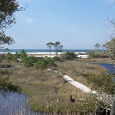
Beach access requires codes or wristbands confirming visitor status, while bicycles are the preferred way to move around the property. Most paths are flat and easy to walk, though cobblestone sections can be bumpy for wheelchairs or strollers.

Every destination within the compound sits less than five minutes on foot from any other, making cars unnecessary for daily errands. Streets carry names like Jasmine, Magnolia, and Hibiscus, each marking a different tree or plant species lining the route.

The community of curious travelers

AroundUs brings together thousands of curated places, local tips, and hidden gems, enriched daily by 60,000 contributors worldwide.

Start exploring
Location
GPS coordinates
30.27968,-86.01448
Latest update
December 13, 2025 18:29
Around this place
Grayton Beach State Park
United States of America

Grayton Beach State Park

6.8 km
Miracle Strip Amusement Park
United States of America

Miracle Strip Amusement Park

20.7 km
St. Andrews State Park
United States of America

St. Andrews State Park

30.6 km
Topsail Hill Preserve State Park
United States of America

Topsail Hill Preserve State Park

29 km
Eden Gardens State Park
United States of America

Eden Gardens State Park

15.1 km
Mid-Bay Bridge
United States of America

Mid-Bay Bridge

42.4 km
Camp Helen State Park
United States of America

Camp Helen State Park

2.3 km
Gulf World Marine Park
United States of America

Gulf World Marine Park

16.1 km
Deer Lake State Park
United States of America

Deer Lake State Park

6.8 km
Hathaway Bridge
United States of America

Hathaway Bridge

28.2 km
Pine Log State Forest
United States of America

Pine Log State Forest

20.3 km
Race City PCB
United States of America

Race City PCB

24.1 km
Shipwreck Island Water Park
United States of America

Shipwreck Island Water Park

20.5 km
Man in the Sea Museum
United States of America

Man in the Sea Museum

12.8 km
Bay County Courthouse
United States of America

Bay County Courthouse

37 km
First Baptist Church
United States of America

First Baptist Church

36.5 km
Destin Beach
United States of America

Destin Beach

38.4 km
First Presbyterian Church
United States of America

First Presbyterian Church

35 km
Robert L. McKenzie House
United States of America

Robert L. McKenzie House

36.8 km
Latimer Cabin
United States of America

Latimer Cabin

2.8 km
Sapp House
United States of America

Sapp House

37 km
A. A. Payne-John Christo, Sr., House
United States of America

A. A. Payne-John Christo, Sr., House

35.4 km
St. Andrew School
United States of America

St. Andrew School

32.2 km
Sherman Arcade
United States of America

Sherman Arcade

36.8 km
Panama City Center for the Arts
United States of America

Panama City Center for the Arts

36.8 km
Science and Discovery Center of Northwest Florida
United States of America

Science and Discovery Center of Northwest Florida

35.5 km
Science & Discovery Center of Northwest Florida
United States of America

Science & Discovery Center of Northwest Florida

35.5 km
Alys Beach
United States of America

Alys Beach

1.6 km
Show the full map
Reviews
Share your experience

No review yet

Discussions
Start a discussion...

No discussion yet

« Rosemary Beach - Planned beach community in Walton County, Florida, United States » is provided by Around Us (aroundus.com). Images and texts are derived from Wikimedia project under a Creative Commons license. You are allowed to copy, distribute, and modify copies of this page, under the conditions set by the license, as long as this note is clearly visible.

Discover hidden gems everywhere you go!

From secret cafés to breathtaking viewpoints, skip the crowded tourist spots and find places that match your style. Our app makes it easy with voice search, smart filtering, route optimization, and insider tips from travelers worldwide. Download now for the complete mobile experience.

Around Us App Screenshot

A unique approach to discovering new places

Le Figaro

All the places worth exploring

France Info

A tailor-made excursion in just a few clicks

20 Minutes

Around Us
Travel Guide & Maps
Download

Send to your phone

QR Code
1

Open the camera app on your mobile.

2

Point at the QR code with your camera. A notification will appear.

3

Tap the notification to open the link.