Chest opened
+${chestReward.xp} XP
Explorer
NOUVEAU ×${chestReward.collectible.quantity}
tapez pour fermer
Chest locked

Open chests in the app

Around Us is built for your phone — chests unlock when you walk, explore and capture nearby places.

Enable Location

We need your location to show you interesting places around you

Discover nearby places

Find interesting locations and hidden gems around you

Precise directions

Get accurate directions and distances to places

Your location is never shared with other users. It's only used when you tap the location button.

Ensley

Log in to your account

Start exploring — it's free

Trusted by 72,879 travelers worldwide

Continue with Google
Continue with Apple
or

We will send you a code to connect

By continuing, you accept our Terms and Conditions and our Privacy Policy

Check your inbox

We've sent a pincode in your inbox. Please enter the code below.

Ensley
Discussion Reviews 1 Photos
10.9k Popularity

Ensley, Historical neighborhood in Birmingham, US.

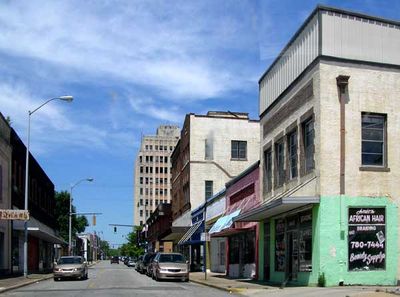
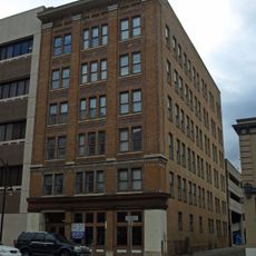
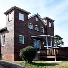
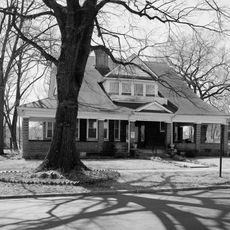
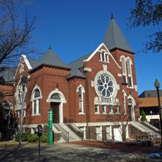
Ensley is a residential neighborhood in Birmingham with many houses built before 1939, featuring wide streets and commercial areas near the former industrial center. The housing stock reflects its roots as a working-class community.

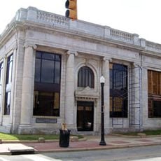
The area was founded in 1886 and grew quickly into an industrial center with four blast furnaces built in 1889. It later merged into Birmingham in 1910 and ceased to exist as an independent city.

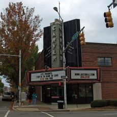
Tuxedo Junction, a neighborhood crossroads, became a center for live music and dancing that drew crowds throughout the mid-20th century and inspired songs by local artists.

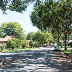
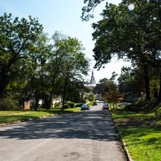
The neighborhood is easily accessible by car via local roads, and the grid street layout makes navigation straightforward. Most homes are visible from the street, and the area is simple to explore on foot during daylight hours.

The area shifted from being an independent industrial city to an annexed neighborhood, yet many original buildings and infrastructure from that era remain standing. This transformation is visible in the wide streets and surviving structures that hint at its earlier grand designs.

The community of curious travelers

AroundUs brings together thousands of curated places, local tips, and hidden gems, enriched daily by 60,000 contributors worldwide.

Start exploring
Location
GPS coordinates
33.50330,-86.89170
Latest update
March 5, 2026 21:06
Around this place
Legion Field
United States of America

Legion Field

4.6 km
Birmingham–Jefferson Convention Complex
United States of America

Birmingham–Jefferson Convention Complex

7.7 km
Rickwood Field
United States of America

Rickwood Field

4.6 km
Kelly Ingram Park
United States of America

Kelly Ingram Park

7.4 km
Birmingham Civil Rights National Monument
United States of America

Birmingham Civil Rights National Monument

7.3 km
Birmingham Civil Rights Institute
United States of America

Birmingham Civil Rights Institute

7.3 km
Alabama Theatre
United States of America

Alabama Theatre

7.8 km
AT&T City Center
United States of America

AT&T City Center

7.6 km
Boutwell Memorial Auditorium
United States of America

Boutwell Memorial Auditorium

7.8 km
Arlington Antebellum Home & Gardens
United States of America

Arlington Antebellum Home & Gardens

4.9 km
Birmingham Civil Rights District
United States of America

Birmingham Civil Rights District

7.3 km
Regions-Harbert Plaza
United States of America

Regions-Harbert Plaza

7.8 km
A.G. Gaston Motel
United States of America

A.G. Gaston Motel

7.3 km
Alabama Power Headquarters Building
United States of America

Alabama Power Headquarters Building

7.5 km
Carver Performing Arts Center
United States of America

Carver Performing Arts Center

7.5 km
Federal Reserve Bank of Atlanta Birmingham Branch
United States of America

Federal Reserve Bank of Atlanta Birmingham Branch

7.7 km
Robert S. Vance Federal Building and United States Courthouse
United States of America

Robert S. Vance Federal Building and United States Courthouse

7.7 km
Flintridge Building
United States of America

Flintridge Building

4 km
Alabama Penny Savings Bank
United States of America

Alabama Penny Savings Bank

7.7 km
West Campus Field
United States of America

West Campus Field

7.4 km
Arlington Park
United States of America

Arlington Park

5.1 km
First Baptist Church, East Thomas
United States of America

First Baptist Church, East Thomas

5.1 km
Dr. A.M. Brown House
United States of America

Dr. A.M. Brown House

5.7 km
Second Presbyterian Church
United States of America

Second Presbyterian Church

7.7 km
Belview Heights Historic District
United States of America

Belview Heights Historic District

1.4 km
Bank of Ensley
United States of America

Bank of Ensley

1.2 km
Negro Southern League Museum
United States of America

Negro Southern League Museum

7.7 km
Trianon Theater
United States of America

Trianon Theater

7.6 km
Show the full map
Reviews
Share your experience

No review yet

Discussions
Start a discussion...

No discussion yet

« Ensley - Historical neighborhood in Birmingham, US » is provided by Around Us (aroundus.com). Images and texts are derived from Wikimedia project under a Creative Commons license. You are allowed to copy, distribute, and modify copies of this page, under the conditions set by the license, as long as this note is clearly visible.

Discover hidden gems everywhere you go!

From secret cafés to breathtaking viewpoints, skip the crowded tourist spots and find places that match your style. Our app makes it easy with voice search, smart filtering, route optimization, and insider tips from travelers worldwide. Download now for the complete mobile experience.

Around Us App Screenshot

A unique approach to discovering new places

Le Figaro

All the places worth exploring

France Info

A tailor-made excursion in just a few clicks

20 Minutes

Around Us
Travel Guide & Maps
Download

Send to your phone

QR Code
1

Open the camera app on your mobile.

2

Point at the QR code with your camera. A notification will appear.

3

Tap the notification to open the link.