Enable Location

We need your location to show you interesting places around you

Discover nearby places

Find interesting locations and hidden gems around you

Precise directions

Get accurate directions and distances to places

Your location is never shared with other users. It's only used when you tap the location button.

Mud Lake Canal

Log in to your account

Start exploring — it's free

Trusted by 62,461 travelers worldwide

Continue with Google
Continue with Apple
or

We will send you a code to connect

By continuing, you accept our Terms and Conditions and our Privacy Policy

Check your inbox

We've sent a pincode in your inbox. Please enter the code below.

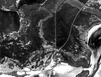
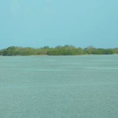
Mud Lake Canal, Aboriginal canal in Monroe County, United States.

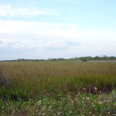
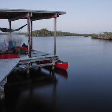
Mud Lake Canal is an ancient waterway running through Monroe County that connects different areas across the landscape. The channel varies in width and depth throughout its length and was engineered to allow water passage and transportation.

The waterway was constructed by Native Americans roughly 800 to 1200 years ago as part of a larger transportation network. It connected distant island groups and coastal areas, enabling trade and communication across significant distances.

The waterway connected settlements across the region and reflects how early Florida communities shaped their environment through careful engineering. The construction reveals sophisticated knowledge about water management and strategic settlement placement.

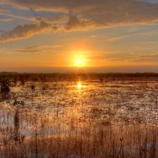
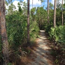
The canal is accessible today mainly through guided boat tours, which allow visitors to directly explore the waterway and surrounding environment. Visiting during drier seasons works better since water levels are more stable and the landscape becomes easier to view.

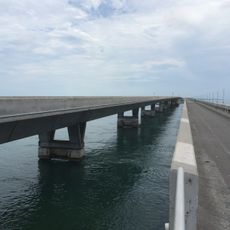
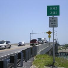
The canal intersects multiple times with modern waterway infrastructure, showing how ancient and contemporary development share the same space. These crossing points are visible to visitors and show the long-term importance of this route for the region.

The community of curious travelers

AroundUs brings together thousands of curated places, local tips, and hidden gems, enriched daily by 60,000 contributors worldwide.

Start exploring
Location
GPS coordinates
25.17390,-80.93810
Latest update
December 14, 2025 11:24
Around this place
Everglades National Park
United States of America

Everglades National Park

29.6 km
Aquarius Reef Base
United States of America

Aquarius Reef Base

54.8 km
Overseas Railroad
United States of America

Overseas Railroad

54.7 km
United States of America

Florida Reef

54.8 km
John Pennekamp Coral Reef State Park
United States of America

John Pennekamp Coral Reef State Park

54.1 km
African Queen
United States of America

African Queen

51.1 km
Alligator Reef Light
United States of America

Alligator Reef Light

48.2 km
Dolphin Research Center
United States of America

Dolphin Research Center

45.3 km
Everglades Alligator Farm
United States of America

Everglades Alligator Farm

50.3 km
Theater of the Sea
United States of America

Theater of the Sea

42.3 km
Indian Key State Historic Site
United States of America

Indian Key State Historic Site

40.2 km
Long Key Bridge
United States of America

Long Key Bridge

42.5 km
Anhinga Trail
United States of America

Anhinga Trail

40.3 km
Jewfish Creek Bridge
United States of America

Jewfish Creek Bridge

55.9 km
Everglades & Dry Tortugas
United States of America

Everglades & Dry Tortugas

24.8 km
George Adderley House
United States of America

George Adderley House

52.4 km
Snake Creek Bridge
United States of America

Snake Creek Bridge

43.1 km
Royal Palm
United States of America

Royal Palm

40.4 km
Pa-hay-okee Trail
United States of America

Pa-hay-okee Trail

33.6 km
Pinelands Trail
United States of America

Pinelands Trail

38.2 km
Hell's Bay Canoe Trail
United States of America

Hell's Bay Canoe Trail

13.3 km
Florida Keys Memorial
United States of America

Florida Keys Memorial

41.8 km
Ernest F. Coe Visitor Center‎
United States of America

Ernest F. Coe Visitor Center‎

43.4 km
Flamingo Visitor Center
United States of America

Flamingo Visitor Center

3.9 km
Flamingo Campground
United States of America

Flamingo Campground

4.2 km
Everglades Homestead Entrance Station
United States of America

Everglades Homestead Entrance Station

42.8 km
Flamingo Campground Amphitheater
United States of America

Flamingo Campground Amphitheater

4.1 km
Long Pine Key Campground
United States of America

Long Pine Key Campground

38 km
Show the full map
« Mud Lake Canal - Aboriginal canal in Monroe County, United States » is provided by Around Us (aroundus.com). Images and texts are derived from Wikimedia project under a Creative Commons license. You are allowed to copy, distribute, and modify copies of this page, under the conditions set by the license, as long as this note is clearly visible.

Discover hidden gems everywhere you go!

From secret cafés to breathtaking viewpoints, skip the crowded tourist spots and find places that match your style. Our app makes it easy with voice search, smart filtering, route optimization, and insider tips from travelers worldwide. Download now for the complete mobile experience.

Around Us App Screenshot

A unique approach to discovering new places

Le Figaro

All the places worth exploring

France Info

A tailor-made excursion in just a few clicks

20 Minutes

Around Us
Travel Guide & Maps
Download

Send to your phone

QR Code
1

Open the camera app on your mobile.

2

Point at the QR code with your camera. A notification will appear.

3

Tap the notification to open the link.