Monroe County

Log in to your account

AroundUs is a community-driven map of interesting places, built by curious explorers like you. It grows with every review, story, and photo you share.
Connect to save your favorite spots, contribute locations, and create personalized routes.
By continuing, you accept our Terms and Conditions and our Privacy Policy
Add to collection
Map
Suggest a change
Share

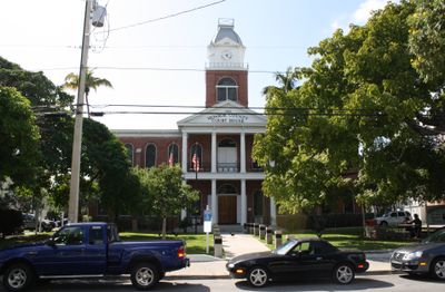
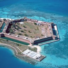
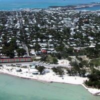
Monroe County, County in southern Florida, United States

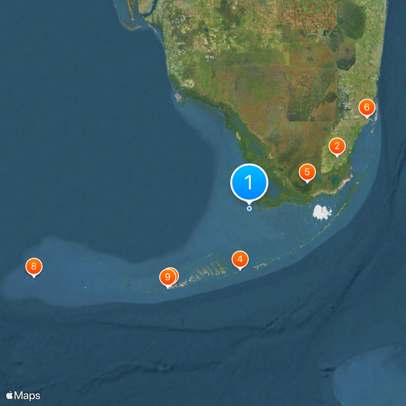
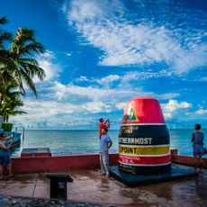
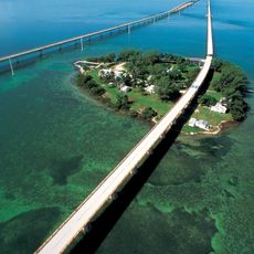
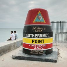
Monroe County is an administrative division in southern Florida that spans the entire Florida Keys island chain and includes a portion of Everglades National Park on the mainland. The county extends from Key Largo in the north to Key West in the south, connecting more than 40 inhabited islands through the Overseas Highway bridge road.

The area was named after US President James Monroe in 1823 when it was established as an administrative unit to organize settlements along the island chain. The construction of a railroad connection in the early 20th century and later the road bridges transformed the region fundamentally and made the islands accessible to residents and travelers.

The Florida Keys Council of the Arts coordinates exhibitions, performances, and educational programs throughout Monroe County, connecting residents with local artists and creators.

The county administration offers online services for permits, licenses, and emergency notifications through its official website, serving both residents and business operators. Administrative offices are located primarily on the larger inhabited islands and handle inquiries from locals and visitors.

Nearly the entire population lives on the islands of the Florida Keys, while the mainland portion of the county remains almost uninhabited. Only a handful of residents have settled in this remote section of the Everglades that belongs to the administrative division.

Location: Florida

Inception: July 3, 1823

Capital city: Key West

Shares border with: Collier County, Miami-Dade County

Website: http://monroecounty-fl.gov

GPS coordinates: 25.12000,-81.15000

Latest update: December 4, 2025 23:01

Around this place
Show the full map
Coral Castle
United States of America

Coral Castle

82.7 km
Conch Republic
United States of America

Conch Republic

89.5 km
Seven Mile Bridge
United States of America

Seven Mile Bridge

49.3 km
Everglades National Park
United States of America

Everglades National Park

51.3 km
Fort Jefferson
United States of America

Fort Jefferson

182.4 km
Ernest Hemingway House
United States of America

Ernest Hemingway House

91.3 km
Vizcaya Museum and Gardens
United States of America

Vizcaya Museum and Gardens

117.2 km
Pitbull Stadium
United States of America

Pitbull Stadium

104.8 km
Southernmost point buoy
United States of America

Southernmost point buoy

91.4 km
Homestead-Miami Speedway
United States of America

Homestead-Miami Speedway

83.2 km
Aquarius Reef Base
United States of America

Aquarius Reef Base

72.7 km
Overseas Railroad
United States of America

Overseas Railroad

45.5 km
Wynwood Walls
United States of America

Wynwood Walls

122 km
One Thousand Museum
United States of America

One Thousand Museum

121.6 km
Venetian Pool
United States of America

Venetian Pool

112.3 km
1101 Brickell
United States of America

1101 Brickell

120.1 km
Freedom Tower
United States of America

Freedom Tower

121.3 km
Harry S. Truman Little White House
United States of America

Harry S. Truman Little White House

91.4 km
Zoo Miami
United States of America

Zoo Miami

93 km
Florida Reef
United States of America

Florida Reef

75.6 km
Biltmore Hotel
United States of America

Biltmore Hotel

111.6 km
Miami Seaquarium
United States of America

Miami Seaquarium

120.2 km
Fort Zachary Taylor Historic State Park
United States of America

Fort Zachary Taylor Historic State Park

92.2 km
Bayside Marketplace
United States of America

Bayside Marketplace

121.5 km
Bayfront Park
United States of America

Bayfront Park

121.3 km
Jungle Island
United States of America

Jungle Island

123 km
John Pennekamp Coral Reef State Park
United States of America

John Pennekamp Coral Reef State Park

75.1 km
Adrienne Arsht Center for the Performing Arts
United States of America

Adrienne Arsht Center for the Performing Arts

121.8 km
Show the full map

Reviews

Visited this place? Tap the stars to rate it and share your experience / photos with the community! Try now! You can cancel it anytime.

Administrative divisions
« Monroe County - County in southern Florida, United States » is provided by Around Us (aroundus.com). Images and texts are derived from Wikimedia project under a Creative Commons license. You are allowed to copy, distribute, and modify copies of this page, under the conditions set by the license, as long as this note is clearly visible.

Discover hidden gems everywhere you go!

From secret cafés to breathtaking viewpoints, skip the crowded tourist spots and find places that match your style. Our app makes it easy with voice search, smart filtering, route optimization, and insider tips from travelers worldwide. Download now for the complete mobile experience.

Around Us App Screenshot

A unique approach to discovering new places

Le Figaro

All the places worth exploring

France Info

A tailor-made excursion in just a few clicks

20 Minutes