Lake Singkarak, Tectonic lake in West Sumatra, Indonesia.
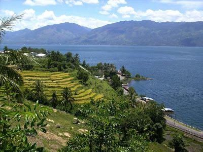
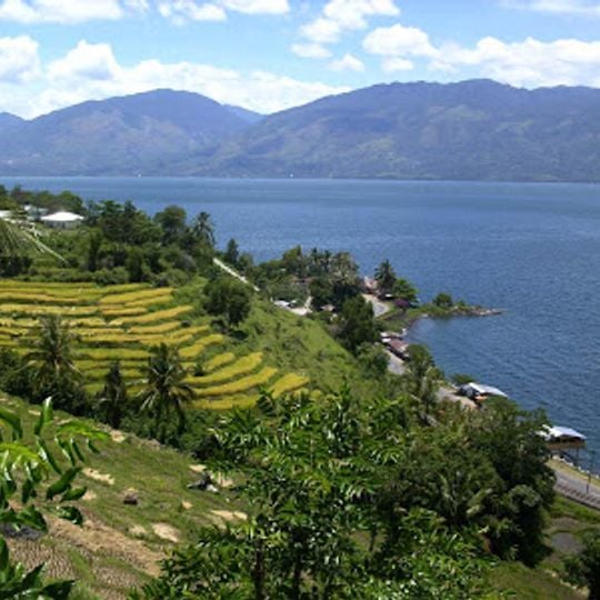
Lake Singkarak lies at 362 metres above sea level between Tanah Datar and Solok in West Sumatra, covering 107.8 square kilometres with a maximum depth of 268 metres. It fills a basin of the Singkarak-Solok Depression, dammed by volcanic material from eruptions, and its shoreline is skirted on the eastern side by the railway between Padang and Sawahlunto-Sijunjung.
Lake Singkarak lies in the Singkarak-Solok basin, a depression formed by subsidence along the Sumatran Fault; the basin was dammed by volcanic material, which created the lake. Its natural outlet is the Ombilin River, but most of the outflow is now diverted through a tunnel under the Bukit Barisan to the Anai River, driving the Singkarak hydroelectric plant near Lubuk Alung.
The lake's name is used for the Tour de Singkarak, a cycle race that circles the water. Visitors can hire a ketek, a small wooden boat, to cross the lake, and fish for bilih from the shore. Villages along the edge serve bilih, often fried whole, as a local dish.
A railway line linking Padang with Sawahlunto-Sijunjung runs the length of the lake's eastern shore, giving a land route along the water. The lake lies at 362 metres above sea level between the Tanah Datar and Solok regencies, so the surrounding roads climb and descend with the terrain.
The lake holds the Mystacoleucus padangensis, an endemic fish species found only here that cannot survive in other environments. This species exists nowhere else in the world.
The community of curious travelers
AroundUs brings together thousands of curated places, local tips, and hidden gems, enriched daily by 94,059 contributors worldwide.