Enable Location

We need your location to show you interesting places around you

Discover nearby places

Find interesting locations and hidden gems around you

Precise directions

Get accurate directions and distances to places

Your location is never shared with other users. It's only used when you tap the location button.

Zero Obelisk

Log in to your account

Start exploring — it's free

Trusted by 62,904 travelers worldwide

Continue with Google
Continue with Apple
or

We will send you a code to connect

By continuing, you accept our Terms and Conditions and our Privacy Policy

Check your inbox

We've sent a pincode in your inbox. Please enter the code below.

Discussion Reviews 1 Photos
1.1k Popularity

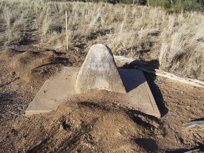
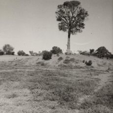
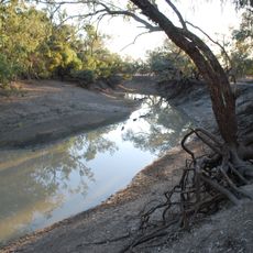
Zero Obelisk, survey marker on the east bank of the Warrego River

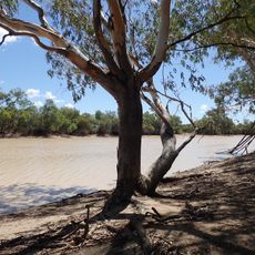
The Zero Obelisk is a survey marker in Queensland located on the east bank of the Warrego River at Barringun. Made of concrete and stone in the shape of a truncated pyramid, it stands about one yard across and marks the starting point for the border survey between Queensland and New South Wales.

Built in 1879, the marker served as the starting point for the border survey between Queensland and New South Wales. Surveyor JB Cameron led the expedition westward for over 200 miles, completing the work in more than a year to establish clear boundary lines between the two colonies.

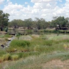
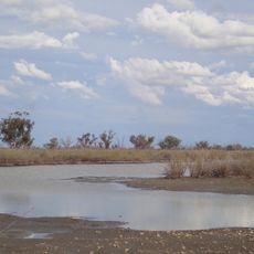
The site sits in a remote location near the Warrego River and is accessible to visitors interested in history and surveying. The open landscape means preparation for travel to this rural area is useful before making the trip.

Surveyor JB Cameron, who was born in Scotland, carved his name on a wooden post by the river to mark the completion of the border survey. He later traveled to New Guinea where he continued significant surveying work before passing away in Brisbane at the end of the century.

The community of curious travelers

AroundUs brings together thousands of curated places, local tips, and hidden gems, enriched daily by 60,000 contributors worldwide.

Start exploring
Location
GPS coordinates
-28.99910,145.66880
Latest update
February 9, 2026 07:41
Reviews
Share your experience

No review yet

Discussions
Start a discussion...

No discussion yet

« Zero Obelisk - survey marker on the east bank of the Warrego River » is provided by Around Us (aroundus.com). Images and texts are derived from Wikimedia project under a Creative Commons license. You are allowed to copy, distribute, and modify copies of this page, under the conditions set by the license, as long as this note is clearly visible.

Discover hidden gems everywhere you go!

From secret cafés to breathtaking viewpoints, skip the crowded tourist spots and find places that match your style. Our app makes it easy with voice search, smart filtering, route optimization, and insider tips from travelers worldwide. Download now for the complete mobile experience.

Around Us App Screenshot

A unique approach to discovering new places

Le Figaro

All the places worth exploring

France Info

A tailor-made excursion in just a few clicks

20 Minutes

Around Us
Travel Guide & Maps
Download

Send to your phone

QR Code
1

Open the camera app on your mobile.

2

Point at the QR code with your camera. A notification will appear.

3

Tap the notification to open the link.