Chest opened
+${chestReward.xp} XP
Explorer
NOUVEAU ×${chestReward.collectible.quantity}
tapez pour fermer
Chest locked

Open chests in the app

Around Us is built for your phone — chests unlock when you walk, explore and capture nearby places.

Enable Location

We need your location to show you interesting places around you

Discover nearby places

Find interesting locations and hidden gems around you

Precise directions

Get accurate directions and distances to places

Your location is never shared with other users. It's only used when you tap the location button.

Log in to your account

Start exploring — it's free

Trusted by 72,881 travelers worldwide

Continue with Google
Continue with Apple
or

We will send you a code to connect

By continuing, you accept our Terms and Conditions and our Privacy Policy

Check your inbox

We've sent a pincode in your inbox. Please enter the code below.

Discussion Reviews Photo
72.7k Popularity

Bell Canyon, Gated residential area in Ventura County, United States.

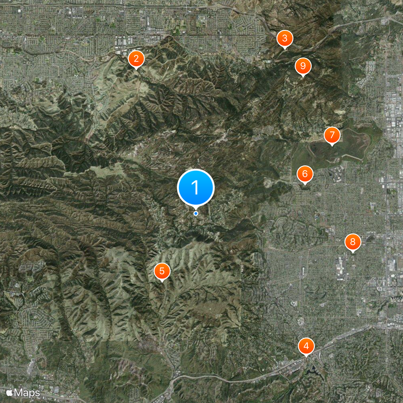
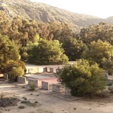
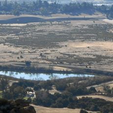
Bell Canyon is a gated residential settlement in the Simi Hills of Ventura County, covering approximately 3.6 square miles of hilly terrain. The community sits at an elevation of around 1,370 feet (417 m) and consists of single-family homes on large lots with equestrian trails and shared green spaces.

The area was part of Rancho El Escorpión, granted by the Mexican government to Chumash-Ventureño Chief Odón Eusebia in 1845. The current residential settlement developed in the 1960s as a planned community with an equestrian center as its focal point.

Bell Creek served as the location of Hu'wam village, where Chumash, Tongva, and Tataviam peoples maintained connections for thousands of years.

Access is through a guarded gate and limited to residents and their guests. The community is managed by a local services district that organizes waste collection, recreation programs, and security services for residents.

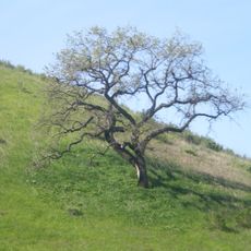
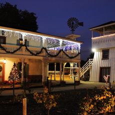
The equestrian center was designed in 1968 by Cliff May, an architect known for his California ranch-style homes. The facility serves as a gathering point for riders and hosts regular horse events within the residential settlement.

The community of curious travelers

AroundUs brings together thousands of curated places, local tips, and hidden gems, enriched daily by 60,000 contributors worldwide.

Start exploring
Location
GPS coordinates
34.20806,-118.68750
Latest update
December 13, 2025 17:28
Around this place
United States of America

Brandeis-Bardin Institute

6.2 km
Corriganville Movie Ranch
United States of America

Corriganville Movie Ranch

7.4 km
Leonis Adobe
United States of America

Leonis Adobe

7.1 km
Upper Las Virgenes Canyon Open Space Preserve
United States of America

Upper Las Virgenes Canyon Open Space Preserve

3 km
Orcutt Ranch Horticulture Center
United States of America

Orcutt Ranch Horticulture Center

4.5 km
Chatsworth Nature Preserve
United States of America

Chatsworth Nature Preserve

6 km
Shadow Ranch
United States of America

Shadow Ranch

6.4 km
United States of America

Chatsworth Peak

6.9 km
Santa Susana Railroad Depot & Museum
United States of America

Santa Susana Railroad Depot & Museum

6.3 km
Leonis Adobe
United States of America

Leonis Adobe

7.1 km
United States of America

Taxco Trails Park

4.6 km
United States of America

Rancho Santa Susana Community Park

7.2 km
United States of America

Valley Girl -- Party House

3.9 km
United States of America

Work of art

4.5 km
United States of America

Jason Goes to Hell: The Final Friday -- Voorhees House

3.9 km
United States of America

Class Act Musical Theatre

6.2 km
United States of America

Flying Pig

5.9 km
United States of America

Stone Woman Face

5.1 km
United States of America

Work of art, sculpture

7.2 km
United States of America

Encino Man -- Family House

3.3 km
United States of America

Scenic viewpoint

5.6 km
United States of America

Scenic viewpoint

5.4 km
United States of America

Scenic viewpoint

5.8 km
United States of America

Canyon Overlook

6.2 km
United States of America

Scenic viewpoint

3.4 km
United States of America

Scenic viewpoint

3.9 km
United States of America

Inspiration Point

6.5 km
United States of America

Waterfall

5.9 km
Show the full map
Reviews
Share your experience

No review yet

Discussions
Start a discussion...

No discussion yet

« Bell Canyon - Gated residential area in Ventura County, United States » is provided by Around Us (aroundus.com). Images and texts are derived from Wikimedia project under a Creative Commons license. You are allowed to copy, distribute, and modify copies of this page, under the conditions set by the license, as long as this note is clearly visible.

Discover hidden gems everywhere you go!

From secret cafés to breathtaking viewpoints, skip the crowded tourist spots and find places that match your style. Our app makes it easy with voice search, smart filtering, route optimization, and insider tips from travelers worldwide. Download now for the complete mobile experience.

Around Us App Screenshot

A unique approach to discovering new places

Le Figaro

All the places worth exploring

France Info

A tailor-made excursion in just a few clicks

20 Minutes

Around Us
Travel Guide & Maps
Download

Send to your phone

QR Code
1

Open the camera app on your mobile.

2

Point at the QR code with your camera. A notification will appear.

3

Tap the notification to open the link.