Enable Location

We need your location to show you interesting places around you

Discover nearby places

Find interesting locations and hidden gems around you

Precise directions

Get accurate directions and distances to places

Your location is never shared with other users. It's only used when you tap the location button.

Shadow Ranch

Log in to your account

Start exploring — it's free

Trusted by 65,229 travelers worldwide

Continue with Google
Continue with Apple
or

We will send you a code to connect

By continuing, you accept our Terms and Conditions and our Privacy Policy

Check your inbox

We've sent a pincode in your inbox. Please enter the code below.

Shadow Ranch
Discussion Reviews 1 Photos
4.2k Popularity

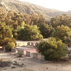
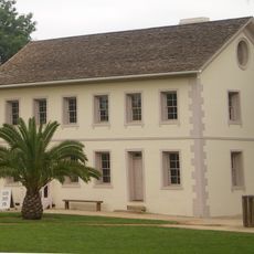
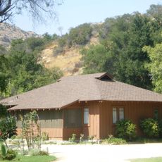
Shadow Ranch, Historic ranch house in West Hills, California.

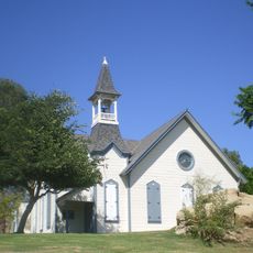
Shadow Ranch is a historic ranch house in the West Hills neighborhood of Los Angeles, built in the late 19th century using adobe walls and a redwood lumber frame. The main building sits on a public park lot surrounded by very tall Australian Blue Gum eucalyptus trees that cover most of the grounds with shade year-round.

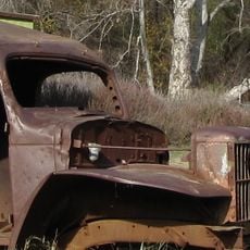
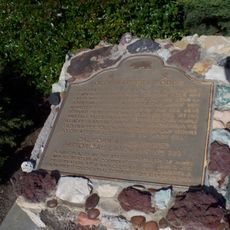
The property was once part of a large wheat-farming operation run by Isaac Lankershim and the San Fernando Homestead Association in the second half of the 19th century. It later passed through several private owners before becoming a public recreation area for the surrounding neighborhoods.

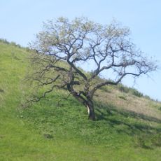
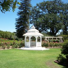
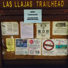
The name Shadow Ranch comes from the deep shade created by the tall Blue Gum eucalyptus trees planted across the grounds. Today the property is a public park where neighbors gather, children play, and community events take place under those same trees.

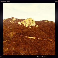
The ranch house sits on Vanowen Street in West Hills and can be reached by car or by public transit from central Los Angeles. Visiting in the morning or late afternoon tends to be more comfortable, as midday heat in this part of California can be strong.

Albert Workman, one of the early owners, had the Blue Gum eucalyptus trees planted on purpose to shield the house from the strong California sun. Those same trees directly inspired the name that the property still carries today.

The community of curious travelers

AroundUs brings together thousands of curated places, local tips, and hidden gems, enriched daily by 60,000 contributors worldwide.

Start exploring
Location
GPS coordinates
34.19450,-118.62000
Latest update
March 3, 2026 10:06
Around this place
Spahn Ranch
United States of America

Spahn Ranch

8.7 km
Malibu Creek State Park
United States of America

Malibu Creek State Park

13.4 km
Corriganville Movie Ranch
United States of America

Corriganville Movie Ranch

8.5 km
Leonis Adobe
United States of America

Leonis Adobe

4.5 km
Malibu Hindu Temple
United States of America

Malibu Hindu Temple

13.8 km
Santa Susana Pass State Historic Park
United States of America

Santa Susana Pass State Historic Park

7.5 km
Topanga State Park
United States of America

Topanga State Park

12.8 km
The Japanese Garden
United States of America

The Japanese Garden

12.9 km
Shepherd of the Hills Church
United States of America

Shepherd of the Hills Church

10.2 km
Grandma Prisbrey's Bottle Village
United States of America

Grandma Prisbrey's Bottle Village

12.3 km
Upper Las Virgenes Canyon Open Space Preserve
United States of America

Upper Las Virgenes Canyon Open Space Preserve

7.6 km
Orcutt Ranch Horticulture Center
United States of America

Orcutt Ranch Horticulture Center

3.3 km
Los Encinos State Historic Park
United States of America

Los Encinos State Historic Park

11.8 km
Matadome
United States of America

Matadome

10.1 km
Chatsworth Nature Preserve
United States of America

Chatsworth Nature Preserve

4.3 km
Topanga Canyon
United States of America

Topanga Canyon

10.3 km
Valley Beth Shalom
United States of America

Valley Beth Shalom

13.9 km
California State University Northridge Botanic Garden
United States of America

California State University Northridge Botanic Garden

9.9 km
Oviatt Library
United States of America

Oviatt Library

9.8 km
Minnie Hill Palmer House
United States of America

Minnie Hill Palmer House

7.4 km
Las Llajas Canyon
United States of America

Las Llajas Canyon

12.7 km
Old Trapper's Lodge
United States of America

Old Trapper's Lodge

3.5 km
Chatsworth Community Church
United States of America

Chatsworth Community Church

6.7 km
Eagle Rock
United States of America

Eagle Rock

10.7 km
Valley Relics Museum
United States of America

Valley Relics Museum

11.3 km
Santa Susana Railroad Depot & Museum
United States of America

Santa Susana Railroad Depot & Museum

8.3 km
Leonis Adobe
United States of America

Leonis Adobe

4.5 km
Munch Box
United States of America

Munch Box

7.2 km
Show the full map
Reviews
Share your experience

No review yet

Discussions
Start a discussion...

No discussion yet

« Shadow Ranch - Historic ranch house in West Hills, California » is provided by Around Us (aroundus.com). Images and texts are derived from Wikimedia project under a Creative Commons license. You are allowed to copy, distribute, and modify copies of this page, under the conditions set by the license, as long as this note is clearly visible.

Discover hidden gems everywhere you go!

From secret cafés to breathtaking viewpoints, skip the crowded tourist spots and find places that match your style. Our app makes it easy with voice search, smart filtering, route optimization, and insider tips from travelers worldwide. Download now for the complete mobile experience.

Around Us App Screenshot

A unique approach to discovering new places

Le Figaro

All the places worth exploring

France Info

A tailor-made excursion in just a few clicks

20 Minutes

Around Us
Travel Guide & Maps
Download

Send to your phone

QR Code
1

Open the camera app on your mobile.

2

Point at the QR code with your camera. A notification will appear.

3

Tap the notification to open the link.