Chest opened
+${chestReward.xp} XP
Explorer
NOUVEAU ×${chestReward.collectible.quantity}
tapez pour fermer
Chest locked

Open chests in the app

Around Us is built for your phone — chests unlock when you walk, explore and capture nearby places.

Enable Location

We need your location to show you interesting places around you

Discover nearby places

Find interesting locations and hidden gems around you

Precise directions

Get accurate directions and distances to places

Your location is never shared with other users. It's only used when you tap the location button.

Santa Teresa

Log in to your account

Start exploring — it's free

Trusted by 72,978 travelers worldwide

Continue with Google
Continue with Apple
or

We will send you a code to connect

By continuing, you accept our Terms and Conditions and our Privacy Policy

Check your inbox

We've sent a pincode in your inbox. Please enter the code below.

Discussion Reviews 1 Photos
15.2k Popularity

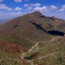
Santa Teresa, Census-designated place in Doña Ana County, United States.

Santa Teresa is a census-designated place in Doña Ana County near the Mexico border, where desert landscape and border infrastructure shape the settlement. The community features an international port of entry and a regional airport that serve as key transportation hubs for the southwestern border area.

The settlement began in the early 1900s as a railroad station and later developed into a cross-border transportation center. This growth transformed it into a vital junction between the United States and Mexico.

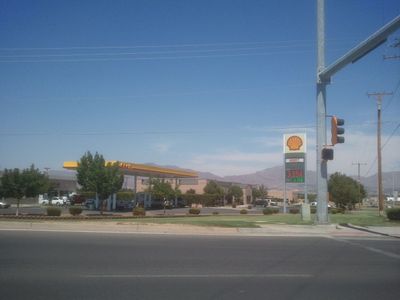
The community sits along the border region where Mexican and American cultures naturally intersect in daily life. Local commerce and social connections reflect this cross-border character that shapes how people here interact and do business.

The area is well connected through the international border crossing and regional airport for easy access. Visitors should be aware that extreme heat and the border location require special planning considerations.

The area hosts a weather forecasting office that serves a large portion of the southwestern border region. This meteorological facility plays a role in regional daily operations.

The community of curious travelers

AroundUs brings together thousands of curated places, local tips, and hidden gems, enriched daily by 60,000 contributors worldwide.

Start exploring
Location
Elevation above the sea
1,156 m
GPS coordinates
31.85330,-106.64100
Latest update
December 7, 2025 19:31
Around this place
Star on the Mountain
United States of America

Star on the Mountain

17.1 km
Sun Bowl Stadium
United States of America

Sun Bowl Stadium

15.4 km
El Paso High School
United States of America

El Paso High School

16.8 km
Franklin Mountains State Park
United States of America

Franklin Mountains State Park

13.6 km
Cathedral Parish of Saint Patrick
United States of America

Cathedral Parish of Saint Patrick

17.1 km
Western Playland
United States of America

Western Playland

9.5 km
San Jacinto Plaza
United States of America

San Jacinto Plaza

17.8 km
Plaza Theatre
United States of America

Plaza Theatre

17.8 km
North Franklin Mountain
United States of America

North Franklin Mountain

15 km
El Paso Museum of Art
United States of America

El Paso Museum of Art

17.7 km
Wet N' Wild Waterworld
United States of America

Wet N' Wild Waterworld

16.1 km
Anson Mills Building
United States of America

Anson Mills Building

17.8 km
O. T. Bassett Tower
United States of America

O. T. Bassett Tower

7.9 km
El Paso Museum of History
United States of America

El Paso Museum of History

17.5 km
Centennial Museum and Chihuahuan Desert Gardens
United States of America

Centennial Museum and Chihuahuan Desert Gardens

15.8 km
United States of America

El Paso Holocaust Museum and Study Center

17.4 km
International Boundary Marker No. 1, U.S. and Mexico
Mexico

International Boundary Marker No. 1, U.S. and Mexico

13.1 km
War Eagles Air Museum
United States of America

War Eagles Air Museum

6.2 km
Chase Tower
United States of America

Chase Tower

17.7 km
Railroad and Transportation Museum of El Paso
United States of America

Railroad and Transportation Museum of El Paso

17.7 km
El Paso Public Libraries
United States of America

El Paso Public Libraries

17.6 km
Woman's Club of El Paso
United States of America

Woman's Club of El Paso

16.9 km
Henry C. Trost House
United States of America

Henry C. Trost House

16.6 km
Adventure Zone
United States of America

Adventure Zone

5.7 km
White House Department Store and Hotel McCoy
United States of America

White House Department Store and Hotel McCoy

17.8 km
International Museum of Art
United States of America

International Museum of Art

17.6 km
Montana Avenue Historic District
United States of America

Montana Avenue Historic District

17.6 km
Old Bnai Zion Synagogue
United States of America

Old Bnai Zion Synagogue

17.7 km
Show the full map
Reviews
Share your experience

No review yet

Discussions
Start a discussion...

No discussion yet

« Santa Teresa - Census-designated place in Doña Ana County, United States » is provided by Around Us (aroundus.com). Images and texts are derived from Wikimedia project under a Creative Commons license. You are allowed to copy, distribute, and modify copies of this page, under the conditions set by the license, as long as this note is clearly visible.

Discover hidden gems everywhere you go!

From secret cafés to breathtaking viewpoints, skip the crowded tourist spots and find places that match your style. Our app makes it easy with voice search, smart filtering, route optimization, and insider tips from travelers worldwide. Download now for the complete mobile experience.

Around Us App Screenshot

A unique approach to discovering new places

Le Figaro

All the places worth exploring

France Info

A tailor-made excursion in just a few clicks

20 Minutes

Around Us
Travel Guide & Maps
Download

Send to your phone

QR Code
1

Open the camera app on your mobile.

2

Point at the QR code with your camera. A notification will appear.

3

Tap the notification to open the link.