Enable Location

We need your location to show you interesting places around you

Discover nearby places

Find interesting locations and hidden gems around you

Precise directions

Get accurate directions and distances to places

Your location is never shared with other users. It's only used when you tap the location button.

Webb County

Log in to your account

Start exploring — it's free

Trusted by 62,487 travelers worldwide

Continue with Google
Continue with Apple
or

We will send you a code to connect

By continuing, you accept our Terms and Conditions and our Privacy Policy

Check your inbox

We've sent a pincode in your inbox. Please enter the code below.

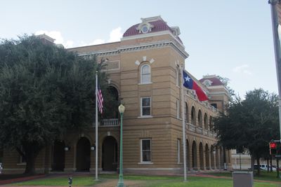
Webb County, Administrative division in South Texas, United States

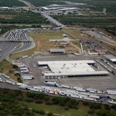
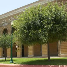
Webb County is an administrative region in southern Texas that spans roughly 3,400 square miles and has Laredo as its administrative center. The area encompasses a densely populated border region with a mix of urban and rural land shaped by trade and cross-border commerce.

The Texas Legislature established this county in 1848 and named it after James Webb, a former Secretary of State for the Texas Republic. The creation occurred during a significant period of border development and shaping of the region's political identity.

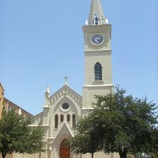
The Washington's Birthday celebration in Laredo draws visitors from both sides of the border and reflects the strong Mexican-American traditions woven into everyday life. The festival shows how two cultures shape the community's identity and local customs year-round.

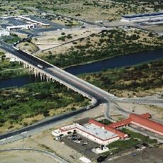
Interstate 35 and U.S. Route 83 run through the area and connect it to major transportation networks for straightforward travel. These highways make it easy to reach Laredo and explore the region without difficulty.

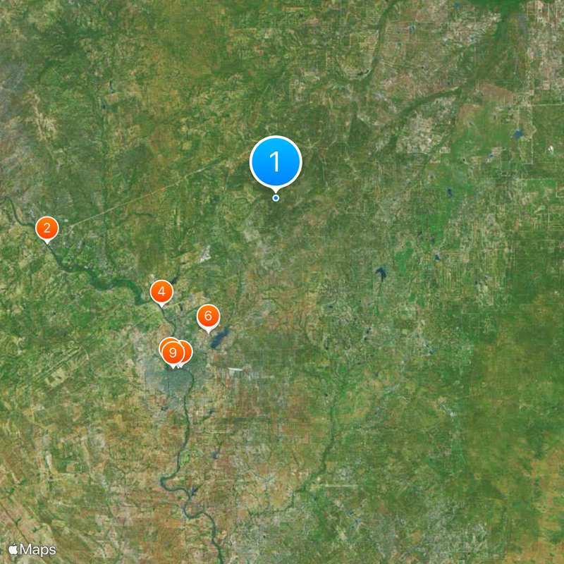
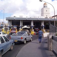
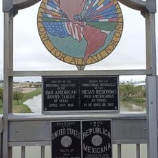
The area borders three Mexican states at the same time: Coahuila, Nuevo León, and Tamaulipas, making it a distinctive border location. No other U.S. county shares this triple border connection with Mexico.

The community of curious travelers

AroundUs brings together thousands of curated places, local tips, and hidden gems, enriched daily by 60,000 contributors worldwide.

Start exploring
Location
Inception
January 28, 1848
Capital city
Laredo
Shares border with
Dimmit County, McMullen County, Jim Hogg County, La Salle County, Duval County, Zapata County, Maverick County
GPS coordinates
27.77000,-99.33000
Latest update
December 20, 2025 00:50
Around this place
Colombia – Solidarity International Bridge
Mexico

Colombia – Solidarity International Bridge

41.7 km
Uni-Trade Stadium
United States of America

Uni-Trade Stadium

26.8 km
World Trade International Bridge
Mexico

World Trade International Bridge

28 km
Gateway to the Americas International Bridge
Mexico

Gateway to the Americas International Bridge

34.8 km
Laredo Energy Arena
United States of America

Laredo Energy Arena

26.5 km
United States of America

Juárez–Lincoln International Bridge

34.5 km
Fort McIntosh
United States of America

Fort McIntosh

35 km
Texas Mexican Railway International Bridge
Mexico

Texas Mexican Railway International Bridge

35.4 km
Cathedral of San Agustin
United States of America

Cathedral of San Agustin

34.4 km
United States of America

Lake Casa Blanca International State Park

28.3 km
Estadio Nuevo Laredo
Mexico

Estadio Nuevo Laredo

41.3 km
United States of America

Los Ojuelos

52.5 km
Parque la Junta
Mexico

Parque la Junta

36.3 km
Student Activity Complex
United States of America

Student Activity Complex

32.1 km
Laredo Convent Avenue Port of Entry
United States of America

Laredo Convent Avenue Port of Entry

34.6 km
Republic of the Rio Grande Museum
United States of America

Republic of the Rio Grande Museum

34.5 km
Mexico

Catedral del Espíritu Santo

37.9 km
Laredo United States Post Office, Court House and Custom House
United States of America

Laredo United States Post Office, Court House and Custom House

34.1 km
Webb County Courthouse
United States of America

Webb County Courthouse

34 km
Gateway to the Americas International Bridge
United States of America

Gateway to the Americas International Bridge

34.8 km
Mexico

Monumento a Colón en Nuevo Laredo

37.9 km
United States of America

Hamilton Seniors Residence

34.2 km
United States of America

Killam Lake Number 1

36.1 km
United States of America

Lovers Leap

33.4 km
United States of America

Nicholson Lake

31.2 km
United States of America

John Z. Leyendecker House

34.5 km
United States of America

Middle Pasture Lake

23.3 km
United States of America

Biel Lake

44.8 km
Show the full map
Administrative divisions
« Webb County - Administrative division in South Texas, United States » is provided by Around Us (aroundus.com). Images and texts are derived from Wikimedia project under a Creative Commons license. You are allowed to copy, distribute, and modify copies of this page, under the conditions set by the license, as long as this note is clearly visible.

Discover hidden gems everywhere you go!

From secret cafés to breathtaking viewpoints, skip the crowded tourist spots and find places that match your style. Our app makes it easy with voice search, smart filtering, route optimization, and insider tips from travelers worldwide. Download now for the complete mobile experience.

Around Us App Screenshot

A unique approach to discovering new places

Le Figaro

All the places worth exploring

France Info

A tailor-made excursion in just a few clicks

20 Minutes

Around Us
Travel Guide & Maps
Download

Send to your phone

QR Code
1

Open the camera app on your mobile.

2

Point at the QR code with your camera. A notification will appear.

3

Tap the notification to open the link.