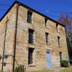
Pinhoti National Recreation Trail, National Recreation Trail in Alabama and Georgia, United States
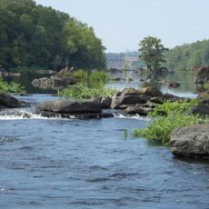
Pinhoti National Recreation Trail is a long-distance footpath in Alabama and Georgia that runs for 335 miles (539 kilometers) through the southern Appalachians, linking forests, ridges, and valleys across two states. The route moves through hardwood groves, over rocky summits, and alongside mountain streams, with terrain that shifts constantly between steep climbs and gentle descents.
Work began in 1970 when forest service staff and hiking clubs started building sections to create a continuous mountain route. Over the following decades, volunteers and agencies gradually extended the path, eventually linking it to the Benton MacKaye Trail and forming part of a broader long-distance network.
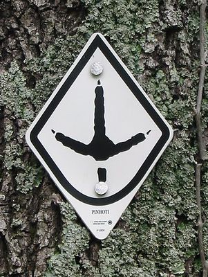
The name comes from the Muskogee language and means "home of the turkeys," reflecting the region's connection to indigenous naming traditions. Hikers today follow a path that crosses old forests and ridges still shaped by the same wildlife and seasonal patterns known to early inhabitants.
Several trailheads with parking offer access to different segments, making it easy to plan day hikes or longer stretches based on fitness and time. Water sources are spaced unevenly along the route, so checking availability beforehand helps, especially during dry months.
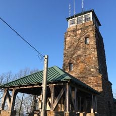
The southern end rests at Flagg Mountain, which holds the title of the southernmost peak above 1000 feet (305 meters) in Alabama. A stone fire tower stands on top, offering a wide view over the surrounding forest when visitors climb its steps.
The community of curious travelers
AroundUs brings together thousands of curated places, local tips, and hidden gems, enriched daily by 60,000 contributors worldwide.