Enable Location

We need your location to show you interesting places around you

Discover nearby places

Find interesting locations and hidden gems around you

Precise directions

Get accurate directions and distances to places

Your location is never shared with other users. It's only used when you tap the location button.

Log in to your account

Start exploring — it's free

Trusted by 68,279 travelers worldwide

Continue with Google
Continue with Apple
or

We will send you a code to connect

By continuing, you accept our Terms and Conditions and our Privacy Policy

Check your inbox

We've sent a pincode in your inbox. Please enter the code below.

Discussion Reviews Photo
16.8k Popularity

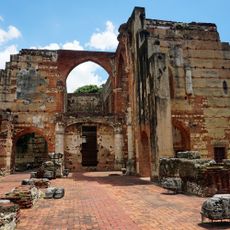
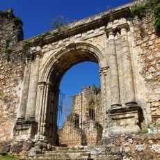
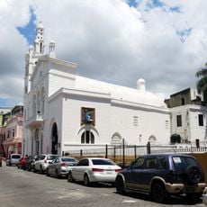
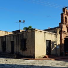
Yamasá, Uno de los Municipios cabecera de la Provincia Monte Plata

Yamasá is a municipality in Monte Plata Province situated in a region of low mountains where green forests and red soils shape the landscape. The area lies between the Lomas de la Guardarraya and the Los Haitises region and receives over 1,500 millimeters of rain yearly, supporting lush subtropical forest growth.

The area was founded in 1859 by nun María Matilde Estevéz de Villa Mella, who arrived with her husband Damián Manzueta. The settlement grew gradually and gained official recognition as a municipality in 1982 after serving as a section of a larger administrative district for many years.

Yamasá's name means humid land, reflecting the region's rainy character and agricultural identity. The community celebrates the Virgin of Mercy each September with processions and shared meals that bring neighbors together and keep local traditions alive.

The area is accessible via rural roads that pass through mountains and green farmland. Come prepared for rainy conditions and wear sturdy shoes, as paths often cross wet terrain.

The area is one of the country's main organic cacao production regions, with a strong tradition of carefully cultivated cacao beans used for high-quality chocolate. Many farmers here work using sustainable methods to preserve their crop quality.

The community of curious travelers

AroundUs brings together thousands of curated places, local tips, and hidden gems, enriched daily by 60,000 contributors worldwide.

Start exploring
Elevation above the sea
82 m
GPS coordinates
18.76667,-70.01667
Latest update
February 17, 2026 01:40
Around this place
Alcázar de Colón
Dominican Republic

Alcázar de Colón

35.2 km
Puerta del Conde
Dominican Republic

Puerta del Conde

35.4 km
Teatro Nacional Eduardo Brito
Dominican Republic

Teatro Nacional Eduardo Brito

34.8 km
National Palace
Dominican Republic

National Palace

34.9 km
Estadio Olímpico Félix Sánchez
Dominican Republic

Estadio Olímpico Félix Sánchez

33.5 km
Dominican National Pantheon
Dominican Republic

Dominican National Pantheon

35.4 km
Dr. Rafael Ma. Moscoso National Botanical Garden
Dominican Republic

Dr. Rafael Ma. Moscoso National Botanical Garden

31.3 km
Museo del Hombre Dominicano
Dominican Republic

Museo del Hombre Dominicano

34.7 km
Hospital San Nicolás de Bari
Dominican Republic

Hospital San Nicolás de Bari

35.3 km
Monasterio de San Francisco
Dominican Republic

Monasterio de San Francisco

35.1 km
Dominican Republic

Pantoja

27 km
Altar of the Homeland
Dominican Republic

Altar of the Homeland

35.4 km
GONZALO 2020 bridge
Dominican Republic

GONZALO 2020 bridge

34.2 km
Puente Juan Pablo Duarte
Dominican Republic

Puente Juan Pablo Duarte

34.3 km
Winston Churchill Avenue, Dominican Republic
Dominican Republic

Winston Churchill Avenue, Dominican Republic

33.7 km
Casa del Cordón
Dominican Republic

Casa del Cordón

35.2 km
Museo Nacional de Historia Natural
Dominican Republic

Museo Nacional de Historia Natural

34.9 km
Santo Domingo Dominican Republic Temple
Dominican Republic

Santo Domingo Dominican Republic Temple

35 km
Dominican Republic

Al-Noor Mosque

34.5 km
Dominican Republic

Museo Bellapart

33.1 km
Puente Matías Ramón Mella
Dominican Republic

Puente Matías Ramón Mella

34.8 km
Centro Israelita de República Dominicana
Dominican Republic

Centro Israelita de República Dominicana

35.3 km
Royal Shipyards of Santo Domingo
Dominican Republic

Royal Shipyards of Santo Domingo

35.1 km
Edificio Saviñón
Dominican Republic

Edificio Saviñón

35.4 km
Terminal Don Diego
Dominican Republic

Terminal Don Diego

35.4 km
Nuestra Señora de la Altagracia church
Dominican Republic

Nuestra Señora de la Altagracia church

35.3 km
Museo Naval de las Atarazanas Reales
Dominican Republic

Museo Naval de las Atarazanas Reales

35.1 km
Capilla de Nuestra Señora de los Remedios
Dominican Republic

Capilla de Nuestra Señora de los Remedios

35.4 km
Show the full map
Reviews
Share your experience

No review yet

Discussions
Start a discussion...

No discussion yet

« Yamasá - Uno de los Municipios cabecera de la Provincia Monte Plata » is provided by Around Us (aroundus.com). Images and texts are derived from Wikimedia project under a Creative Commons license. You are allowed to copy, distribute, and modify copies of this page, under the conditions set by the license, as long as this note is clearly visible.

Discover hidden gems everywhere you go!

From secret cafés to breathtaking viewpoints, skip the crowded tourist spots and find places that match your style. Our app makes it easy with voice search, smart filtering, route optimization, and insider tips from travelers worldwide. Download now for the complete mobile experience.

Around Us App Screenshot

A unique approach to discovering new places

Le Figaro

All the places worth exploring

France Info

A tailor-made excursion in just a few clicks

20 Minutes

Around Us
Travel Guide & Maps
Download

Send to your phone

QR Code
1

Open the camera app on your mobile.

2

Point at the QR code with your camera. A notification will appear.

3

Tap the notification to open the link.