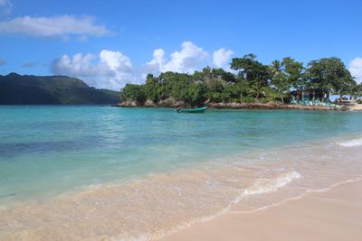
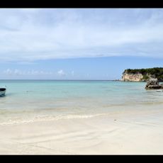
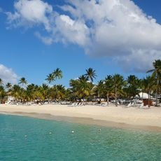
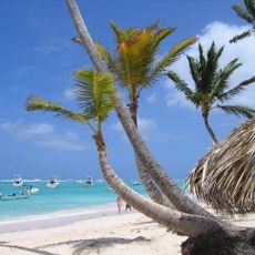
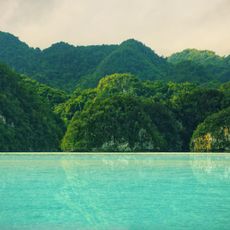
Playa Rincón, Atlantic beach on Samaná Peninsula, Dominican Republic
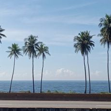
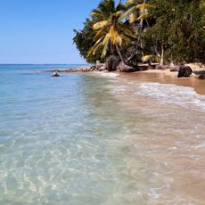
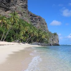
Playa Rincón is a beach on the Samaná Peninsula in the Dominican Republic where white sand stretches between two rocky capes. The water shines turquoise, and coconut palms line the entire shoreline.
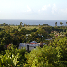
The Samaná Peninsula remained largely undeveloped until new highways and an airport were built in recent decades, making the area easier to reach. Since then, the coastline has slowly become a destination for visitors.
Local vendors cook traditional Dominican meals on the sand, serving rice with beans and grilled seafood prepared over open fires right where you are. The food tastes simple and fresh, flavored by the ocean breeze and the rhythm of the beach.
The best time to visit is during months with less rain, when the sand is dry and the water is pleasant. Bring plenty of water and sun protection, as there is little shade and the sun is intense by the ocean.
The beach splits into two sections with very different conditions: the western end has calm water for swimming, while the eastern end has strong waves for surfing. This separation lets different visitors find what suits them best.
Elevation above the sea: 4 m
GPS coordinates: 19.28833,-69.24833
Latest update: December 6, 2025 19:07
The Dominican Republic draws photographers with its range of landscapes and subjects. Along the coast, long stretches of sand beaches appear, some with calm water, others with waves that attract surfers. Inland, trails lead to waterfalls that drop over rocks into natural pools, while caves and underground lakes offer unexpected finds. Colonial buildings in Santo Domingo display 16th-century architecture, with stone churches, monastery ruins, and fortresses that stand along harbor walls. Places in the collection include the Basilica of Santa Maria la Menor, the Dominican Convent, and Fortaleza San Felipe. Beaches like Bavaro, Macao, and Playa Rincon provide different coastal views, while Los Haitises National Park shows mangrove forests and limestone formations. Waterfalls such as El Limon and the 27 Charcos de Damajagua sit within forested areas. Saona and Cayo Arena are small islands with shallow water. Lago Enriquillo, a saltwater lake below sea level, lies in a dry setting near the Haitian border. These locations give a sense of the natural and built environments across the island.
Los Haitises National Park
45.3 km
Alcázar de Colón
112.3 km
Columbus Lighthouse
111.3 km
Basílica Catedral Nuestra Señora de la Altagracia
93.4 km
Los Tres Ojos National Park
109.5 km
Park nacional cueva de las maravillas
93.5 km
Macao playa turística
94.2 km
Reserva científica natural lagunas Redonda y Limón
44.8 km
GONZALO 2020 bridge
111.5 km
Parque Nacional Submarino La Caleta
104.1 km
Puente Juan Pablo Duarte
111.4 km
Casa del Cordón
112.5 km
Jardín Botanico
105.2 km
El Limón Waterfall
20.9 km
Puente Matías Ramón Mella
111.9 km
Molinos Park
107.7 km
Abreu (distrito municipal)
85 km
Playa Catalina
106.4 km
Playa Cosón
37 km
Playa Bavaro
105.4 km
Cueva Arena
32.4 km
Playa Bonita
33.7 km
Terminal Don Diego
112.4 km
Los Haitises
61.6 km
Museo Naval de las Atarazanas Reales
112.3 km
Bayahibe Beach
110.6 km
Playa Fronton
10.2 km
Plaza Bonaire
109 kmVisited this place? Tap the stars to rate it and share your experience / photos with the community! Try now! You can cancel it anytime.
Discover hidden gems everywhere you go!
From secret cafés to breathtaking viewpoints, skip the crowded tourist spots and find places that match your style. Our app makes it easy with voice search, smart filtering, route optimization, and insider tips from travelers worldwide. Download now for the complete mobile experience.
A unique approach to discovering new places❞
— Le Figaro
All the places worth exploring❞
— France Info
A tailor-made excursion in just a few clicks❞
— 20 Minutes