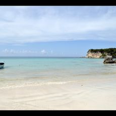
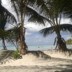
Bayahibe Beach, Public beach in La Altagracia Province, Dominican Republic
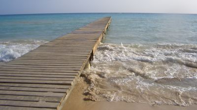
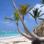
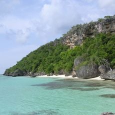
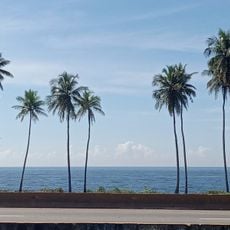
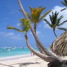
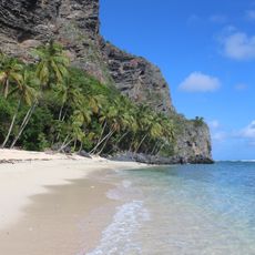
Bayahibe Beach is a coastal stretch with light-colored sand and clear water along the Caribbean, bordered by palms and rocky formations. The shoreline combines shallow swimming areas with deeper zones suitable for various water activities.
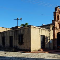
The village of Bayahibe was founded in the late 1800s when families from other regions settled here for fishing. It later developed slowly into a small tourist destination while keeping its roots in fishing.
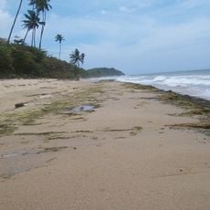
The beach remains connected to the working lives of local fishers who practice their traditional craft here. You can watch colorful boats and observe fishing methods that have been central to the area for generations.
The beach is easily accessible during the day and has basic services like restaurants and boat rentals nearby. You'll find the water calmest in morning hours when the area is less crowded.
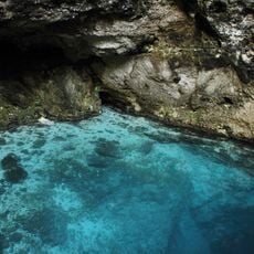
The waters offshore are home to sea turtles that you can sometimes spot, especially in shallower areas. These animals are important to the ecosystem and make a visit feel like a special nature experience.
Location: La Altagracia Province
GPS coordinates: 18.37269,-68.84198
Latest update: December 6, 2025 19:09
The Dominican Republic draws photographers with its range of landscapes and subjects. Along the coast, long stretches of sand beaches appear, some with calm water, others with waves that attract surfers. Inland, trails lead to waterfalls that drop over rocks into natural pools, while caves and underground lakes offer unexpected finds. Colonial buildings in Santo Domingo display 16th-century architecture, with stone churches, monastery ruins, and fortresses that stand along harbor walls. Places in the collection include the Basilica of Santa Maria la Menor, the Dominican Convent, and Fortaleza San Felipe. Beaches like Bavaro, Macao, and Playa Rincon provide different coastal views, while Los Haitises National Park shows mangrove forests and limestone formations. Waterfalls such as El Limon and the 27 Charcos de Damajagua sit within forested areas. Saona and Cayo Arena are small islands with shallow water. Lago Enriquillo, a saltwater lake below sea level, lies in a dry setting near the Haitian border. These locations give a sense of the natural and built environments across the island.
Los Haitises National Park
108.9 km
Isla de Mona
105.6 km
Alcázar de Colón
110.5 km
Columbus Lighthouse
109 km
Basílica Catedral Nuestra Señora de la Altagracia
30.1 km
Los Tres Ojos National Park
106.5 km
Altos de Chavón
7.5 km
Fortaleza Ozama
110.4 km
Dominican National Pantheon
110.6 km
Park nacional cueva de las maravillas
34.8 km
Macao playa turística
55 km
Reserva científica natural lagunas Redonda y Limón
71.8 km
Parque Nacional Submarino La Caleta
89.5 km
Puente Juan Pablo Duarte
110.5 km
Cotubanamá National Park
23.3 km
Mona and Monito Islands Nature Reserve
105.6 km
Jardín Botanico
83.7 km
Parque Nacional Del Este
29.2 km
Molinos Park
100.4 km
Mona Island Light
110 km
Playa Bavaro
56.4 km
Terminal Don Diego
110.4 km
Cueva Arena
102.9 km
Capilla de Nuestra Señora de los Remedios
110.5 km
Playa Fronton
108 km
Hoyo Azul
44 km
Arena Gorda Beach
56.4 km
Visited this place? Tap the stars to rate it and share your experience / photos with the community! Try now! You can cancel it anytime.
Discover hidden gems everywhere you go!
From secret cafés to breathtaking viewpoints, skip the crowded tourist spots and find places that match your style. Our app makes it easy with voice search, smart filtering, route optimization, and insider tips from travelers worldwide. Download now for the complete mobile experience.
A unique approach to discovering new places❞
— Le Figaro
All the places worth exploring❞
— France Info
A tailor-made excursion in just a few clicks❞
— 20 Minutes