Enable Location

We need your location to show you interesting places around you

Discover nearby places

Find interesting locations and hidden gems around you

Precise directions

Get accurate directions and distances to places

Your location is never shared with other users. It's only used when you tap the location button.

Cotubanamá National Park

Log in to your account

Start exploring — it's free

Trusted by 61,527 travelers worldwide

Continue with Google
Continue with Apple
or

We will send you a code to connect

By continuing, you accept our Terms and Conditions and our Privacy Policy

Check your inbox

We've sent a pincode in your inbox. Please enter the code below.

Cotubanamá National Park

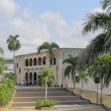
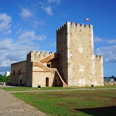
Cotubanamá National Park, national park in the Dominican Republic

Description

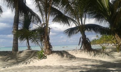
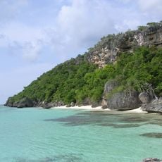
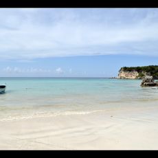
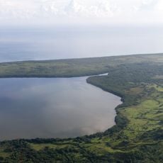
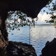
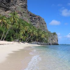
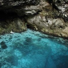
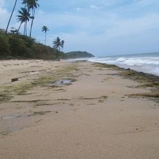
Cotubanamá National Park is a protected area in La Altagracia Province featuring subtropical forests, mangrove wetlands, sandy coastlines, and numerous caves. The park encompasses Saona Island, which holds coral reef systems, along with underground springs that feed the caves throughout the region.

History

The park received its current name in 2014 to honor Chief Cotubanamá, who resisted Spanish colonizers in the early 1500s. The naming acknowledges the region's long indigenous settlement and the struggle against external conquest.

Culture

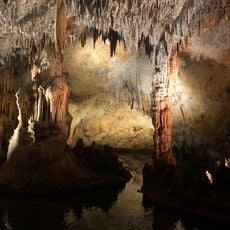
The park holds ceremonial sites and caves with petroglyphs left by the Taíno people who inhabited this land long ago. These places remain meaningful to local communities today, shaping how the land is visited and cared for.

Practical

The park is accessed through two main gates in Bayahibe, where visitors receive wristbands and can arrange boat excursions to Saona Island or guided cave tours. Wear sturdy footwear and bring plenty of water, since trails pass through wet terrain and rocky ground.

Did you know?

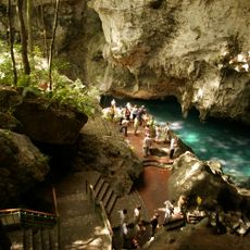
The Sendero Padre Nuestro trail network connects multiple caves holding ancient pictographs with pure underground water sources that remain valuable to nearby communities. This system shows how natural springs and pre-colonial art sites are found together in one linked network of paths.

GPS coordinates
18.22830,-68.68300
Latest update
December 12, 2025 08:01

AroundUs brings together thousands of curated places, local tips, and hidden gems, enriched daily by 60,000 contributors worldwide. Discover all places nearby (La Altagracia Province).

Around this place
Isla de Mona
United States of America

Isla de Mona

85.3 km
Alcázar de Colón
Dominican Republic

Alcázar de Colón

129.8 km
Columbus Lighthouse
Dominican Republic

Columbus Lighthouse

128.3 km
Basílica Catedral Nuestra Señora de la Altagracia
Dominican Republic

Basílica Catedral Nuestra Señora de la Altagracia

43.3 km
Basílica Catedral Metropolitana Santa María de la Encarnación
Dominican Republic

Basílica Catedral Metropolitana Santa María de la Encarnación

129.8 km
Los Tres Ojos National Park
Dominican Republic

Los Tres Ojos National Park

125.8 km
Altos de Chavón
Dominican Republic

Altos de Chavón

30.8 km
Fortaleza Ozama
Dominican Republic

Fortaleza Ozama

129.6 km
Dominican National Pantheon
Dominican Republic

Dominican National Pantheon

129.7 km
Park nacional cueva de las maravillas
Dominican Republic

Park nacional cueva de las maravillas

56.3 km
Macao playa turística
Dominican Republic

Macao playa turística

62.7 km
Reserva científica natural lagunas Redonda y Limón
Dominican Republic

Reserva científica natural lagunas Redonda y Limón

91.2 km
Parque Nacional Submarino La Caleta
Dominican Republic

Parque Nacional Submarino La Caleta

108.7 km
United States of America

Mona and Monito Islands Nature Reserve

85.4 km
Jardín Botanico
Dominican Republic

Jardín Botanico

102.6 km
Dominican Republic

Parque Nacional Del Este

7.6 km
Molinos Park
Dominican Republic

Molinos Park

119.7 km
Mona Island Light
United States of America

Mona Island Light

89.9 km
Casa de Tostado
Dominican Republic

Casa de Tostado

129.8 km
Playa Bavaro
Dominican Republic

Playa Bavaro

59.7 km
Terminal Don Diego
Dominican Republic

Terminal Don Diego

129.6 km
Cueva Arena
Dominican Republic

Cueva Arena

126.1 km
Museo Naval de las Atarazanas Reales
Dominican Republic

Museo Naval de las Atarazanas Reales

129.8 km
Capilla de Nuestra Señora de los Remedios
Dominican Republic

Capilla de Nuestra Señora de los Remedios

129.7 km
Bayahibe Beach
Dominican Republic

Bayahibe Beach

23.3 km
Playa Fronton
Dominican Republic

Playa Fronton

128.8 km
Hoyo Azul
Dominican Republic

Hoyo Azul

37.8 km
Arena Gorda Beach
Dominican Republic

Arena Gorda Beach

59.5 km
Show the full map
« Cotubanamá National Park - national park in the Dominican Republic » is provided by Around Us (aroundus.com). Images and texts are derived from Wikimedia project under a Creative Commons license. You are allowed to copy, distribute, and modify copies of this page, under the conditions set by the license, as long as this note is clearly visible.

Discover hidden gems everywhere you go!

From secret cafés to breathtaking viewpoints, skip the crowded tourist spots and find places that match your style. Our app makes it easy with voice search, smart filtering, route optimization, and insider tips from travelers worldwide. Download now for the complete mobile experience.

Around Us App Screenshot

A unique approach to discovering new places

Le Figaro

All the places worth exploring

France Info

A tailor-made excursion in just a few clicks

20 Minutes

Around Us
Travel Guide & Maps
Download

Send to your phone

QR Code
1

Open the camera app on your mobile.

2

Point at the QR code with your camera. A notification will appear.

3

Tap the notification to open the link.