Enable Location

We need your location to show you interesting places around you

Discover nearby places

Find interesting locations and hidden gems around you

Precise directions

Get accurate directions and distances to places

Your location is never shared with other users. It's only used when you tap the location button.

Log in to your account

Start exploring — it's free

Trusted by 62,062 travelers worldwide

Continue with Google
Continue with Apple
or

We will send you a code to connect

By continuing, you accept our Terms and Conditions and our Privacy Policy

Check your inbox

We've sent a pincode in your inbox. Please enter the code below.

Parque Nacional Del Este

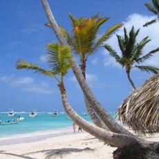
Parque Nacional Del Este, National park in southeastern Dominican Republic

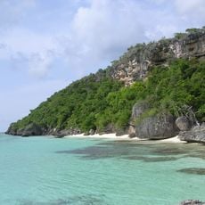
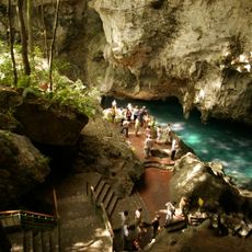
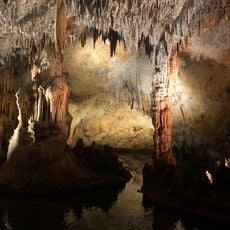
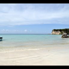
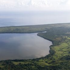
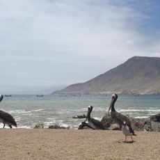
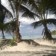
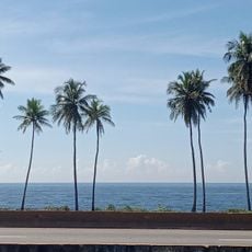
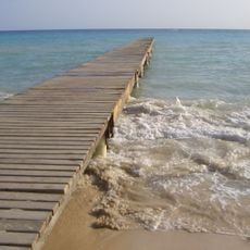
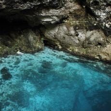
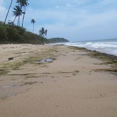
The national park combines tropical rainforests, drier forest zones, and coastal areas with coral reefs across its territory. The landscape includes numerous caves, sandy beaches, and small islands that together create a varied natural environment.

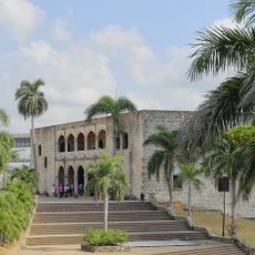
The protected area was established in 1975 as one of the Dominican Republic's early conservation efforts. Archaeological remains scattered throughout the park show how indigenous people inhabited and used these lands long before modern times.

The Padre Nuestro Ecological Trail passes through caves decorated with rock art created by the Taíno people who once lived in this region. Walking through these spaces, visitors can sense the connection between the indigenous community and the natural landscape they inhabited.

Entry points are available at Bayahibe and Boca de Yuma, and a local guide is needed for exploring specific trails and cave systems. Bring sturdy shoes and water, as the terrain can be rough and caves require careful movement.

The park serves as a crucial nesting ground where three sea turtle species come ashore to lay their eggs each year. This breeding cycle makes it an important stop on the migration routes of these marine animals.

The community of curious travelers

AroundUs brings together thousands of curated places, local tips, and hidden gems, enriched daily by 60,000 contributors worldwide.

Start exploring
GPS coordinates
18.16000,-68.68000
Latest update
December 12, 2025 16:41
Around this place
Isla de Mona
United States of America

Isla de Mona

83.9 km
Alcázar de Colón
Dominican Republic

Alcázar de Colón

131.9 km
Columbus Lighthouse
Dominican Republic

Columbus Lighthouse

130.5 km
Basílica Catedral Nuestra Señora de la Altagracia
Dominican Republic

Basílica Catedral Nuestra Señora de la Altagracia

50.9 km
Basílica Catedral Metropolitana Santa María de la Encarnación
Dominican Republic

Basílica Catedral Metropolitana Santa María de la Encarnación

131.9 km
Los Tres Ojos National Park
Dominican Republic

Los Tres Ojos National Park

128.1 km
Altos de Chavón
Dominican Republic

Altos de Chavón

36.7 km
Fortaleza Ozama
Dominican Republic

Fortaleza Ozama

131.7 km
Dominican National Pantheon
Dominican Republic

Dominican National Pantheon

131.9 km
Park nacional cueva de las maravillas
Dominican Republic

Park nacional cueva de las maravillas

60.3 km
Macao playa turística
Dominican Republic

Macao playa turística

70 km
Reserva científica natural lagunas Redonda y Limón
Dominican Republic

Reserva científica natural lagunas Redonda y Limón

98.6 km
Parque Nacional Submarino La Caleta
Dominican Republic

Parque Nacional Submarino La Caleta

111 km
Cotubanamá National Park
Dominican Republic

Cotubanamá National Park

7.6 km
United States of America

Mona and Monito Islands Nature Reserve

84 km
Jardín Botanico
Dominican Republic

Jardín Botanico

104.7 km
Molinos Park
Dominican Republic

Molinos Park

121.9 km
Mona Island Light
United States of America

Mona Island Light

88.6 km
Museo de Ámbar
Dominican Republic

Museo de Ámbar

132 km
Casa de Tostado
Dominican Republic

Casa de Tostado

131.9 km
Playa Bavaro
Dominican Republic

Playa Bavaro

66.6 km
Terminal Don Diego
Dominican Republic

Terminal Don Diego

131.8 km
Palacio Consistorial
Dominican Republic

Palacio Consistorial

132 km
Museo Naval de las Atarazanas Reales
Dominican Republic

Museo Naval de las Atarazanas Reales

132 km
Capilla de Nuestra Señora de los Remedios
Dominican Republic

Capilla de Nuestra Señora de los Remedios

131.9 km
Bayahibe Beach
Dominican Republic

Bayahibe Beach

29.2 km
Hoyo Azul
Dominican Republic

Hoyo Azul

43.5 km
Arena Gorda Beach
Dominican Republic

Arena Gorda Beach

66.4 km
Show the full map
« Parque Nacional Del Este - National park in southeastern Dominican Republic » is provided by Around Us (aroundus.com). Images and texts are derived from Wikimedia project under a Creative Commons license. You are allowed to copy, distribute, and modify copies of this page, under the conditions set by the license, as long as this note is clearly visible.

Discover hidden gems everywhere you go!

From secret cafés to breathtaking viewpoints, skip the crowded tourist spots and find places that match your style. Our app makes it easy with voice search, smart filtering, route optimization, and insider tips from travelers worldwide. Download now for the complete mobile experience.

Around Us App Screenshot

A unique approach to discovering new places

Le Figaro

All the places worth exploring

France Info

A tailor-made excursion in just a few clicks

20 Minutes

Around Us
Travel Guide & Maps
Download

Send to your phone

QR Code
1

Open the camera app on your mobile.

2

Point at the QR code with your camera. A notification will appear.

3

Tap the notification to open the link.