Chest opened
+${chestReward.xp} XP
Explorer
NOUVEAU ×${chestReward.collectible.quantity}
tapez pour fermer
Chest locked

Open chests in the app

Around Us is built for your phone — chests unlock when you walk, explore and capture nearby places.

Enable Location

We need your location to show you interesting places around you

Discover nearby places

Find interesting locations and hidden gems around you

Precise directions

Get accurate directions and distances to places

Your location is never shared with other users. It's only used when you tap the location button.

Caloosahatchee River

Log in to your account

Start exploring — it's free

Trusted by 72,889 travelers worldwide

Continue with Google
Continue with Apple
or

We will send you a code to connect

By continuing, you accept our Terms and Conditions and our Privacy Policy

Check your inbox

We've sent a pincode in your inbox. Please enter the code below.

Caloosahatchee River
Discussion Reviews 1 Photos
30.4k Popularity

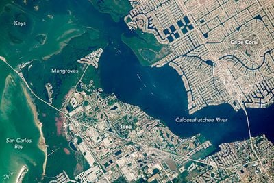
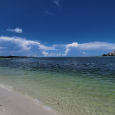
Caloosahatchee River, River estuary in southwestern Florida, United States.

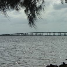
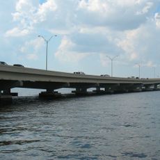
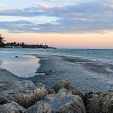
The Caloosahatchee River is a river estuary in southwestern Florida that stretches from Lake Hicpochee to the Gulf of Mexico. It flows past Fort Myers and Cape Coral before emptying into San Carlos Bay, where fresh and salt water mix.

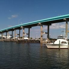
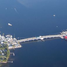
In the 1880s, the river was transformed into a continuous waterway system through canal dredging that connected inland waters with the outside world. This change made shipping and boat traffic possible and shaped the development of settlements in the region.

The river is an important place for locals and visitors to paddle and fish, where you can experience the tidal life directly. Along the banks you can watch fishermen casting nets and people using the water the way they have for generations.

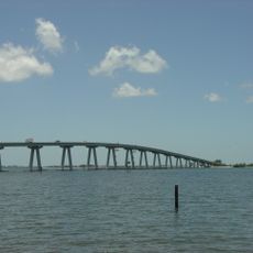
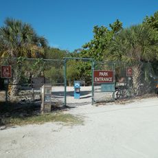
The river has several access points with boat launches and is easiest to navigate during the drier months. Visitors should pay attention to tidal changes, as they significantly affect water levels and current flow.

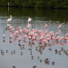
At the river mouth there is a protected area for manatees, where you can watch these gentle marine mammals in their natural habitat. Manatees are found here year-round and are protected by local conservation efforts.

The community of curious travelers

AroundUs brings together thousands of curated places, local tips, and hidden gems, enriched daily by 60,000 contributors worldwide.

Start exploring
GPS coordinates
26.51702,-82.03314
Latest update
December 20, 2025 02:21
Around this place
Edison and Ford Winter Estates
United States of America

Edison and Ford Winter Estates

20 km
Sanibel Causeway
United States of America

Sanibel Causeway

4.6 km
J.N. "Ding" Darling National Wildlife Refuge
United States of America

J.N. "Ding" Darling National Wildlife Refuge

9.3 km
Lovers Key State Park
United States of America

Lovers Key State Park

20.6 km
Sanibel Island Light
United States of America

Sanibel Island Light

7.4 km
Cape Coral Bridge
United States of America

Cape Coral Bridge

11.5 km
Midpoint Memorial Bridge
United States of America

Midpoint Memorial Bridge

16.1 km
Bailey-Matthews Shell Museum
United States of America

Bailey-Matthews Shell Museum

10.9 km
Matanzas Pass Bridge
United States of America

Matanzas Pass Bridge

10.3 km
Matlacha Bridge
United States of America

Matlacha Bridge

13.3 km
Sun Splash Family Waterpark
United States of America

Sun Splash Family Waterpark

14.8 km
John Yarbrough Linear Park
United States of America

John Yarbrough Linear Park

18.6 km
Turner Beach
United States of America

Turner Beach

15.5 km
Casa Rio
United States of America

Casa Rio

19.9 km
Edison Park Elementary School
United States of America

Edison Park Elementary School

20.4 km
Tween Waters Inn Historic District
United States of America

Tween Waters Inn Historic District

15.7 km
Fort Myers Beach School
United States of America

Fort Myers Beach School

12.1 km
Punta Gorda Fish Company Ice House
United States of America

Punta Gorda Fish Company Ice House

20.1 km
Captiva School and Chapel-by-the-Sea Historic District
United States of America

Captiva School and Chapel-by-the-Sea Historic District

15.9 km
Jewett-Thompson House
United States of America

Jewett-Thompson House

17.5 km
Blind Pass Beach
United States of America

Blind Pass Beach

15.3 km
Fish Cabin at White Rock Shoals
United States of America

Fish Cabin at White Rock Shoals

9.4 km
Railroad Museum of South Florida
United States of America

Railroad Museum of South Florida

15.6 km
Cape Coral Yacht club beach
United States of America

Cape Coral Yacht club beach

8.6 km
Mound House
United States of America

Mound House

13.1 km
Bunche Beach
United States of America

Bunche Beach

8 km
Lovers Key State Park
United States of America

Lovers Key State Park

20.8 km
Henry Ford Winter Estate
United States of America

Henry Ford Winter Estate

19.9 km
Show the full map
Reviews
Share your experience

No review yet

Discussions
Start a discussion...

No discussion yet

« Caloosahatchee River - River estuary in southwestern Florida, United States » is provided by Around Us (aroundus.com). Images and texts are derived from Wikimedia project under a Creative Commons license. You are allowed to copy, distribute, and modify copies of this page, under the conditions set by the license, as long as this note is clearly visible.

Discover hidden gems everywhere you go!

From secret cafés to breathtaking viewpoints, skip the crowded tourist spots and find places that match your style. Our app makes it easy with voice search, smart filtering, route optimization, and insider tips from travelers worldwide. Download now for the complete mobile experience.

Around Us App Screenshot

A unique approach to discovering new places

Le Figaro

All the places worth exploring

France Info

A tailor-made excursion in just a few clicks

20 Minutes

Around Us
Travel Guide & Maps
Download

Send to your phone

QR Code
1

Open the camera app on your mobile.

2

Point at the QR code with your camera. A notification will appear.

3

Tap the notification to open the link.