Tallapoosa County

Log in to your account

AroundUs is a community-driven map of interesting places, built by curious explorers like you. It grows with every review, story, and photo you share.
Connect to save your favorite spots, contribute locations, and create personalized routes.
By continuing, you accept our Terms and Conditions and our Privacy Policy
Add to collection
Map
Suggest a change
Share

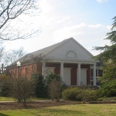
Tallapoosa County, County administrative division in east-central Alabama, United States

Tallapoosa County is an administrative region in east-central Alabama with varied landscapes ranging from hilly areas with clay soils to fertile valleys. A major river runs through the territory and shapes the land's natural divisions.

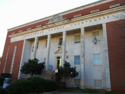
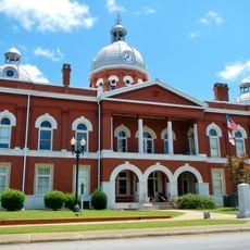
The region was established as a political unit in 1832, formed from territories previously inhabited by Creek Indian peoples. The first administrative center changed location as the population grew and shifted over time.

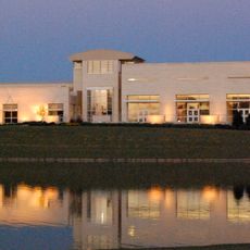
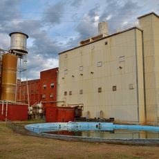
The name comes from the Tallapoosa River, which winds through the land and shaped how people settled here. Today, visitors can see how manufacturing and service work have become central to how communities function and develop.

The area is accessible by car and most destinations can be reached along the main roads. Visitors should expect that some parts are rural, so travel times between attractions may be longer than in urban areas.

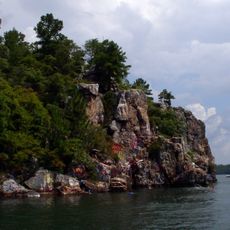
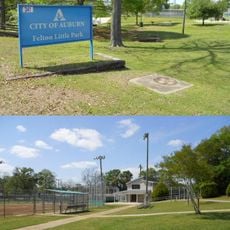
A large reservoir sits within the county's borders and serves as a hub for boating and water recreation. Many visitors come to the surrounding parks for camping and waterside leisure activities.

Location: Alabama

Inception: December 18, 1832

Capital city: Dadeville

Shares border with: Clay County, Randolph County, Chambers County, Lee County, Macon County, Elmore County, Coosa County

Website: http://tallaco.com

GPS coordinates: 32.86139,-85.79722

Latest update: December 7, 2025 10:07

Photos
Around this place
Show the full map
Lake Martin
United States of America

Lake Martin

14.4 km
Neville Arena
United States of America

Neville Arena

40.5 km
Jordan–Hare Stadium
United States of America

Jordan–Hare Stadium

40.8 km
Samford Hall
United States of America

Samford Hall

41 km
Langdon Hall
United States of America

Langdon Hall

41 km
Jule Collins Smith Museum of Fine Art
United States of America

Jule Collins Smith Museum of Fine Art

42.3 km
Duck Samford Stadium
United States of America

Duck Samford Stadium

43.1 km
Auburn University Chapel
United States of America

Auburn University Chapel

41.1 km
Drake Field
United States of America

Drake Field

40.9 km
Shiloh Missionary Baptist Church and Rosenwald School
United States of America

Shiloh Missionary Baptist Church and Rosenwald School

38.8 km
County Line Baptist Church
United States of America

County Line Baptist Church

20.4 km
Auburn Softball Complex
United States of America

Auburn Softball Complex

43.4 km
Pebble Hill
United States of America

Pebble Hill

41.6 km
Felton Little Park
United States of America

Felton Little Park

41 km
Cater Hall
United States of America

Cater Hall

41 km
Ebenezer Missionary Baptist Church
United States of America

Ebenezer Missionary Baptist Church

41.7 km
Russell Family Historic District
United States of America

Russell Family Historic District

17.9 km
Chambers County Courthouse Square Historic District
United States of America

Chambers County Courthouse Square Historic District

37.3 km
Auburn University Historic District
United States of America

Auburn University Historic District

41 km
A.J. and Emma E. Thomas Coley House
United States of America

A.J. and Emma E. Thomas Coley House

17.1 km
Reuben Herzfeld House
United States of America

Reuben Herzfeld House

17 km
Avondale Historic District
United States of America

Avondale Historic District

16 km
Robert Wilton Burton House
United States of America

Robert Wilton Burton House

41.2 km
Ernest McCarty Oliver House
United States of America

Ernest McCarty Oliver House

37.2 km
North Central Historic District
United States of America

North Central Historic District

18.6 km
South Central Historic District
United States of America

South Central Historic District

16.5 km
Miller Covered Bridge
United States of America

Miller Covered Bridge

13.9 km
Horseshoe Bend National Military Park Visitor Center
United States of America

Horseshoe Bend National Military Park Visitor Center

14.6 km
Show the full map
Reviews

Visited this place? Tap the stars to rate it and share your experience / photos with the community! Try now! You can cancel it anytime.

« Tallapoosa County - County administrative division in east-central Alabama, United States » is provided by Around Us (aroundus.com). Images and texts are derived from Wikimedia project under a Creative Commons license. You are allowed to copy, distribute, and modify copies of this page, under the conditions set by the license, as long as this note is clearly visible.

Discover hidden gems everywhere you go!

From secret cafés to breathtaking viewpoints, skip the crowded tourist spots and find places that match your style. Our app makes it easy with voice search, smart filtering, route optimization, and insider tips from travelers worldwide. Download now for the complete mobile experience.

Around Us App Screenshot

A unique approach to discovering new places

Le Figaro

All the places worth exploring

France Info

A tailor-made excursion in just a few clicks

20 Minutes