Chest opened
+${chestReward.xp} XP
Explorer
NOUVEAU ×${chestReward.collectible.quantity}
tapez pour fermer
Chest locked

Open chests in the app

Around Us is built for your phone — chests unlock when you walk, explore and capture nearby places.

Enable Location

We need your location to show you interesting places around you

Discover nearby places

Find interesting locations and hidden gems around you

Precise directions

Get accurate directions and distances to places

Your location is never shared with other users. It's only used when you tap the location button.

Central Savannah River Area

Log in to your account

Start exploring — it's free

Trusted by 72,941 travelers worldwide

Continue with Google
Continue with Apple
or

We will send you a code to connect

By continuing, you accept our Terms and Conditions and our Privacy Policy

Check your inbox

We've sent a pincode in your inbox. Please enter the code below.

Central Savannah River Area
Discussion Reviews 1 Photos
17.9k Popularity

Central Savannah River Area, Trading and marketing region in Georgia and South Carolina, United States.

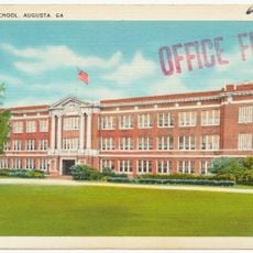
The Central Savannah River Area is a trading and economic region along the Savannah River spanning Georgia and South Carolina. It encompasses multiple counties on both sides of the river and functions as a connected economic zone with Augusta as its largest city.

The name originated in 1950 when a local newspaper held a naming contest to define the region's identity. The winning suggestion helped establish the area as a recognized economic zone linking both sides of the river.

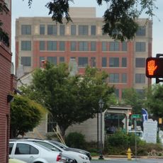
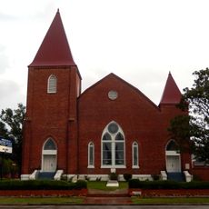
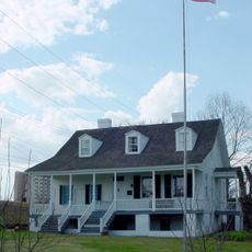
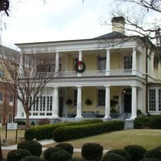
The region connects urban centers with surrounding countryside, with Augusta and Aiken serving as hubs where commerce and community life intersect. Local identity centers on the river's importance as both a physical and cultural landmark.

The region is most easily accessed through its main cities, which have road, rail, and air connections available. Visitors should know this covers a large area, so having your own transportation makes exploring much easier.

The region is divided by the Savannah River yet economically bound across it, making it a cross-border trade zone defined by commerce rather than political lines. This cross-river interdependence allowed the area to function as a single economic unit despite the state boundary.

The community of curious travelers

AroundUs brings together thousands of curated places, local tips, and hidden gems, enriched daily by 60,000 contributors worldwide.

Start exploring
Location
GPS coordinates
33.51500,-82.21610
Latest update
December 7, 2025 19:23
Around this place
Augusta National Golf Club
United States of America

Augusta National Golf Club

18.3 km
Fort Eisenhower
United States of America

Fort Eisenhower

13.6 km
Lake Strom Thurmond
United States of America

Lake Strom Thurmond

16.3 km
Augusta Canal
United States of America

Augusta Canal

20.2 km
United States of America

Confederate Powderworks

21 km
Sacred Heart Cultural Center
United States of America

Sacred Heart Cultural Center

22.6 km
Butt Memorial Bridge
United States of America

Butt Memorial Bridge

21.9 km
Morris Museum of Art
United States of America

Morris Museum of Art

23.3 km
Springfield Baptist Church
United States of America

Springfield Baptist Church

23 km
Meadow Garden
United States of America

Meadow Garden

22.4 km
Heggie's Rock
United States of America

Heggie's Rock

4.6 km
Augusta Botanical Gardens
United States of America

Augusta Botanical Gardens

22.9 km
Seclusaval and Windsor Spring
United States of America

Seclusaval and Windsor Spring

19.7 km
College Hill
United States of America

College Hill

19.6 km
Tubman High School
United States of America

Tubman High School

20.8 km
Kiokee Baptist Church
United States of America

Kiokee Baptist Church

10 km
Charles Hammond House
United States of America

Charles Hammond House

22 km
Stephen Vincent Benét House
United States of America

Stephen Vincent Benét House

18.4 km
Shiloh Orphanage
United States of America

Shiloh Orphanage

21.1 km
Lookaway Hall
United States of America

Lookaway Hall

23 km
Georgia Avenue-Butler Avenue Historic District
United States of America

Georgia Avenue-Butler Avenue Historic District

23.1 km
Rosemary Hall
United States of America

Rosemary Hall

22.9 km
Bath Presbyterian Church and Cemetery
United States of America

Bath Presbyterian Church and Cemetery

20.4 km
B.C. Wall House
United States of America

B.C. Wall House

22.7 km
Reid-Jones-Carpenter House
United States of America

Reid-Jones-Carpenter House

19.1 km
Hopewell Rosenwald School
United States of America

Hopewell Rosenwald School

13.5 km
Columbia County Courthouse
United States of America

Columbia County Courthouse

9.8 km
Lucy Craft Laney Museum
United States of America

Lucy Craft Laney Museum

22.4 km
Show the full map
Reviews
Share your experience

No review yet

Discussions
Start a discussion...

No discussion yet

« Central Savannah River Area - Trading and marketing region in Georgia and South Carolina, United States » is provided by Around Us (aroundus.com). Images and texts are derived from Wikimedia project under a Creative Commons license. You are allowed to copy, distribute, and modify copies of this page, under the conditions set by the license, as long as this note is clearly visible.

Discover hidden gems everywhere you go!

From secret cafés to breathtaking viewpoints, skip the crowded tourist spots and find places that match your style. Our app makes it easy with voice search, smart filtering, route optimization, and insider tips from travelers worldwide. Download now for the complete mobile experience.

Around Us App Screenshot

A unique approach to discovering new places

Le Figaro

All the places worth exploring

France Info

A tailor-made excursion in just a few clicks

20 Minutes

Around Us
Travel Guide & Maps
Download

Send to your phone

QR Code
1

Open the camera app on your mobile.

2

Point at the QR code with your camera. A notification will appear.

3

Tap the notification to open the link.