Enable Location

We need your location to show you interesting places around you

Discover nearby places

Find interesting locations and hidden gems around you

Precise directions

Get accurate directions and distances to places

Your location is never shared with other users. It's only used when you tap the location button.

Log in to your account

Start exploring — it's free

Trusted by 63,688 travelers worldwide

Continue with Google
Continue with Apple
or

We will send you a code to connect

By continuing, you accept our Terms and Conditions and our Privacy Policy

Check your inbox

We've sent a pincode in your inbox. Please enter the code below.

Discussion Reviews Photo
1.3k Popularity

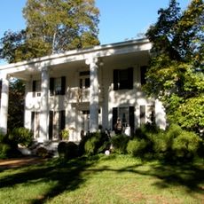
Turnwold, historic plantation in Georgia, USA

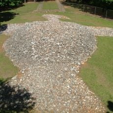
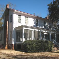
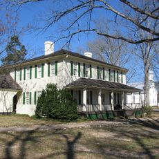
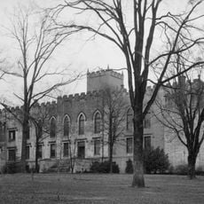
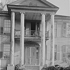
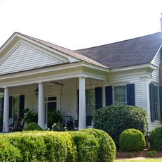
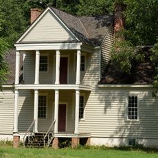
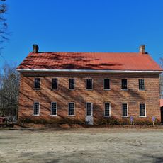
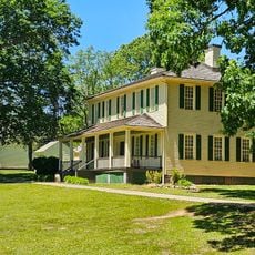
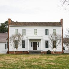
Turnwold is a plantation in Putnam County, Georgia, founded in the early 1800s and now listed on the National Register of Historic Places. The property consisted of two houses and agricultural structures, including a print shop where the newspaper The Countryman was published during the Civil War.

Brothers William and Joseph Turner received the land in 1805 through a land lottery and named it Turnwold. William Turner transformed the plantation into not only an agricultural center but also a publishing site, where the only known newspaper printed on a plantation during the Civil War was produced.

The name Turnwold comes from the Turner brothers who received the land in 1805 and named it Turner's field. The plantation served as more than just a farm, functioning as a place where a printing press operated and stories were shared among the people who lived and worked there.

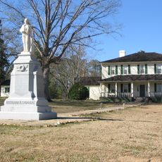
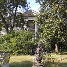
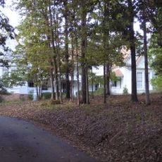
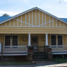
The plantation sits on private land, so free wandering is not possible for visitors. You can only view the buildings and grounds from a distance, typically from the roadside.

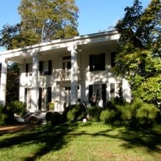
Joel Chandler Harris worked here as a young printer and heard stories from enslaved people that later inspired his famous Uncle Remus tales. These narratives, collected on a plantation, shaped an important chapter in American literary history.

The community of curious travelers

AroundUs brings together thousands of curated places, local tips, and hidden gems, enriched daily by 60,000 contributors worldwide.

Start exploring
Location
GPS coordinates
33.37861,-83.27472
Latest update
February 9, 2026 07:46
Around this place
Rock Eagle Effigy Mound
United States of America

Rock Eagle Effigy Mound

11.4 km
Andalusia
United States of America

Andalusia

28.2 km
Liberty Hall
United States of America

Liberty Hall

40.4 km
Old Governor's Mansion
United States of America

Old Governor's Mansion

33.5 km
Old State Capitol
United States of America

Old State Capitol

33.8 km
A. H. Stephens State Park
United States of America

A. H. Stephens State Park

40.7 km
Madison Historic District
United States of America

Madison Historic District

30.1 km
Samuel Rockwell House
United States of America

Samuel Rockwell House

36.1 km
Carter-Newton House
United States of America

Carter-Newton House

30.1 km
Monticello High School
United States of America

Monticello High School

39.2 km
Atkinson Hall, Georgia College
United States of America

Atkinson Hall, Georgia College

33.3 km
Milledgeville Historic District
United States of America

Milledgeville Historic District

33.7 km
Morgan County Courthouse
United States of America

Morgan County Courthouse

30 km
Springfield Baptist Church (Greensboro, Georgia)
United States of America

Springfield Baptist Church (Greensboro, Georgia)

23.9 km
Jefferson Hall
United States of America

Jefferson Hall

33.2 km
Jasper County Courthouse
United States of America

Jasper County Courthouse

38.9 km
Terrell-Sadler House
United States of America

Terrell-Sadler House

10.7 km
Cabaniss-Hanberry House
United States of America

Cabaniss-Hanberry House

40.5 km
Devereux-Coleman House
United States of America

Devereux-Coleman House

25.8 km
Siloam Historic District
United States of America

Siloam Historic District

25 km
Bethesda Baptist Church and Cemetery
United States of America

Bethesda Baptist Church and Cemetery

39.1 km
A. H. Stephens State Park
United States of America

A. H. Stephens State Park

40.7 km
Dr. Calvin M. Baber House
United States of America

Dr. Calvin M. Baber House

24.8 km
John O'Flaherty House
United States of America

John O'Flaherty House

22.6 km
Eatonton Historic District
United States of America

Eatonton Historic District

12.2 km
Greene County Courthouse
United States of America

Greene County Courthouse

23.7 km
Zachry-Kingston House
United States of America

Zachry-Kingston House

15.7 km
Greensboro Commercial Historic District
United States of America

Greensboro Commercial Historic District

23.6 km
Show the full map
Reviews
Share your experience

No review yet

Discussions
Start a discussion...

No discussion yet

« Turnwold - historic plantation in Georgia, USA » is provided by Around Us (aroundus.com). Images and texts are derived from Wikimedia project under a Creative Commons license. You are allowed to copy, distribute, and modify copies of this page, under the conditions set by the license, as long as this note is clearly visible.

Discover hidden gems everywhere you go!

From secret cafés to breathtaking viewpoints, skip the crowded tourist spots and find places that match your style. Our app makes it easy with voice search, smart filtering, route optimization, and insider tips from travelers worldwide. Download now for the complete mobile experience.

Around Us App Screenshot

A unique approach to discovering new places

Le Figaro

All the places worth exploring

France Info

A tailor-made excursion in just a few clicks

20 Minutes

Around Us
Travel Guide & Maps
Download

Send to your phone

QR Code
1

Open the camera app on your mobile.

2

Point at the QR code with your camera. A notification will appear.

3

Tap the notification to open the link.