Log in to your account

AroundUs is a community-driven map of interesting places, built by curious explorers like you. It grows with every review, story, and photo you share.
Connect to save your favorite spots, contribute locations, and create personalized routes.
Continue with Google
Continue with Apple
Continue with X
Continue with Facebook
Continue with email
By continuing, you accept our Terms and Conditions and our Privacy Policy
Create an account
Add to collection
Map
Suggest a change
Share

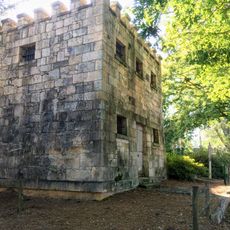
Dyar site, Archaeological site in Greene County, Georgia, United States.

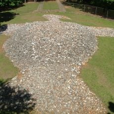
The Dyar site is an archaeological location in Greene County featuring a platform mound roughly 33 feet (10 meters) high with a base around 170 feet (52 meters) across. The area spans several hectares and contains layered deposits from different periods of occupation by Mississippian peoples.

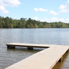
The settlement served as a principal center of the Ocute chiefdom from around 1100 to 1600, playing a key role in the broader Mississippian world. The site was eventually submerged beneath Lake Oconee, making access to its remains limited to research and documentation work.

The site served as a major center for Mississippian peoples, with two main buildings that reveal how daily and ritual life were organized. One structure was dedicated to food preparation, while the other shows evidence of ceremonial activities that held spiritual importance for the community.

The site is now submerged, but research records from past excavations are available through national archaeological databases and institutions. Visitors interested in the location can learn about it through digital resources and museum collections that house artifacts recovered from the site.

Pottery styles in different layers reveal changes in craft traditions across five centuries, showing how the community evolved over time. This layered record helps archaeologists track cultural shifts and how people adapted their practices across generations.

Location: Georgia

GPS coordinates: 33.59330,-83.27100

Latest update: December 12, 2025 12:05

Photos
Around this place
Sanford Stadium
United States of America

Sanford Stadium

40.8 km
Rock Eagle Effigy Mound
United States of America

Rock Eagle Effigy Mound

22.4 km
Stegeman Coliseum
United States of America

Stegeman Coliseum

40.1 km
Hard Labor Creek State Park
United States of America

Hard Labor Creek State Park

31 km
Liberty Hall
United States of America

Liberty Hall

35 km
Athens Confederate Monument
United States of America

Athens Confederate Monument

37.8 km
A. H. Stephens State Park
United States of America

A. H. Stephens State Park

34.8 km
The State Botanical Garden of Georgia
United States of America

The State Botanical Garden of Georgia

35.7 km
Madison Historic District
United States of America

Madison Historic District

18.6 km
Eagle Tavern
United States of America

Eagle Tavern

32.8 km
Richard B. Russell Library for Political Research and Studies
United States of America

Richard B. Russell Library for Political Research and Studies

41.5 km
Carter-Newton House
United States of America

Carter-Newton House

18.9 km
Elder's Mill Covered Bridge and Elder Mill
United States of America

Elder's Mill Covered Bridge and Elder Mill

24.9 km
Morgan County Courthouse
United States of America

Morgan County Courthouse

18.1 km
Springfield Baptist Church (Greensboro, Georgia)
United States of America

Springfield Baptist Church (Greensboro, Georgia)

8.8 km
Jefferson Hall
United States of America

Jefferson Hall

21.5 km
Terrell-Sadler House
United States of America

Terrell-Sadler House

20.3 km
Siloam Historic District
United States of America

Siloam Historic District

18.7 km
Bethesda Baptist Church and Cemetery
United States of America

Bethesda Baptist Church and Cemetery

25.1 km
A. H. Stephens State Park
United States of America

A. H. Stephens State Park

35 km
United States of America

Wilkins House

41.2 km
Dr. Calvin M. Baber House
United States of America

Dr. Calvin M. Baber House

9.1 km
John O'Flaherty House
United States of America

John O'Flaherty House

8.7 km
Eatonton Historic District
United States of America

Eatonton Historic District

31.7 km
Bear Hollow Zoo
United States of America

Bear Hollow Zoo

38.7 km
Greene County Courthouse
United States of America

Greene County Courthouse

8.4 km
Zachry-Kingston House
United States of America

Zachry-Kingston House

10.7 km
Greensboro Commercial Historic District
United States of America

Greensboro Commercial Historic District

8.4 km
Show the full map
Reviews

Visited this place? Tap the stars to rate it and share your experience / photos with the community! Try now! You can cancel it anytime.

« Dyar site - Archaeological site in Greene County, Georgia, United States » is provided by Around Us (aroundus.com). Images and texts are derived from Wikimedia project under a Creative Commons license. You are allowed to copy, distribute, and modify copies of this page, under the conditions set by the license, as long as this note is clearly visible.

Discover hidden gems everywhere you go!

From secret cafés to breathtaking viewpoints, skip the crowded tourist spots and find places that match your style. Our app makes it easy with voice search, smart filtering, route optimization, and insider tips from travelers worldwide. Download now for the complete mobile experience.

Around Us App Screenshot

A unique approach to discovering new places

Le Figaro

All the places worth exploring

France Info

A tailor-made excursion in just a few clicks

20 Minutes