Chest opened
+${chestReward.xp} XP
Explorer
NOUVEAU ×${chestReward.collectible.quantity}
tapez pour fermer
Chest locked

Open chests in the app

Around Us is built for your phone — chests unlock when you walk, explore and capture nearby places.

Enable Location

We need your location to show you interesting places around you

Discover nearby places

Find interesting locations and hidden gems around you

Precise directions

Get accurate directions and distances to places

Your location is never shared with other users. It's only used when you tap the location button.

Log in to your account

Start exploring — it's free

Trusted by 72,984 travelers worldwide

Continue with Google
Continue with Apple
or

We will send you a code to connect

By continuing, you accept our Terms and Conditions and our Privacy Policy

Check your inbox

We've sent a pincode in your inbox. Please enter the code below.

Dames Point Light
Discussion Reviews Photo
1.3k Popularity

Dames Point Light, River lighthouse at St. Johns River, United States

Dames Point Light was a square metal tower built on six wooden pilings with cast-iron sleeves to reinforce the structure. It was positioned at a bend in the St. Johns River to warn boat captains of a shallow underwater ridge.

The light was authorized by Congress in 1871 and began operating in 1872 to guide ships through this dangerous section of the river. Over time, newer light signals were installed further downriver, making this tower obsolete.

The lighthouse served as a vital reference point for boats traveling up and down the river. Ship captains relied on its light to safely steer through shallow and treacherous waters.

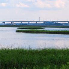
The site sits along the riverbank and is best accessed by boat, since the structure stands in the water. Views and photographs of the ruins can be captured from nearby land areas or from a river tour.

An earthquake in 1886 damaged the structure, prompting the installation of copper lightning rods for protection. These early safety improvements show how operators worked to shield the tower from natural hazards.

The community of curious travelers

AroundUs brings together thousands of curated places, local tips, and hidden gems, enriched daily by 60,000 contributors worldwide.

Start exploring
Location
GPS coordinates
30.38330,-81.55440
Latest update
December 14, 2025 18:11
Around this place
Daily's Place
United States of America

Daily's Place

10.5 km
Fort Caroline
United States of America

Fort Caroline

5.2 km
Dames Point Bridge
United States of America

Dames Point Bridge

467 m
United States of America

Jacksonville Sheriff's Office

11.4 km
Mathews Bridge
United States of America

Mathews Bridge

8.8 km
Hart Bridge
United States of America

Hart Bridge

10.3 km
First Baptist Church of Jacksonville
United States of America

First Baptist Church of Jacksonville

11.5 km
Norman Studios
United States of America

Norman Studios

6.7 km
Metropolitan Park
United States of America

Metropolitan Park

10.7 km
Morocco Temple
United States of America

Morocco Temple

11.5 km
D. B. Milne Field
United States of America

D. B. Milne Field

5.7 km
Bethel Baptist Institutional Church
United States of America

Bethel Baptist Institutional Church

11.3 km
Yellow Bluff Fort Historic State Park
United States of America

Yellow Bluff Fort Historic State Park

1.8 km
Karpeles Manuscript Library Museum, Jacksonville
United States of America

Karpeles Manuscript Library Museum, Jacksonville

11.1 km
Henry John Klutho House
United States of America

Henry John Klutho House

10.5 km
Marabanong
United States of America

Marabanong

9.8 km
Jacksonville Fire Museum
United States of America

Jacksonville Fire Museum

11.3 km
Mount Zion AME Church
United States of America

Mount Zion AME Church

9.8 km
Trout River Bridge
United States of America

Trout River Bridge

10.8 km
United States of America

Old St. Luke's Hospital

11 km
Charles E. Bennett Memorial Bridge
United States of America

Charles E. Bennett Memorial Bridge

11 km
John S. Sammis House
United States of America

John S. Sammis House

8.8 km
Merrill House Museum
United States of America

Merrill House Museum

10.6 km
Hands on Childrens Museum
United States of America

Hands on Childrens Museum

10.8 km
South Atlantic Investment Corporation Building
United States of America

South Atlantic Investment Corporation Building

11.2 km
Tree Hill Nature Center
United States of America

Tree Hill Nature Center

6.2 km
Buckman and Ulmer Building
United States of America

Buckman and Ulmer Building

11.2 km
St. Andrew's Episcopal Church
United States of America

St. Andrew's Episcopal Church

10.7 km
Show the full map
Reviews
Share your experience

No review yet

Discussions
Start a discussion...

No discussion yet

« Dames Point Light - River lighthouse at St. Johns River, United States » is provided by Around Us (aroundus.com). Images and texts are derived from Wikimedia project under a Creative Commons license. You are allowed to copy, distribute, and modify copies of this page, under the conditions set by the license, as long as this note is clearly visible.

Discover hidden gems everywhere you go!

From secret cafés to breathtaking viewpoints, skip the crowded tourist spots and find places that match your style. Our app makes it easy with voice search, smart filtering, route optimization, and insider tips from travelers worldwide. Download now for the complete mobile experience.

Around Us App Screenshot

A unique approach to discovering new places

Le Figaro

All the places worth exploring

France Info

A tailor-made excursion in just a few clicks

20 Minutes

Around Us
Travel Guide & Maps
Download

Send to your phone

QR Code
1

Open the camera app on your mobile.

2

Point at the QR code with your camera. A notification will appear.

3

Tap the notification to open the link.