Enable Location

We need your location to show you interesting places around you

Discover nearby places

Find interesting locations and hidden gems around you

Precise directions

Get accurate directions and distances to places

Your location is never shared with other users. It's only used when you tap the location button.

Fort Caroline

Log in to your account

Start exploring — it's free

Trusted by 63,016 travelers worldwide

Continue with Google
Continue with Apple
or

We will send you a code to connect

By continuing, you accept our Terms and Conditions and our Privacy Policy

Check your inbox

We've sent a pincode in your inbox. Please enter the code below.

Discussion Reviews 1 Photos
47.7k Popularity

Fort Caroline, Historic district in Arlington, Jacksonville, United States.

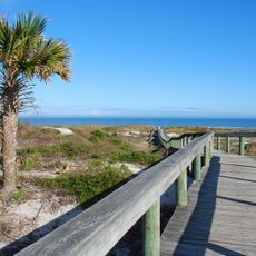
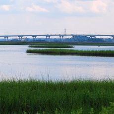
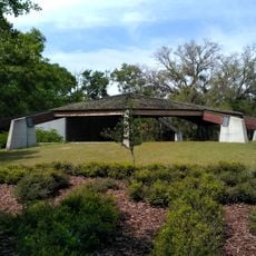
Fort Caroline is a national memorial in Arlington, a neighborhood of Jacksonville in Florida. The site includes a reconstructed wooden stockade, exhibit halls, and several trails through wetlands and forest along the St. Johns River.

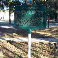
French Huguenots established the first settlement in 1564, naming it after their king Charles IX. Spanish forces under Pedro Menéndez de Avilés captured it in 1565 and renamed it San Mateo.

The replica shows how a 16th-century wooden fort was built, with pointed palisades forming a triangular layout. Visitor panels explain the encounters between French Huguenots and the Timucua people who lived in the region at that time.

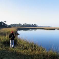
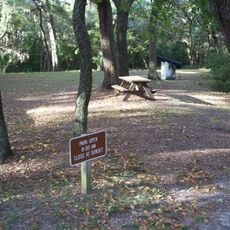
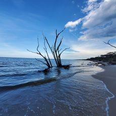
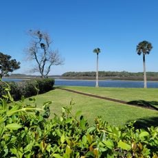
The memorial sits within Timucuan Ecological Preserve and is reached via Fort Caroline Road. Trails wind through shaded riverside areas, and a visitor center shows films and distributes maps.

Archaeologists have searched for decades for the exact location of the original 16th-century fort. The current replica stands on a spot considered probable but never definitively confirmed.

The community of curious travelers

AroundUs brings together thousands of curated places, local tips, and hidden gems, enriched daily by 60,000 contributors worldwide.

Start exploring
Location
Inception
January 16, 1953
Architects
René Goulaine de Laudonnière
GPS coordinates
30.38690,-81.50060
Latest update
December 14, 2025 19:24
Around this place
Kingsley Plantation
United States of America

Kingsley Plantation

8.3 km
Dames Point Bridge
United States of America

Dames Point Bridge

5.5 km
Hanna Park
United States of America

Hanna Park

8.7 km
Mathews Bridge
United States of America

Mathews Bridge

13.1 km
Little Talbot Island State Park
United States of America

Little Talbot Island State Park

10.7 km
Hodges Stadium
United States of America

Hodges Stadium

12.5 km
Adventure Landing
United States of America

Adventure Landing

14 km
Norman Studios
United States of America

Norman Studios

10.7 km
Alhambra Dinner Theatre
United States of America

Alhambra Dinner Theatre

11.1 km
D. B. Milne Field
United States of America

D. B. Milne Field

10.6 km
Yellow Bluff Fort Historic State Park
United States of America

Yellow Bluff Fort Historic State Park

5.5 km
Boneyard Beach
United States of America

Boneyard Beach

13.8 km
San Juan del Puerto, Florida
United States of America

San Juan del Puerto, Florida

7.3 km
Ribault Inn Club
United States of America

Ribault Inn Club

8.6 km
Marabanong
United States of America

Marabanong

13.9 km
St. Johns River Light
United States of America

St. Johns River Light

7.2 km
121 Atlantic Place
United States of America

121 Atlantic Place

12.2 km
St. Johns Light
United States of America

St. Johns Light

9.9 km
Thomas G. Carpenter Library
United States of America

Thomas G. Carpenter Library

13.1 km
Napoleon Bonaparte Broward House
United States of America

Napoleon Bonaparte Broward House

6.7 km
Kingsley Plantation
United States of America

Kingsley Plantation

8.4 km
Charles E. Bennett Memorial Bridge
United States of America

Charles E. Bennett Memorial Bridge

6.3 km
John S. Sammis House
United States of America

John S. Sammis House

12.9 km
Hands on Childrens Museum
United States of America

Hands on Childrens Museum

12.9 km
Tree Hill Nature Center
United States of America

Tree Hill Nature Center

9.9 km
Regal Beach Boulevard 18
United States of America

Regal Beach Boulevard 18

12 km
Seminole Beach
United States of America

Seminole Beach

10.1 km
Ribault Club
United States of America

Ribault Club

8.6 km
Show the full map
Reviews
Share your experience

No review yet

Discussions
Start a discussion...

No discussion yet

« Fort Caroline - Historic district in Arlington, Jacksonville, United States » is provided by Around Us (aroundus.com). Images and texts are derived from Wikimedia project under a Creative Commons license. You are allowed to copy, distribute, and modify copies of this page, under the conditions set by the license, as long as this note is clearly visible.

Discover hidden gems everywhere you go!

From secret cafés to breathtaking viewpoints, skip the crowded tourist spots and find places that match your style. Our app makes it easy with voice search, smart filtering, route optimization, and insider tips from travelers worldwide. Download now for the complete mobile experience.

Around Us App Screenshot

A unique approach to discovering new places

Le Figaro

All the places worth exploring

France Info

A tailor-made excursion in just a few clicks

20 Minutes

Around Us
Travel Guide & Maps
Download

Send to your phone

QR Code
1

Open the camera app on your mobile.

2

Point at the QR code with your camera. A notification will appear.

3

Tap the notification to open the link.