Enable Location

We need your location to show you interesting places around you

Discover nearby places

Find interesting locations and hidden gems around you

Precise directions

Get accurate directions and distances to places

Your location is never shared with other users. It's only used when you tap the location button.

Hanna Park

Log in to your account

Start exploring — it's free

Trusted by 62,563 travelers worldwide

Continue with Google
Continue with Apple
or

We will send you a code to connect

By continuing, you accept our Terms and Conditions and our Privacy Policy

Check your inbox

We've sent a pincode in your inbox. Please enter the code below.

Hanna Park

Hanna Park, Coastal park in Jacksonville, United States.

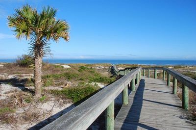
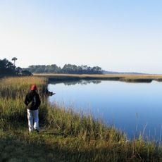
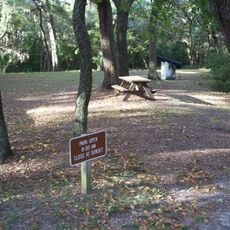
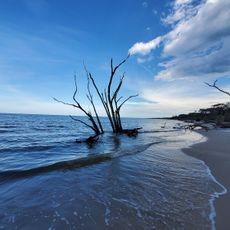
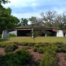
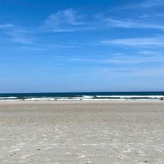
Hanna Park is a large coastal park in Jacksonville with direct access to an Atlantic Ocean beach and an inland freshwater lake surrounded by pine forest. The property features multiple sections developed for swimming, mountain biking, hiking, and water activities, all connected by trails.

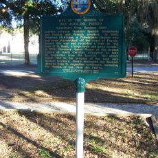
The site was originally called Manhattan Beach and functioned as the only recreational destination for Black Americans in Florida during the segregation era until 1932. The area underwent transformation and reopened as a public park later in the 20th century under its current name.

The park maintains multiple facilities for outdoor activities, including surfing at The Poles section, mountain biking trails, and camping areas.

The park is accessible by car with parking areas distributed throughout different zones based on activity type. Arriving early, particularly on weekends, helps ensure space availability and allows time to enjoy the popular trails and water areas.

The site is known among mountain biking enthusiasts for trails with colorful names like Grunt and Misery that host organized competitions. These routes attract riders from across the region seeking the challenge and reputation the location has built.

The community of curious travelers

AroundUs brings together thousands of curated places, local tips, and hidden gems, enriched daily by 60,000 contributors worldwide.

Start exploring
Location
Inception
1967
GPS coordinates
30.37530,-81.41080
Latest update
December 7, 2025 20:23
Around this place
Fort Caroline
United States of America

Fort Caroline

8.7 km
Kingsley Plantation
United States of America

Kingsley Plantation

7.5 km
Dames Point Bridge
United States of America

Dames Point Bridge

14.2 km
Little Talbot Island State Park
United States of America

Little Talbot Island State Park

8.6 km
Hodges Stadium
United States of America

Hodges Stadium

14.8 km
Adventure Landing
United States of America

Adventure Landing

9.8 km
Freebird Live
United States of America

Freebird Live

9.6 km
Norman Studios
United States of America

Norman Studios

18.2 km
Alhambra Dinner Theatre
United States of America

Alhambra Dinner Theatre

13.1 km
Amelia Island State Park
United States of America

Amelia Island State Park

17.4 km
D. B. Milne Field
United States of America

D. B. Milne Field

18.8 km
Yellow Bluff Fort Historic State Park
United States of America

Yellow Bluff Fort Historic State Park

14.2 km
Boneyard Beach
United States of America

Boneyard Beach

14.6 km
San Juan del Puerto, Florida
United States of America

San Juan del Puerto, Florida

4.3 km
Ribault Inn Club
United States of America

Ribault Inn Club

5.9 km
St. Johns River Light
United States of America

St. Johns River Light

2.5 km
121 Atlantic Place
United States of America

121 Atlantic Place

5.8 km
St. Johns Light
United States of America

St. Johns Light

1.7 km
Casa Marina Hotel
United States of America

Casa Marina Hotel

9.2 km
Thomas G. Carpenter Library
United States of America

Thomas G. Carpenter Library

15.1 km
Napoleon Bonaparte Broward House
United States of America

Napoleon Bonaparte Broward House

3.7 km
Kingsley Plantation
United States of America

Kingsley Plantation

7.6 km
Charles E. Bennett Memorial Bridge
United States of America

Charles E. Bennett Memorial Bridge

3.4 km
Hands on Childrens Museum
United States of America

Hands on Childrens Museum

18 km
Tree Hill Nature Center
United States of America

Tree Hill Nature Center

17.2 km
Regal Beach Boulevard 18
United States of America

Regal Beach Boulevard 18

10.2 km
Seminole Beach
United States of America

Seminole Beach

2.3 km
Ribault Club
United States of America

Ribault Club

6 km
Show the full map
« Hanna Park - Coastal park in Jacksonville, United States » is provided by Around Us (aroundus.com). Images and texts are derived from Wikimedia project under a Creative Commons license. You are allowed to copy, distribute, and modify copies of this page, under the conditions set by the license, as long as this note is clearly visible.

Discover hidden gems everywhere you go!

From secret cafés to breathtaking viewpoints, skip the crowded tourist spots and find places that match your style. Our app makes it easy with voice search, smart filtering, route optimization, and insider tips from travelers worldwide. Download now for the complete mobile experience.

Around Us App Screenshot

A unique approach to discovering new places

Le Figaro

All the places worth exploring

France Info

A tailor-made excursion in just a few clicks

20 Minutes

Around Us
Travel Guide & Maps
Download

Send to your phone

QR Code
1

Open the camera app on your mobile.

2

Point at the QR code with your camera. A notification will appear.

3

Tap the notification to open the link.