Chest opened
+${chestReward.xp} XP
Explorer
NOUVEAU ×${chestReward.collectible.quantity}
tapez pour fermer
Chest locked

Open chests in the app

Around Us is built for your phone — chests unlock when you walk, explore and capture nearby places.

Enable Location

We need your location to show you interesting places around you

Discover nearby places

Find interesting locations and hidden gems around you

Precise directions

Get accurate directions and distances to places

Your location is never shared with other users. It's only used when you tap the location button.

St. Marys River

Log in to your account

Start exploring — it's free

Trusted by 72,880 travelers worldwide

Continue with Google
Continue with Apple
or

We will send you a code to connect

By continuing, you accept our Terms and Conditions and our Privacy Policy

Check your inbox

We've sent a pincode in your inbox. Please enter the code below.

St. Marys River
Discussion Reviews 1 Photos
14k Popularity

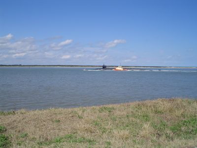
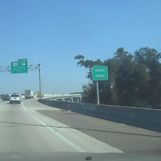
St. Marys River, Natural border river in southeastern Georgia and Florida, United States.

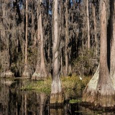
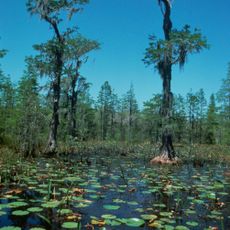
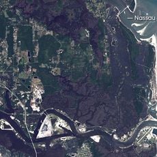
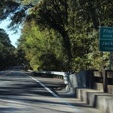
St. Marys River is a waterway that forms the boundary between Georgia and Florida. It flows for about 130 miles from the Okefenokee Swamp to Cumberland Sound, passing through thick forests and swampland where the water appears dark due to tannins from vegetation.

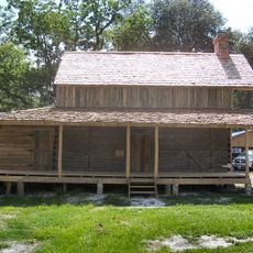
French explorer Jean Ribault discovered this river in 1562 and named it the Seine based on his own geography. The Timucua people who lived here long before had their own name for the waterway, reflecting thousands of years of inhabitation.

The river basin maintains diverse wildlife populations, including 52 fish species, deer, otters, beavers, raccoons, alligators, and red-cockaded woodpeckers.

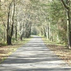
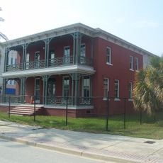
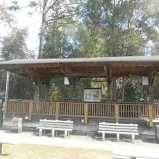
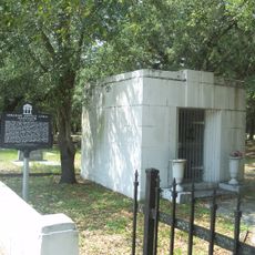
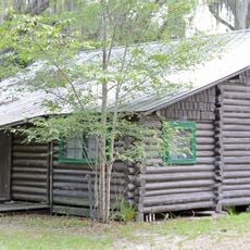
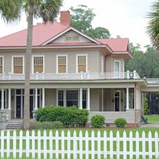
You can access this river at several parks where boating and fishing are popular activities. Many spots offer camping and rest areas, making it easy to spend time exploring the water and nearby woods.

The river changes direction several times during its journey, flowing south, east, and north before reaching the Atlantic between two towns. This winding path means the trip downriver is longer than you might expect from a straight line on the map.

The community of curious travelers

AroundUs brings together thousands of curated places, local tips, and hidden gems, enriched daily by 60,000 contributors worldwide.

Start exploring
GPS coordinates
30.59357,-82.01183
Latest update
December 7, 2025 20:23
Around this place
Edward Waters College
United States of America

Edward Waters College

41.9 km
Prime F. Osborn III Convention Center
United States of America

Prime F. Osborn III Convention Center

44.1 km
J. P. Small Memorial Stadium
United States of America

J. P. Small Memorial Stadium

42.4 km
Stephen C. Foster State Park
United States of America

Stephen C. Foster State Park

42.4 km
Jacksonville-Baldwin Rail Trail
United States of America

Jacksonville-Baldwin Rail Trail

35.9 km
Ritz Theatre
United States of America

Ritz Theatre

43.9 km
United States of America

Cecil Commerce Center

43.7 km
Theatre Jacksonville
United States of America

Theatre Jacksonville

44 km
Okefenokee Wilderness
United States of America

Okefenokee Wilderness

40.9 km
Brewster Hospital
United States of America

Brewster Hospital

44 km
Henry John Klutho House
United States of America

Henry John Klutho House

43.9 km
Murray Hill Theatre
United States of America

Murray Hill Theatre

42 km
Folkston Railfan Platform
United States of America

Folkston Railfan Platform

26.4 km
Trout River Bridge
United States of America

Trout River Bridge

39.6 km
Our Lady of the Angels Catholic Church
United States of America

Our Lady of the Angels Catholic Church

42.6 km
Old Baker County Courthouse
United States of America

Old Baker County Courthouse

36.5 km
Glen Saint Mary Nurseries Company
United States of America

Glen Saint Mary Nurseries Company

41 km
Burnsed Blockhouse
United States of America

Burnsed Blockhouse

36.9 km
Charlton County Courthouse
United States of America

Charlton County Courthouse

26.5 km
Lewis Mausoleum
United States of America

Lewis Mausoleum

38.4 km
Kingsland Commercial Historic District
United States of America

Kingsland Commercial Historic District

38.4 km
Machaba Balu Preserve
United States of America

Machaba Balu Preserve

28.2 km
John M. Hopkins Cabin
United States of America

John M. Hopkins Cabin

19.6 km
William Mizell, Sr., House
United States of America

William Mizell, Sr., House

26.8 km
Florida–Georgia border
United States of America

Florida–Georgia border

38.1 km
Heritage Park
United States of America

Heritage Park

37 km
The Selfie Showroom
United States of America

The Selfie Showroom

37.1 km
Folkston Railroad Transportation Museum
United States of America

Folkston Railroad Transportation Museum

26.5 km
Show the full map
Reviews
Share your experience

No review yet

Discussions
Start a discussion...

No discussion yet

« St. Marys River - Natural border river in southeastern Georgia and Florida, United States » is provided by Around Us (aroundus.com). Images and texts are derived from Wikimedia project under a Creative Commons license. You are allowed to copy, distribute, and modify copies of this page, under the conditions set by the license, as long as this note is clearly visible.

Discover hidden gems everywhere you go!

From secret cafés to breathtaking viewpoints, skip the crowded tourist spots and find places that match your style. Our app makes it easy with voice search, smart filtering, route optimization, and insider tips from travelers worldwide. Download now for the complete mobile experience.

Around Us App Screenshot

A unique approach to discovering new places

Le Figaro

All the places worth exploring

France Info

A tailor-made excursion in just a few clicks

20 Minutes

Around Us
Travel Guide & Maps
Download

Send to your phone

QR Code
1

Open the camera app on your mobile.

2

Point at the QR code with your camera. A notification will appear.

3

Tap the notification to open the link.