Summerville, Historic town in South Carolina, United States
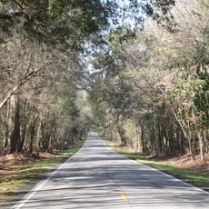
Summerville is a town in South Carolina that spreads across three counties and is shaped by pine forests and flowering gardens. The streets run through shady avenues, and along many residential areas stand old trees with overhanging branches.
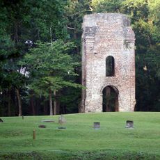
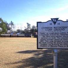
Plantation owners from Charleston founded the place in 1847 as a retreat during the warm months. The elevation and pines offered cooler air and protection from diseases that were common along the coast.
The name Flowertown refers to the azaleas and camellias that bloom along wide streets in spring. Visitors see the plants in private front yards as well as in public parks, where locals walk and hold picnics.
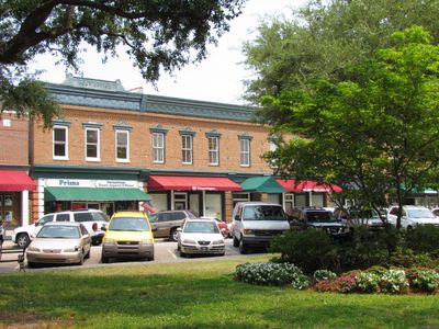
The visitor center offers maps and information about accommodations and restaurants in the area. The downtown can be explored on foot, with most paths flat and shaded.
A large container shaped like a mason jar filled with sweet tea stands in the town center and bears the name Mason. The entry in the Guinness Book of Records connects the town with the invention of this drink in the American South.
Location: Dorchester County
Location: Berkeley County
Location: Charleston County
Inception: 1847
Elevation above the sea: 27 m
Website: http://summerville.sc.us
GPS coordinates: 33.01850,-80.17565
Latest update: December 4, 2025 23:40
Magnolia Plantation and Gardens
18 km
Drayton Hall
18.9 km
Middleton Place
13.5 km
Charleston Naval Shipyard
26.4 km
Mepkin Abbey
23.7 km
Lewisfield Plantation
23.2 km
Magnolia Plantation
17.9 km
Cypress Gardens
21.4 km
Edmondston-Alston House
21.1 km
Medway
19.2 km
Colonial Dorchester State Historic Site
7.7 km
Mulberry Plantation (Moncks Corner, South Carolina)
20.1 km
Don N. Holt Bridge
24.4 km
South Carolina Highway 61
14.2 km
Givhans Ferry State Park
18.9 km
John F. Limehouse Memorial Bridge
26.7 km
Cypress Gardens
21 km
Ashley River Historic District
12.8 km
General William C. Westmoreland Bridge
24.8 km
St. Andrews Episcopal Church
23.3 km
Old White Meeting House Ruins and Cemetery
6.2 km
Gippy Plantation
23.3 km
Charleston Navy Yard Officers' Quarters Historic District
25.5 km
Cypress Methodist Camp Ground
9.6 km
Stono River Slave Rebellion Site
25.9 km
Taveau Church
24.1 km
St. Paul's Church
1.3 km
Regal Charles Towne Square Stadium 18
21.8 kmReviews
Visited this place? Tap the stars to rate it and share your experience / photos with the community! Try now! You can cancel it anytime.
Discover hidden gems everywhere you go!
From secret cafés to breathtaking viewpoints, skip the crowded tourist spots and find places that match your style. Our app makes it easy with voice search, smart filtering, route optimization, and insider tips from travelers worldwide. Download now for the complete mobile experience.
A unique approach to discovering new places❞
— Le Figaro
All the places worth exploring❞
— France Info
A tailor-made excursion in just a few clicks❞
— 20 Minutes