Enable Location

We need your location to show you interesting places around you

Discover nearby places

Find interesting locations and hidden gems around you

Precise directions

Get accurate directions and distances to places

Your location is never shared with other users. It's only used when you tap the location button.

Log in to your account

Start exploring — it's free

Trusted by 61,816 travelers worldwide

Continue with Google
Continue with Apple
or

We will send you a code to connect

By continuing, you accept our Terms and Conditions and our Privacy Policy

Check your inbox

We've sent a pincode in your inbox. Please enter the code below.

The Battery

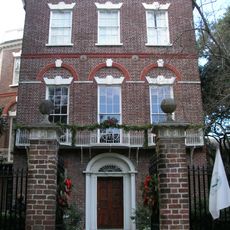
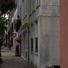
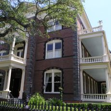
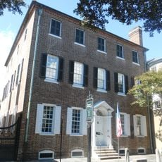
The Battery, Historic seawall and promenade in Charleston, United States

Description

The Battery is a paved promenade at the tip of the Charleston peninsula where the Ashley and Cooper Rivers meet at Charleston Harbor. A sturdy stone wall runs along the waterfront and creates an elevated walkway with views across the water toward the opposite shores.

History

The original Broughton's Battery was built in 1737 for coastal defense and was later expanded and reinforced. The current stone wall dates to the 1750s and represents a pivotal chapter in Charleston's military past.

Culture

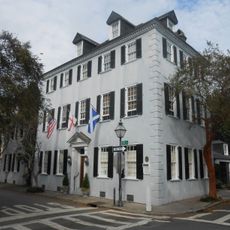
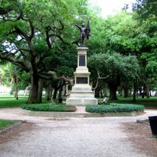
The name originates from its original defensive military role, and the place now serves as a social gathering point for locals and visitors. The White Point Garden at the center features ancient oak trees where people walk and rest beneath the shade.

Practical

The site is easy to reach on foot and the path is level and well-paved, making it comfortable for a stroll in most weather conditions. The best times to visit are early morning or late afternoon when the sun is lower and temperatures are more pleasant.

Did you know?

The Williams Music Pavilion was built in 1907 at the center of White Point Garden and now hosts open-air concerts and cultural events. This covered structure serves as a gathering place for local performances and brings music and community life beneath the ancient trees.

Location
Shares border with
White Point Gardens
GPS coordinates
32.76920,-79.92880
Latest update
December 15, 2025 13:21

AroundUs brings together thousands of curated places, local tips, and hidden gems, enriched daily by 60,000 contributors worldwide. Discover all places nearby (Charleston).

Around this place
Nathaniel Russell House
United States of America

Nathaniel Russell House

575 m
White Point Gardens
United States of America

White Point Gardens

150 m
Rainbow Row
United States of America

Rainbow Row

677 m
Calhoun Mansion
United States of America

Calhoun Mansion

280 m
Heyward-Washington House
United States of America

Heyward-Washington House

728 m
Miles Brewton House
United States of America

Miles Brewton House

534 m
Robert William Roper House
United States of America

Robert William Roper House

183 m
Sword Gate House
United States of America

Sword Gate House

702 m
Simmons-Edwards House
United States of America

Simmons-Edwards House

614 m
Col. John Ashe House
United States of America

Col. John Ashe House

320 m
First Presbyterian Church
United States of America

First Presbyterian Church

618 m
William Gibbes House
United States of America

William Gibbes House

427 m
U. S. Post Office and Courthouse
United States of America

U. S. Post Office and Courthouse

786 m
Robert Pringle House
United States of America

Robert Pringle House

675 m
Samuel Wainwright House
United States of America

Samuel Wainwright House

689 m
The Defenders of Fort Moultrie
United States of America

The Defenders of Fort Moultrie

88 m
Charles Drayton House
United States of America

Charles Drayton House

310 m
Robert Brewton House
United States of America

Robert Brewton House

587 m
Dubose Heyward House
United States of America

Dubose Heyward House

522 m
Colonel John Stuart House
United States of America

Colonel John Stuart House

729 m
Branford-Horry House
United States of America

Branford-Horry House

632 m
Clark Mills Studio
United States of America

Clark Mills Studio

773 m
Vanderhorst Row
United States of America

Vanderhorst Row

631 m
Thomas Rose House
United States of America

Thomas Rose House

464 m
Cleland Kinloch and Burnet R. Maybank Huger House
United States of America

Cleland Kinloch and Burnet R. Maybank Huger House

583 m
Albert W. Todd House
United States of America

Albert W. Todd House

430 m
George Mathews House
United States of America

George Mathews House

403 m
Historic Charleston Foundation
United States of America

Historic Charleston Foundation

475 m
Show the full map
« The Battery - Historic seawall and promenade in Charleston, United States » is provided by Around Us (aroundus.com). Images and texts are derived from Wikimedia project under a Creative Commons license. You are allowed to copy, distribute, and modify copies of this page, under the conditions set by the license, as long as this note is clearly visible.

Discover hidden gems everywhere you go!

From secret cafés to breathtaking viewpoints, skip the crowded tourist spots and find places that match your style. Our app makes it easy with voice search, smart filtering, route optimization, and insider tips from travelers worldwide. Download now for the complete mobile experience.

Around Us App Screenshot

A unique approach to discovering new places

Le Figaro

All the places worth exploring

France Info

A tailor-made excursion in just a few clicks

20 Minutes

Around Us
Travel Guide & Maps
Download

Send to your phone

QR Code
1

Open the camera app on your mobile.

2

Point at the QR code with your camera. A notification will appear.

3

Tap the notification to open the link.