Chest opened
+${chestReward.xp} XP
Explorer
NOUVEAU ×${chestReward.collectible.quantity}
tapez pour fermer
Chest locked

Open chests in the app

Around Us is built for your phone — chests unlock when you walk, explore and capture nearby places.

Enable Location

We need your location to show you interesting places around you

Discover nearby places

Find interesting locations and hidden gems around you

Precise directions

Get accurate directions and distances to places

Your location is never shared with other users. It's only used when you tap the location button.

Log in to your account

Start exploring — it's free

Trusted by 72,885 travelers worldwide

Continue with Google
Continue with Apple
or

We will send you a code to connect

By continuing, you accept our Terms and Conditions and our Privacy Policy

Check your inbox

We've sent a pincode in your inbox. Please enter the code below.

Dewees Island
Discussion Reviews Photo
10.1k Popularity

Dewees Island, Private barrier island in Charleston, United States.

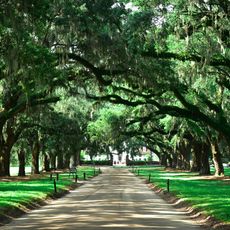
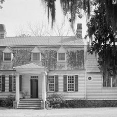
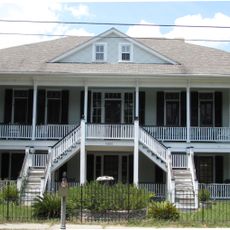
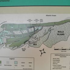
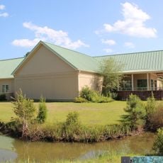
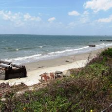
Dewees Island is a private barrier island north of Charleston that spans roughly 1,200 acres of oceanfront property with sandy beaches, salt marshes, and protected natural habitats. The land supports a small residential community while remaining largely undeveloped wilderness with native plants and local wildlife.

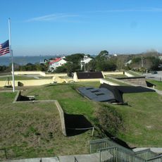
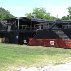
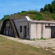
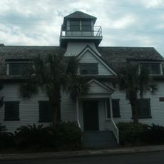
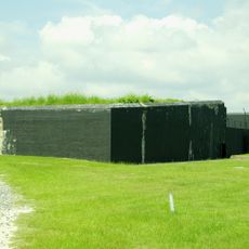
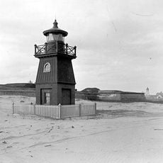
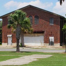
The island was originally hunting grounds for the Sewee Indians and later fell under British control before Cornelius Dewees acquired it and gave it his name. A World War II observation tower still stands on the property as evidence of its role in coastal defense during the war years.

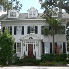
The residential community maintains strict environmental guidelines, prohibiting gas vehicles and limiting construction to preserve the natural landscape.

The island is accessible only by private ferry from Isle of Palms, and there are no stores or commercial services on site. Visitors should bring supplies, insect repellent, and appropriate clothing for weather that can change quickly.

The World War II submarine observation tower remains standing on the island as a reminder of its military significance during wartime.

The community of curious travelers

AroundUs brings together thousands of curated places, local tips, and hidden gems, enriched daily by 60,000 contributors worldwide.

Start exploring
Location
GPS coordinates
32.84017,-79.71647
Latest update
March 5, 2026 21:06
Around this place
Fort Moultrie
United States of America

Fort Moultrie

15.9 km
Sinking of USS Housatonic
United States of America

Sinking of USS Housatonic

15.9 km
Ben Sawyer Bridge
United States of America

Ben Sawyer Bridge

13.9 km
Boone Hall Plantation
United States of America

Boone Hall Plantation

10.2 km
Charleston Light
United States of America

Charleston Light

15 km
Oakland Plantation House
United States of America

Oakland Plantation House

6.6 km
Mount Pleasant Historic District
United States of America

Mount Pleasant Historic District

16.1 km
Christ Church
United States of America

Christ Church

9.1 km
Battery Thomson
United States of America

Battery Thomson

14.7 km
Battery Gadsden
United States of America

Battery Gadsden

14.6 km
U.S. Coast Guard Historic District
United States of America

U.S. Coast Guard Historic District

15 km
Old Berkeley County Courthouse
United States of America

Old Berkeley County Courthouse

15.1 km
Battery Jasper
United States of America

Battery Jasper

15.8 km
Moultrieville Historic District
United States of America

Moultrieville Historic District

16 km
Sullivan's Island Range Lights
United States of America

Sullivan's Island Range Lights

15.8 km
Dr. John B. Patrick House
United States of America

Dr. John B. Patrick House

14.9 km
Sullivan's Island Historic District
United States of America

Sullivan's Island Historic District

15.1 km
Bull Island
United States of America

Bull Island

12.6 km
Snee Farm House
United States of America

Snee Farm House

10.1 km
Osceola's tomb
United States of America

Osceola's tomb

16 km
Fort Moultrie Visitor Center
United States of America

Fort Moultrie Visitor Center

15.9 km
Smokehouse
United States of America

Smokehouse

10.2 km
Fort Moultrie Quartermaster and Support Facilities Historic District
United States of America

Fort Moultrie Quartermaster and Support Facilities Historic District

15.6 km
Stella Maris Catholic Church
United States of America

Stella Maris Catholic Church

16 km
1809 Powder Magazine
United States of America

1809 Powder Magazine

16 km
Patapsco Monument
United States of America

Patapsco Monument

16 km
Sewee Visitor and Environmental Education Center
United States of America

Sewee Visitor and Environmental Education Center

15.6 km
Sullivan's Island Beach
United States of America

Sullivan's Island Beach

15 km
Show the full map
Reviews
Share your experience

No review yet

Discussions
Start a discussion...

No discussion yet

« Dewees Island - Private barrier island in Charleston, United States » is provided by Around Us (aroundus.com). Images and texts are derived from Wikimedia project under a Creative Commons license. You are allowed to copy, distribute, and modify copies of this page, under the conditions set by the license, as long as this note is clearly visible.

Discover hidden gems everywhere you go!

From secret cafés to breathtaking viewpoints, skip the crowded tourist spots and find places that match your style. Our app makes it easy with voice search, smart filtering, route optimization, and insider tips from travelers worldwide. Download now for the complete mobile experience.

Around Us App Screenshot

A unique approach to discovering new places

Le Figaro

All the places worth exploring

France Info

A tailor-made excursion in just a few clicks

20 Minutes

Around Us
Travel Guide & Maps
Download

Send to your phone

QR Code
1

Open the camera app on your mobile.

2

Point at the QR code with your camera. A notification will appear.

3

Tap the notification to open the link.