Chest opened
+${chestReward.xp} XP
Explorer
NOUVEAU ×${chestReward.collectible.quantity}
tapez pour fermer
Chest locked

Open chests in the app

Around Us is built for your phone — chests unlock when you walk, explore and capture nearby places.

Enable Location

We need your location to show you interesting places around you

Discover nearby places

Find interesting locations and hidden gems around you

Precise directions

Get accurate directions and distances to places

Your location is never shared with other users. It's only used when you tap the location button.

Santa Ynez River

Log in to your account

Start exploring — it's free

Trusted by 72,882 travelers worldwide

Continue with Google
Continue with Apple
or

We will send you a code to connect

By continuing, you accept our Terms and Conditions and our Privacy Policy

Check your inbox

We've sent a pincode in your inbox. Please enter the code below.

Santa Ynez River
Discussion Reviews 1 Photos
9k Popularity

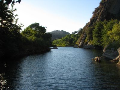
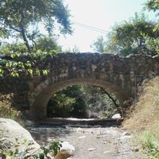
Santa Ynez River, River system in Santa Barbara County, United States.

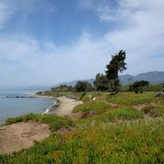
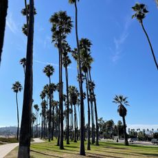
The Santa Ynez River is a river in Santa Barbara County, California, rising in the Santa Ynez Mountains and flowing generally westward before reaching the Pacific Ocean. Several dams cross its course, creating reservoirs that supply water to the surrounding region.

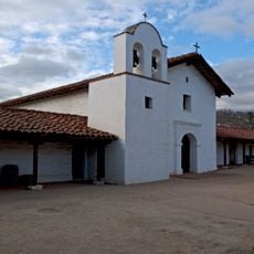
Spanish explorers of the Portolà expedition first recorded this river in 1769, calling it Río Grande de San Verardo. The name changed after a nearby mission was established, and the river has carried its current name ever since.

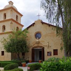
The river takes its name from Mission Santa Inés, founded in the early 1800s and dedicated to Saint Agnes of Rome. The Spanish form of the saint's name gradually shifted to the anglicized Santa Ynez that appears on maps today.

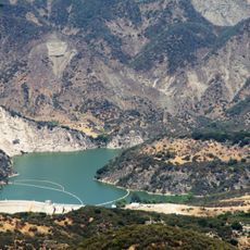
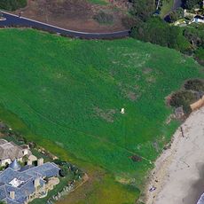
Lake Cachuma is the most accessible point along the river and is easy to reach by car from nearby towns. Spring and fall tend to offer cooler temperatures, which makes outdoor time along the water more enjoyable.

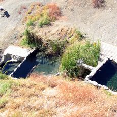
The river supports a population of California golden beavers whose dams create pools that shelter the Tidewater goby, a fish found on the endangered species list. Without the beavers' work, these fish would have far fewer places to survive along the lower stretches of the river.

The community of curious travelers

AroundUs brings together thousands of curated places, local tips, and hidden gems, enriched daily by 60,000 contributors worldwide.

Start exploring
Elevation above the sea
2 m
GPS coordinates
34.47778,-119.44750
Latest update
March 3, 2026 10:13
Around this place
El Fureidis
United States of America

El Fureidis

18.7 km
Moreton Bay Fig Tree
United States of America

Moreton Bay Fig Tree

23.7 km
Presidio of Santa Barbara
United States of America

Presidio of Santa Barbara

23.8 km
Lotusland
United States of America

Lotusland

19.6 km
Santa Barbara Bowl
United States of America

Santa Barbara Bowl

23.2 km
Stearns Wharf
United States of America

Stearns Wharf

23.2 km
Santa Barbara Zoo
United States of America

Santa Barbara Zoo

20.9 km
Carpinteria State Beach
United States of America

Carpinteria State Beach

11.7 km
Casa del Herrero
United States of America

Casa del Herrero

18 km
Camp Ramah in California
United States of America

Camp Ramah in California

16.8 km
Santa Barbara Vedanta Temple
United States of America

Santa Barbara Vedanta Temple

12.7 km
Gibraltar Dam
United States of America

Gibraltar Dam

22.6 km
Rafael Gonzalez House
United States of America

Rafael Gonzalez House

23.6 km
Charles M. Pratt House
United States of America

Charles M. Pratt House

17.8 km
Santa Barbara Museum of Natural History Sea Center
United States of America

Santa Barbara Museum of Natural History Sea Center

23.1 km
East Beach
United States of America

East Beach

22.7 km
East Beach
United States of America

East Beach

22.6 km
Bart's Books
United States of America

Bart's Books

18.4 km
Foster Park Bowl
United States of America

Foster Park Bowl

18.8 km
San Buenaventura Mission Aqueduct
United States of America

San Buenaventura Mission Aqueduct

20.9 km
United States of America

Covarrubias Adobe

23.7 km
St. Thomas Aquinas Chapel
United States of America

St. Thomas Aquinas Chapel

18.6 km
Big Caliente Hot Springs
United States of America

Big Caliente Hot Springs

12.7 km
Allan Herschell 3-Abreast Carousel
United States of America

Allan Herschell 3-Abreast Carousel

22.9 km
Shalawa Meadow, California
United States of America

Shalawa Meadow, California

18.6 km
The Wolf Museum of Exploration and Innovation
United States of America

The Wolf Museum of Exploration and Innovation

23.5 km
Acacia Lodge
United States of America

Acacia Lodge

17.8 km
Rattlesnake Canyon Bridge
United States of America

Rattlesnake Canyon Bridge

22.6 km
Show the full map
Reviews
Share your experience

No review yet

Discussions
Start a discussion...

No discussion yet

« Santa Ynez River - River system in Santa Barbara County, United States » is provided by Around Us (aroundus.com). Images and texts are derived from Wikimedia project under a Creative Commons license. You are allowed to copy, distribute, and modify copies of this page, under the conditions set by the license, as long as this note is clearly visible.

Discover hidden gems everywhere you go!

From secret cafés to breathtaking viewpoints, skip the crowded tourist spots and find places that match your style. Our app makes it easy with voice search, smart filtering, route optimization, and insider tips from travelers worldwide. Download now for the complete mobile experience.

Around Us App Screenshot

A unique approach to discovering new places

Le Figaro

All the places worth exploring

France Info

A tailor-made excursion in just a few clicks

20 Minutes

Around Us
Travel Guide & Maps
Download

Send to your phone

QR Code
1

Open the camera app on your mobile.

2

Point at the QR code with your camera. A notification will appear.

3

Tap the notification to open the link.