Enable Location

We need your location to show you interesting places around you

Discover nearby places

Find interesting locations and hidden gems around you

Precise directions

Get accurate directions and distances to places

Your location is never shared with other users. It's only used when you tap the location button.

Muir Beach Overlook

Log in to your account

Start exploring — it's free

Trusted by 63,360 travelers worldwide

Continue with Google
Continue with Apple
or

We will send you a code to connect

By continuing, you accept our Terms and Conditions and our Privacy Policy

Check your inbox

We've sent a pincode in your inbox. Please enter the code below.

Muir Beach Overlook
Discussion Reviews 1 Photos
2.5k Popularity

Muir Beach Overlook, Coastal viewpoint in Marin County, United States.

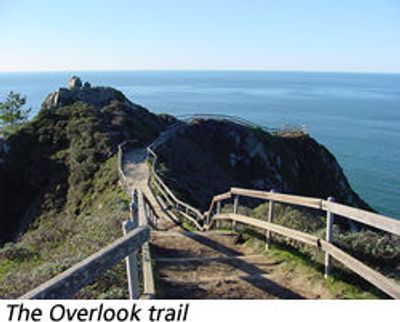
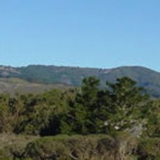
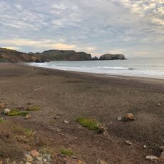
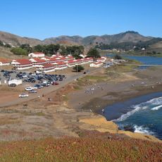
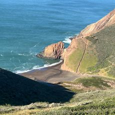
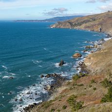
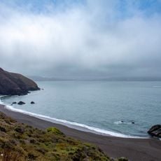
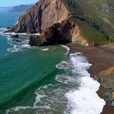
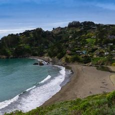
Muir Beach Overlook is a coastal viewpoint featuring views across 120-meter cliffs, offshore rock formations, and the rugged Pacific shoreline. The site sits within a protected recreation area connected to a network of hiking trails popular with photographers and outdoor enthusiasts.

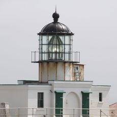
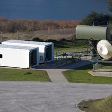
The site once held military installations used during wartime to monitor aircraft and ships approaching San Francisco. These fortifications formed part of a larger coastal defense network protecting the bay.

The observation point connects to a network of hiking paths within the Golden Gate National Recreation Area, frequented by nature photographers and hikers.

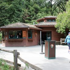
A parking area with restroom facilities and picnic tables sits at the trailhead, from which a short walk of about 200 yards leads to the main viewing platform. Clear days offer the best conditions for visiting, as visibility stretches far across the water and rock formations stand out clearly.

During winter months, visitors can spot gray whales migrating along the Pacific coast from this vantage point, with their movements visible directly from the overlook. This annual migration offers a rare chance to watch the whales from a nearby shore location.

The community of curious travelers

AroundUs brings together thousands of curated places, local tips, and hidden gems, enriched daily by 60,000 contributors worldwide.

Start exploring
Location
GPS coordinates
37.86310,-122.58600
Latest update
December 12, 2025 17:42
Around this place
United States of America

Druid Heights

3.4 km
U.S. Army Corps of Engineers Bay Model
United States of America

U.S. Army Corps of Engineers Bay Model

8 km
Point Bonita Lighthouse
United States of America

Point Bonita Lighthouse

7.3 km
SF-88
United States of America

SF-88

6.5 km
Mount Tamalpais State Park
United States of America

Mount Tamalpais State Park

4.5 km
Green Gulch Farm Zen Center
United States of America

Green Gulch Farm Zen Center

2 km
Rodeo Beach
United States of America

Rodeo Beach

5.7 km
Fort Cronkhite
United States of America

Fort Cronkhite

5.7 km
2 AM Club
United States of America

2 AM Club

5.7 km
Sweetwater Saloon
United States of America

Sweetwater Saloon

5.7 km
Fort Barry
United States of America

Fort Barry

6.6 km
Cushing Memorial Amphitheatre
United States of America

Cushing Memorial Amphitheatre

5.9 km
Benjamin and Hilarita Lyford House
United States of America

Benjamin and Hilarita Lyford House

8.6 km
Edgewood Botanic Garden
United States of America

Edgewood Botanic Garden

5 km
Congregation Kol Shofar
United States of America

Congregation Kol Shofar

8.7 km
Sausalito Library
United States of America

Sausalito Library

8.5 km
Bothin Marsh
United States of America

Bothin Marsh

6.1 km
Silva Island
United States of America

Silva Island

6.8 km
Alley
United States of America

Alley

5.9 km
Tennessee Beach
United States of America

Tennessee Beach

3.8 km
Scenic viewpoint
United States of America

Scenic viewpoint

158 m
Black Sands Beach
United States of America

Black Sands Beach

8.1 km
Scenic viewpoint
United States of America

Scenic viewpoint

4.1 km
Muir Woods Visitor Center
United States of America

Muir Woods Visitor Center

3.5 km
Muir Beach
United States of America

Muir Beach

880 m
Muir Woods National Monument Historic District
United States of America

Muir Woods National Monument Historic District

3.7 km
Muir Woods National Monument Entrance Gate
United States of America

Muir Woods National Monument Entrance Gate

3.5 km
Muir Woods National Monument Administration-Concession Building
United States of America

Muir Woods National Monument Administration-Concession Building

3.6 km
Show the full map
Reviews
Share your experience

No review yet

Discussions
Start a discussion...

No discussion yet

« Muir Beach Overlook - Coastal viewpoint in Marin County, United States » is provided by Around Us (aroundus.com). Images and texts are derived from Wikimedia project under a Creative Commons license. You are allowed to copy, distribute, and modify copies of this page, under the conditions set by the license, as long as this note is clearly visible.

Discover hidden gems everywhere you go!

From secret cafés to breathtaking viewpoints, skip the crowded tourist spots and find places that match your style. Our app makes it easy with voice search, smart filtering, route optimization, and insider tips from travelers worldwide. Download now for the complete mobile experience.

Around Us App Screenshot

A unique approach to discovering new places

Le Figaro

All the places worth exploring

France Info

A tailor-made excursion in just a few clicks

20 Minutes

Around Us
Travel Guide & Maps
Download

Send to your phone

QR Code
1

Open the camera app on your mobile.

2

Point at the QR code with your camera. A notification will appear.

3

Tap the notification to open the link.