Enable Location

We need your location to show you interesting places around you

Discover nearby places

Find interesting locations and hidden gems around you

Precise directions

Get accurate directions and distances to places

Your location is never shared with other users. It's only used when you tap the location button.

St. Helena High School

Log in to your account

Start exploring — it's free

Trusted by 62,429 travelers worldwide

Continue with Google
Continue with Apple
or

We will send you a code to connect

By continuing, you accept our Terms and Conditions and our Privacy Policy

Check your inbox

We've sent a pincode in your inbox. Please enter the code below.

St. Helena High School, high school in St. Helena, Napa County, California

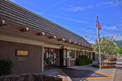
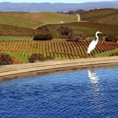
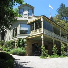
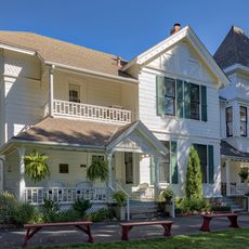
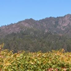
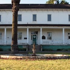
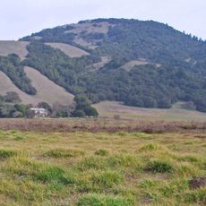
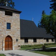
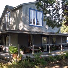
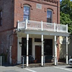
St. Helena High School is a public school serving grades 9 through 12 in a small California town. The campus includes a restored stone building from 1912, modern classrooms, sports facilities, and sits near vineyards that surround the area.

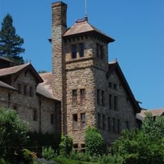
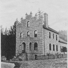
The school was founded in 1912 on land donated by Frances Grayson Crane, supporting the town's growth. After seismic safety concerns in the 1960s prompted the halt of classes in the original building, restoration work in 2003 made it earthquake-resistant and preserved it.

The school building anchors community life in St. Helena, hosting sports events, theater performances, and band concerts where students and families gather. These gatherings reflect the town's identity and how residents connect through the school's daily activities.

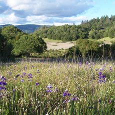
The school sits near Main Street, making it easy to locate, and is surrounded by vineyards. Access to the campus may be limited to certain areas, so checking with the office about visiting conditions beforehand is helpful.

The school has a sister relationship with Nuriootpa High School in South Australia, allowing students to learn about other cultures. Several alumni have pursued notable careers, including filmmaker Sofia Coppola.

The community of curious travelers

AroundUs brings together thousands of curated places, local tips, and hidden gems, enriched daily by 60,000 contributors worldwide.

Start exploring
Location
Inception
1897
GPS coordinates
38.49750,-122.46056
Latest update
February 7, 2026 11:00
Around this place
Valle de Napa
United States of America

Valle de Napa

12.2 km
Petrified Forest
United States of America

Petrified Forest

16.9 km
Culinary Institute of America at Greystone
United States of America

Culinary Institute of America at Greystone

2.8 km
Sugarloaf Ridge State Park
United States of America

Sugarloaf Ridge State Park

7.3 km
Bothe-Napa Valley State Park
United States of America

Bothe-Napa Valley State Park

7.7 km
Schramsberg Vineyards
United States of America

Schramsberg Vineyards

9.1 km
Trione-Annadel State Park
United States of America

Trione-Annadel State Park

16.2 km
Elmshaven
United States of America

Elmshaven

4.7 km
Mount Hood
United States of America

Mount Hood

9.2 km
William Hood House
United States of America

William Hood House

11.8 km
Sonoma Botanical Garden
United States of America

Sonoma Botanical Garden

14.4 km
Lake Suttonfield
United States of America

Lake Suttonfield

16.7 km
Bennett Mountain
United States of America

Bennett Mountain

17.1 km
Pacific Union College Church
United States of America

Pacific Union College Church

8.3 km
Sam Brannan Cottage
United States of America

Sam Brannan Cottage

13.8 km
Rector Reservoir
United States of America

Rector Reservoir

12.4 km
Pope Street Bridge
United States of America

Pope Street Bridge

1.6 km
Atkinson House
United States of America

Atkinson House

6.4 km
James H. Francis House
United States of America

James H. Francis House

13.7 km
Grace Episcopal Church
United States of America

Grace Episcopal Church

981 m
Chateau Pacheteau
United States of America

Chateau Pacheteau

12.7 km
John Lee Webber House
United States of America

John Lee Webber House

13.4 km
St. Helena Historic Commercial District
United States of America

St. Helena Historic Commercial District

1.1 km
Dominus Winery
United States of America

Dominus Winery

12.8 km
Chauvet Building
United States of America

Chauvet Building

16.1 km
Richie Block
United States of America

Richie Block

1.1 km
Veterans Home of California Chapel
United States of America

Veterans Home of California Chapel

14.5 km
Maxwell Creek Bridge on Hardin Road
United States of America

Maxwell Creek Bridge on Hardin Road

14 km
Show the full map
« St. Helena High School - high school in St. Helena, Napa County, California » is provided by Around Us (aroundus.com). Images and texts are derived from Wikimedia project under a Creative Commons license. You are allowed to copy, distribute, and modify copies of this page, under the conditions set by the license, as long as this note is clearly visible.

Discover hidden gems everywhere you go!

From secret cafés to breathtaking viewpoints, skip the crowded tourist spots and find places that match your style. Our app makes it easy with voice search, smart filtering, route optimization, and insider tips from travelers worldwide. Download now for the complete mobile experience.

Around Us App Screenshot

A unique approach to discovering new places

Le Figaro

All the places worth exploring

France Info

A tailor-made excursion in just a few clicks

20 Minutes

Around Us
Travel Guide & Maps
Download

Send to your phone

QR Code
1

Open the camera app on your mobile.

2

Point at the QR code with your camera. A notification will appear.

3

Tap the notification to open the link.