Enable Location

We need your location to show you interesting places around you

Discover nearby places

Find interesting locations and hidden gems around you

Precise directions

Get accurate directions and distances to places

Your location is never shared with other users. It's only used when you tap the location button.

Trione-Annadel State Park

Log in to your account

Start exploring — it's free

Trusted by travelers worldwide

Continue with Google
Continue with Apple
or

We will send you a code to connect

By continuing, you accept our Terms and Conditions and our Privacy Policy

Check your inbox

We've sent a pincode in your inbox. Please enter the code below.

Trione-Annadel State Park

Trione-Annadel State Park, State park in Sonoma County, California.

Description

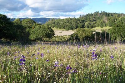
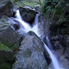
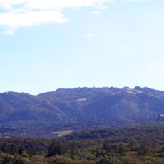
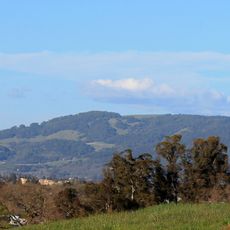
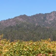
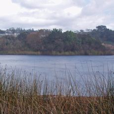
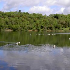
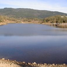
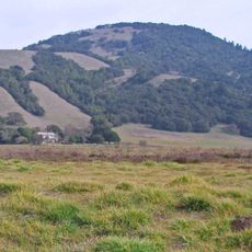
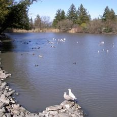
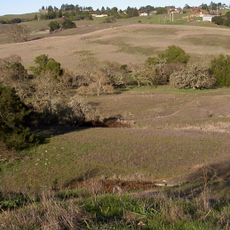
Trione-Annadel State Park is a large protected area in Sonoma County covering thousands of acres with diverse natural features. The landscape includes oak woodlands, volcanic rock formations, seasonal streams, meadows, redwood groves, grasslands, and a 26-acre lake that supports various plants and animals.

History

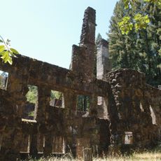
The park was established in 1971 to protect the natural landscape. The area beneath its current boundaries was once home to the Wymore Quarry, which extracted stone for San Francisco's streets and buildings from the late 1800s until the 1920s.

Culture

The park serves as a gathering place where locals come to hike, mountain bike, and ride horses along its many routes. These activities shape how people experience and connect with the natural landscape throughout the seasons.

Practical

The park provides roughly 40 kilometers of trails suitable for hiking, mountain biking, and horseback riding at various difficulty levels. Plan visits during cooler months since much of the terrain is exposed with limited shade from trees.

Did you know?

The park is home to rare California red-legged frogs found in Ledson Marsh, the same species mentioned in Mark Twain's famous tale about jumping frogs from Calaveras County. Spotting these frogs during a visit connects travelers to a story that inspired American literature.

Location
Inception
1971
Phone
GPS coordinates
38.42920,-122.62500
Latest update
December 9, 2025 18:49

AroundUs brings together thousands of curated places, local tips, and hidden gems, enriched daily by 60,000 contributors worldwide. Discover all places nearby (Sonoma County).

Around this place
Jack London State Historic Park
United States of America

Jack London State Historic Park

11.2 km
Charles M. Schulz Museum and Research Center
United States of America

Charles M. Schulz Museum and Research Center

10.2 km
Wolf House
United States of America

Wolf House

11.3 km
Sugarloaf Ridge State Park
United States of America

Sugarloaf Ridge State Park

11 km
McDonald Mansion
United States of America

McDonald Mansion

7.3 km
Sonoma Mountain
United States of America

Sonoma Mountain

12.6 km
Taylor Mountain
United States of America

Taylor Mountain

5.4 km
Luther Burbank Home and Gardens
United States of America

Luther Burbank Home and Gardens

7.6 km
Mount Hood
United States of America

Mount Hood

7.1 km
Church of One Tree
United States of America

Church of One Tree

7.8 km
Naval Auxiliary Landing Field Santa Rosa
United States of America

Naval Auxiliary Landing Field Santa Rosa

12.3 km
Fountaingrove Lake
United States of America

Fountaingrove Lake

10.2 km
Sonoma Mountain Zen Center
United States of America

Sonoma Mountain Zen Center

8.1 km
William Hood House
United States of America

William Hood House

4.5 km
Lake Ralphine
United States of America

Lake Ralphine

4.7 km
Sonoma Botanical Garden
United States of America

Sonoma Botanical Garden

11.4 km
Lake Suttonfield
United States of America

Lake Suttonfield

12.6 km
Sonoma County Museum
United States of America

Sonoma County Museum

8.3 km
Bennett Mountain
United States of America

Bennett Mountain

1.8 km
De Turk Round Barn
United States of America

De Turk Round Barn

8.7 km
Roberts Lake
United States of America

Roberts Lake

10.3 km
Crane Creek Regional Park
United States of America

Crane Creek Regional Park

9.4 km
Sonoma State Observatory
United States of America

Sonoma State Observatory

11 km
Children's Museum of Sonoma County
United States of America

Children's Museum of Sonoma County

10.4 km
Fountaingrove Round Barn
United States of America

Fountaingrove Round Barn

10.3 km
Cambria Hotel
United States of America

Cambria Hotel

12.1 km
Wasserman House
United States of America

Wasserman House

8.4 km
Chauvet Building
United States of America

Chauvet Building

11.4 km
Show the full map
« Trione-Annadel State Park - State park in Sonoma County, California » is provided by Around Us (aroundus.com). Images and texts are derived from Wikimedia project under a Creative Commons license. You are allowed to copy, distribute, and modify copies of this page, under the conditions set by the license, as long as this note is clearly visible.

Discover hidden gems everywhere you go!

From secret cafés to breathtaking viewpoints, skip the crowded tourist spots and find places that match your style. Our app makes it easy with voice search, smart filtering, route optimization, and insider tips from travelers worldwide. Download now for the complete mobile experience.

Around Us App Screenshot

A unique approach to discovering new places

Le Figaro

All the places worth exploring

France Info

A tailor-made excursion in just a few clicks

20 Minutes

Around Us
Travel Guide & Maps
Download

Send to your phone

QR Code
1

Open the camera app on your mobile.

2

Point at the QR code with your camera. A notification will appear.

3

Tap the notification to open the link.