Enable Location

We need your location to show you interesting places around you

Discover nearby places

Find interesting locations and hidden gems around you

Precise directions

Get accurate directions and distances to places

Your location is never shared with other users. It's only used when you tap the location button.

Sugarloaf Ridge State Park

Log in to your account

Start exploring — it's free

Trusted by travelers worldwide

Continue with Google
Continue with Apple
or

We will send you a code to connect

By continuing, you accept our Terms and Conditions and our Privacy Policy

Check your inbox

We've sent a pincode in your inbox. Please enter the code below.

Sugarloaf Ridge State Park

Sugarloaf Ridge State Park, State park in Mayacamas Mountains, Northern California.

Description

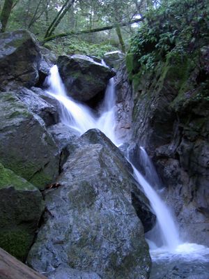
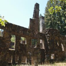
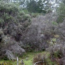
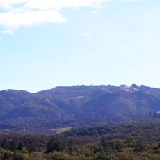
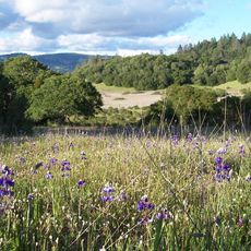
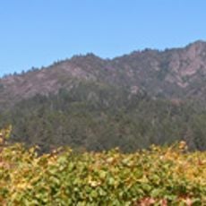
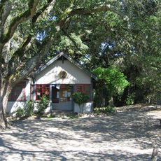
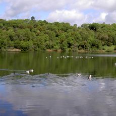
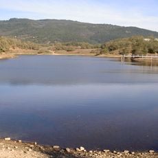
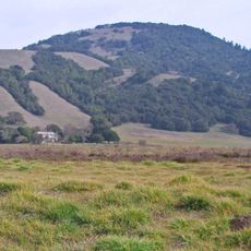
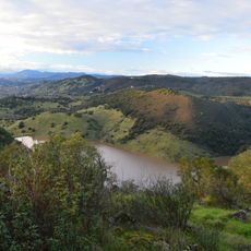
Sugarloaf Ridge State Park is a natural area in the Mayacamas Mountains featuring volcanic rock formations and two prominent peaks with views across the region. The park contains hiking trails, mountain biking routes, and overnight camping facilities for visitors.

History

The area became a state park in 1964, protecting the region's natural landscape for public use. After closure, community efforts helped restore and reopen the park for visitors.

Culture

The Onasáti people first inhabited this region, developing agricultural practices and creating distinctive basketry from local materials.

Practical

The park is open year-round and offers trails of different difficulty levels for various skill levels. Bring plenty of water and sun protection since shaded areas are limited and elevation can affect your pace.

Did you know?

An astronomical observatory within the park allows visitors to observe stars and planets through telescopes under clear night skies. This facility attracts people interested in exploring the cosmos from a location far from city lights.

Location
Location
GPS coordinates
38.44000,-122.50000
Latest update
December 8, 2025 19:57

AroundUs brings together thousands of curated places, local tips, and hidden gems, enriched daily by 60,000 contributors worldwide. Discover all places nearby (Sonoma County).

Around this place
The French Laundry
United States of America

The French Laundry

12.5 km
Jack London State Historic Park
United States of America

Jack London State Historic Park

11.5 km
Culinary Institute of America at Greystone
United States of America

Culinary Institute of America at Greystone

8.4 km
Wolf House
United States of America

Wolf House

10.6 km
Sonoma Developmental Center
United States of America

Sonoma Developmental Center

10.5 km
Bothe-Napa Valley State Park
United States of America

Bothe-Napa Valley State Park

12.4 km
Sonoma Mountain
United States of America

Sonoma Mountain

14.6 km
Schramsberg Vineyards
United States of America

Schramsberg Vineyards

12.8 km
Trione-Annadel State Park
United States of America

Trione-Annadel State Park

11 km
St. Helena High School
United States of America

St. Helena High School

7.3 km
Elmshaven
United States of America

Elmshaven

11 km
Mount Hood
United States of America

Mount Hood

5.2 km
Sonoma Mountain Zen Center
United States of America

Sonoma Mountain Zen Center

10.6 km
William Hood House
United States of America

William Hood House

6.7 km
Lake Ralphine
United States of America

Lake Ralphine

14.7 km
Sonoma Botanical Garden
United States of America

Sonoma Botanical Garden

7.4 km
Lake Suttonfield
United States of America

Lake Suttonfield

9.7 km
Bennett Mountain
United States of America

Bennett Mountain

11.2 km
Rector Reservoir
United States of America

Rector Reservoir

14.1 km
Pope Street Bridge
United States of America

Pope Street Bridge

8.9 km
Arnold Drive Bridge
United States of America

Arnold Drive Bridge

10.1 km
Atkinson House
United States of America

Atkinson House

7.7 km
Grace Episcopal Church
United States of America

Grace Episcopal Church

7.5 km
John Lee Webber House
United States of America

John Lee Webber House

12.5 km
St. Helena Historic Commercial District
United States of America

St. Helena Historic Commercial District

7.7 km
Dominus Winery
United States of America

Dominus Winery

11.7 km
Chauvet Building
United States of America

Chauvet Building

8.9 km
Veterans Home of California Chapel
United States of America

Veterans Home of California Chapel

13 km
Show the full map
« Sugarloaf Ridge State Park - State park in Mayacamas Mountains, Northern California » is provided by Around Us (aroundus.com). Images and texts are derived from Wikimedia project under a Creative Commons license. You are allowed to copy, distribute, and modify copies of this page, under the conditions set by the license, as long as this note is clearly visible.

Discover hidden gems everywhere you go!

From secret cafés to breathtaking viewpoints, skip the crowded tourist spots and find places that match your style. Our app makes it easy with voice search, smart filtering, route optimization, and insider tips from travelers worldwide. Download now for the complete mobile experience.

Around Us App Screenshot

A unique approach to discovering new places

Le Figaro

All the places worth exploring

France Info

A tailor-made excursion in just a few clicks

20 Minutes

Around Us
Travel Guide & Maps
Download

Send to your phone

QR Code
1

Open the camera app on your mobile.

2

Point at the QR code with your camera. A notification will appear.

3

Tap the notification to open the link.