Napa County

Log in to your account

AroundUs is a community-driven map of interesting places, built by curious explorers like you. It grows with every review, story, and photo you share.
Connect to save your favorite spots, contribute locations, and create personalized routes.
By continuing, you accept our Terms and Conditions and our Privacy Policy
Add to collection
Map
Suggest a change
Share

Napa County, Wine region county in California, United States

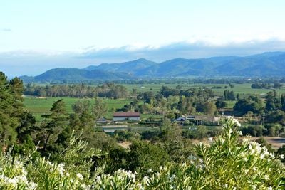
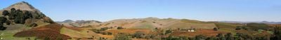
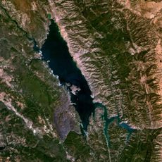
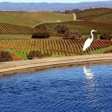
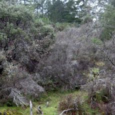
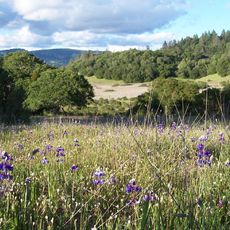
Napa County is an administrative unit in California stretching across valleys, ridges and waterways between San Pablo Bay and the Mayacamas Mountains. Most of the area consists of vineyards, oak woodlands and rolling hills crossed by small roads and scattered villages.

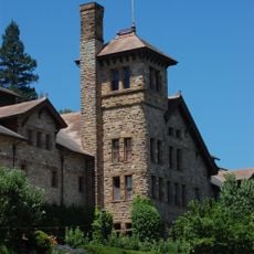
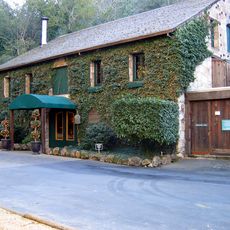
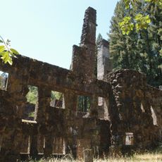
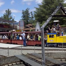
The unit formed in 1850 during California's founding period, when American settlers divided the old ranchos. In the 1970s the wine economy grew, and small wineries spread across the hills and valley floors where wheat fields and orchards once lay.

The name comes from the Wappo word for fish land, pointing to the early inhabitants of the valleys. Today wine culture runs through every corner: families harvest along the vine rows, winemakers guide visitors into small cellar rooms, and village shops hang handwritten signs for harvest festivals and market days.

Most public routes follow narrow country roads winding between vineyards and oak groves. Sun protection helps in summer, as the valleys heat up and shade is missing across the open farming areas.

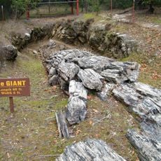
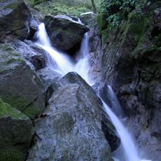
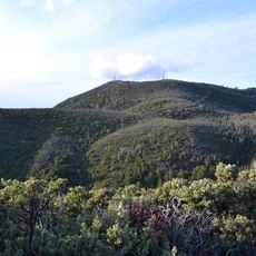
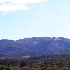
Mount Saint Helena rises to 1323 meters (4340 feet) and ranks as the second-highest peak in the San Francisco Bay region. On clear days hikers can see from the ridge all the way to the Pacific coast and the Sierra Nevada range to the east.

Location: California

Inception: 1850

Capital city: Napa

Shares border with: Lake County, Yolo County, Solano County, Sonoma County

Website: http://countyofnapa.org

GPS coordinates: 38.50000,-122.32000

Latest update: December 4, 2025 19:02

Around this place
Show the full map
The French Laundry
United States of America

The French Laundry

11.3 km
Sonoma Raceway
United States of America

Sonoma Raceway

39.6 km
Monticello Dam
United States of America

Monticello Dam

18.8 km
Napa Valley Wine Train
United States of America

Napa Valley Wine Train

22.2 km
Jack London State Historic Park
United States of America

Jack London State Historic Park

26.7 km
Valle de Napa
United States of America

Valle de Napa

0 m
Petrified Forest
United States of America

Petrified Forest

28.5 km
Culinary Institute of America at Greystone
United States of America

Culinary Institute of America at Greystone

14.4 km
Buena Vista Winery
United States of America

Buena Vista Winery

24.1 km
Wolf House
United States of America

Wolf House

25.6 km
Sonoma Developmental Center
United States of America

Sonoma Developmental Center

24.2 km
COPIA
United States of America

COPIA

22.2 km
Sugarloaf Ridge State Park
United States of America

Sugarloaf Ridge State Park

17.1 km
Robert Louis Stevenson State Park
United States of America

Robert Louis Stevenson State Park

30 km
Bothe-Napa Valley State Park
United States of America

Bothe-Napa Valley State Park

18 km
Sonoma Mountain
United States of America

Sonoma Mountain

29.7 km
Schramsberg Vineyards
United States of America

Schramsberg Vineyards

19.9 km
Sonoma Plaza
United States of America

Sonoma Plaza

25.8 km
Sonoma TrainTown Railroad
United States of America

Sonoma TrainTown Railroad

27.6 km
Trione-Annadel State Park
United States of America

Trione-Annadel State Park

27.7 km
St. Helena High School
United States of America

St. Helena High School

12.2 km
Sonoma Barracks
United States of America

Sonoma Barracks

25.9 km
Stebbins Cold Canyon Reserve
United States of America

Stebbins Cold Canyon Reserve

19.5 km
Elmshaven
United States of America

Elmshaven

14.4 km
Mount Hood
United States of America

Mount Hood

20.9 km
Blue Ridge Berryessa Natural Area
United States of America

Blue Ridge Berryessa Natural Area

28.7 km
Napa Valley Opera House
United States of America

Napa Valley Opera House

22.5 km
Mount Vaca
United States of America

Mount Vaca

21.7 km
Show the full map

Reviews

Visited this place? Tap the stars to rate it and share your experience / photos with the community! Try now! You can cancel it anytime.

Administrative divisions
« Napa County - Wine region county in California, United States » is provided by Around Us (aroundus.com). Images and texts are derived from Wikimedia project under a Creative Commons license. You are allowed to copy, distribute, and modify copies of this page, under the conditions set by the license, as long as this note is clearly visible.

Discover hidden gems everywhere you go!

From secret cafés to breathtaking viewpoints, skip the crowded tourist spots and find places that match your style. Our app makes it easy with voice search, smart filtering, route optimization, and insider tips from travelers worldwide. Download now for the complete mobile experience.

Around Us App Screenshot

A unique approach to discovering new places

Le Figaro

All the places worth exploring

France Info

A tailor-made excursion in just a few clicks

20 Minutes