Enable Location

We need your location to show you interesting places around you

Discover nearby places

Find interesting locations and hidden gems around you

Precise directions

Get accurate directions and distances to places

Your location is never shared with other users. It's only used when you tap the location button.

Robert Louis Stevenson State Park

Log in to your account

Start exploring — it's free

Trusted by 62,021 travelers worldwide

Continue with Google
Continue with Apple
or

We will send you a code to connect

By continuing, you accept our Terms and Conditions and our Privacy Policy

Check your inbox

We've sent a pincode in your inbox. Please enter the code below.

Robert Louis Stevenson State Park, State park with hiking trails and mountain summit in Napa County, United States.

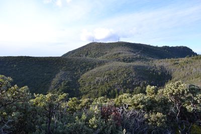
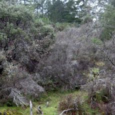
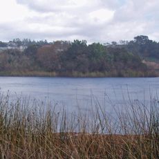
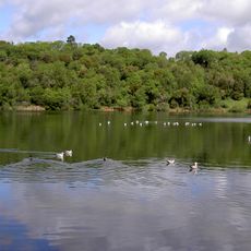
Robert Louis Stevenson State Park spans a large area across multiple counties, with forested sections, open brush-covered slopes, and Mount Saint Helena as its highest point. Trails wind through changing terrain and lead to the summit where views extend far across the region.

The location gained attention when author Robert Louis Stevenson spent part of his honeymoon there in the early 1880s at an old mining site. His time in the area influenced his writing and drew interest to the mountain and surrounding lands.

Mount Saint Helena inspired Robert Louis Stevenson during his time in the region and appears woven into his famous novels. The mountain's connection to his stories adds a literary layer to the natural landscape that hikers experience today.

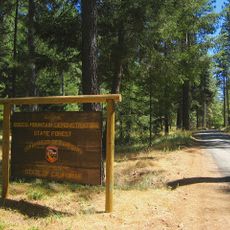
The park is accessible by car via a main highway, with parking near the trailheads and no entry fee required. Visitors should wear sturdy footwear since trails can be rocky and steep in places.

On clear days, the summit reveals distant views extending far across the landscape to other mountain peaks in the region. These rare panoramic moments reward the effort of climbing and offer perspective on the scale of the surrounding wilderness.

The community of curious travelers

AroundUs brings together thousands of curated places, local tips, and hidden gems, enriched daily by 60,000 contributors worldwide.

Start exploring
Location
Location
Location
Operator
California Department of Parks and Recreation
GPS coordinates
38.65340,-122.60300
Latest update
December 8, 2025 20:01
Around this place
Petrified Forest
United States of America

Petrified Forest

11.2 km
Culinary Institute of America at Greystone
United States of America

Culinary Institute of America at Greystone

18.6 km
Safari West
United States of America

Safari West

13.4 km
Bothe-Napa Valley State Park
United States of America

Bothe-Napa Valley State Park

13.7 km
Schramsberg Vineyards
United States of America

Schramsberg Vineyards

12.7 km
St. Helena High School
United States of America

St. Helena High School

21.3 km
Boggs Mountain Demonstration State Forest
United States of America

Boggs Mountain Demonstration State Forest

20 km
Elmshaven
United States of America

Elmshaven

16.9 km
Mount Hood
United States of America

Mount Hood

22 km
Luther Burbank Center for the Arts
United States of America

Luther Burbank Center for the Arts

21.9 km
Blue Ridge Berryessa Natural Area
United States of America

Blue Ridge Berryessa Natural Area

20.7 km
Fountaingrove Lake
United States of America

Fountaingrove Lake

21.1 km
William Hood House
United States of America

William Hood House

23.5 km
Lake Ralphine
United States of America

Lake Ralphine

22.8 km
Pacific Union College Church
United States of America

Pacific Union College Church

16.8 km
Sam Brannan Cottage
United States of America

Sam Brannan Cottage

8.3 km
Pope Street Bridge
United States of America

Pope Street Bridge

20.4 km
James H. and Frances E. Laughlin House
United States of America

James H. and Frances E. Laughlin House

22.2 km
James H. Francis House
United States of America

James H. Francis House

8.7 km
Grace Episcopal Church
United States of America

Grace Episcopal Church

20.4 km
Chateau Pacheteau
United States of America

Chateau Pacheteau

10.2 km
Fountaingrove Round Barn
United States of America

Fountaingrove Round Barn

22.5 km
Cunningham-Hembree Estate
United States of America

Cunningham-Hembree Estate

21.3 km
Swartz Creek Bridge on Aetna Springs Road
United States of America

Swartz Creek Bridge on Aetna Springs Road

11.1 km
St. Helena Historic Commercial District
United States of America

St. Helena Historic Commercial District

20.2 km
Stoke Ranch
United States of America

Stoke Ranch

21.1 km
Maxwell Creek Bridge on Hardin Road
United States of America

Maxwell Creek Bridge on Hardin Road

21 km
Richie Block
United States of America

Richie Block

20.2 km
Show the full map
« Robert Louis Stevenson State Park - State park with hiking trails and mountain summit in Napa County, United States » is provided by Around Us (aroundus.com). Images and texts are derived from Wikimedia project under a Creative Commons license. You are allowed to copy, distribute, and modify copies of this page, under the conditions set by the license, as long as this note is clearly visible.

Discover hidden gems everywhere you go!

From secret cafés to breathtaking viewpoints, skip the crowded tourist spots and find places that match your style. Our app makes it easy with voice search, smart filtering, route optimization, and insider tips from travelers worldwide. Download now for the complete mobile experience.

Around Us App Screenshot

A unique approach to discovering new places

Le Figaro

All the places worth exploring

France Info

A tailor-made excursion in just a few clicks

20 Minutes

Around Us
Travel Guide & Maps
Download

Send to your phone

QR Code
1

Open the camera app on your mobile.

2

Point at the QR code with your camera. A notification will appear.

3

Tap the notification to open the link.