Mount Hood, Mountain in Sonoma County, California, United States
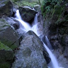
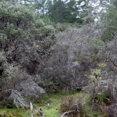
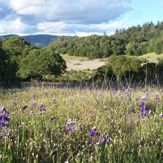
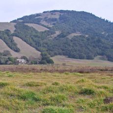
Mount Hood, also called Hood Mountain, is a 2,733-foot peak at the southeastern edge of Santa Rosa, California, in the Mayacamas Range. A large rock face shows on its upper half when seen from State Route 12, and Gunsight Point, a rocky outcrop near the summit, stands out on the ridgeline. Its slopes hold mixed oak forest, chaparral, pygmy forest and shaded riparian ravines.
The mountain was originally called Mount Wilikos, a Native American name meaning "willows." In prehistoric times its slopes were inhabited by a division of the Yuki tribe. Most of the mountain now lies within Hood Mountain Regional Park, maintained by Sonoma County, and it also appears as Hood Mountain on some maps.
The mountain's original name was Mount Wilikos, a Yuki word meaning "willows"; in prehistoric times its slopes were inhabited by a division of the Yuki tribe. Visitors today see the name carried on by Hood Mountain Regional Park, which covers most of the peak.
Mount Hood is most easily reached via State Route 12 along the Sonoma Valley floor, with close views from Kenwood, the Pythian Road junction and the Oakmont neighbourhood of Santa Rosa. Most of the mountain lies in Hood Mountain Regional Park, managed by Sonoma County. Trails climb steep terrain, and the upper western face is extensive rock outcrop. Precipitation averages about 30 inches a year, and rattlesnakes favour the sun-exposed west-facing rocky slopes.
The mountain's original name was Mount Wilikos, a Yuki word meaning "willows"; the Yuki inhabited its slopes in prehistoric times. A rocky outcrop near the peak, Gunsight Point, stands out on the ridgeline when seen from State Route 12 near Kenwood. Most of the mountain lies in Hood Mountain Regional Park.
The community of curious travelers
AroundUs brings together thousands of curated places, local tips, and hidden gems, enriched daily by 93,390 contributors worldwide.