Enable Location

We need your location to show you interesting places around you

Discover nearby places

Find interesting locations and hidden gems around you

Precise directions

Get accurate directions and distances to places

Your location is never shared with other users. It's only used when you tap the location button.

Lunar Orbiter Image Recovery Project

Log in to your account

Join the adventure

Create your free account and start exploring (like 60k+ others)

We will send you a code to connect

or
Continue with Google
Continue with Apple
By continuing, you accept our Terms and Conditions and our Privacy Policy

Check your inbox

We've sent a pincode in your inbox. Please enter the code below.

Lunar Orbiter Image Recovery Project

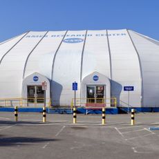
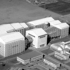
Lunar Orbiter Image Recovery Project, Space data recovery operation in Mountain View, California

Description

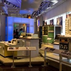
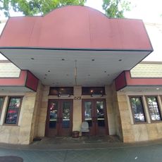
The Lunar Orbiter Image Recovery Project was a data processing center housed in a former McDonald's restaurant in Mountain View. Engineers there used restored Ampex magnetic tape drives to extract information from vintage recording media and convert photographs of the lunar surface into digital formats.

History

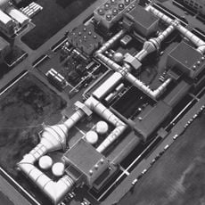
From 1966 to 1967, five Lunar Orbiter spacecraft captured high-resolution photographs of the Moon, creating mapping data that was essential for choosing Apollo landing sites. Decades later, this recovery project began to rescue those original tapes and convert their contents into modern formats.

Culture

The team worked to save recordings from the space age, digitizing tapes that contained the first complete photographic record of the Moon's surface. This effort kept an important chapter of 1960s space exploration alive for researchers and the public.

Practical

The building is located on the NASA Ames campus in Mountain View, so visits are typically only possible with prior permission. Those interested should contact NASA Ames in advance since it remains an active research facility.

Did you know?

The facility became known as 'McMoons' because it operated inside a converted fast-food restaurant. This unusual location became a symbol of how creative spaces can serve serious scientific work.

Location
GPS coordinates
37.40940,-122.05500
Latest update
December 18, 2025 11:40

AroundUs brings together thousands of curated places, local tips, and hidden gems, enriched daily by 60,000 contributors worldwide. Discover all places nearby (California).

Around this place
Computer History Museum
United States of America

Computer History Museum

2 km
Shoreline Amphitheatre
United States of America

Shoreline Amphitheatre

3 km
Hangar One
United States of America

Hangar One

403 m
Android sculptures
United States of America

Android sculptures

3.1 km
Gold Striker
United States of America

Gold Striker

7.2 km
Shoreline Park, Mountain View
United States of America

Shoreline Park, Mountain View

3.3 km
Our Lady of Peace Shrine
United States of America

Our Lady of Peace Shrine

7.2 km
Rengstorff House
United States of America

Rengstorff House

3.8 km
Palo Alto Baylands Nature Preserve
United States of America

Palo Alto Baylands Nature Preserve

7.2 km
Mountain View Center for the Performing Arts
United States of America

Mountain View Center for the Performing Arts

3.2 km
NASA Ames Exploration Center
United States of America

NASA Ames Exploration Center

801 m
Saint Joseph Parish
United States of America

Saint Joseph Parish

3.4 km
Unitary Plan Wind Tunnel
United States of America

Unitary Plan Wind Tunnel

967 m
Sunnyvale Heritage Park Museum
United States of America

Sunnyvale Heritage Park Museum

6.4 km
Los Altos History Museum
United States of America

Los Altos History Museum

6 km
Paul Shoup House
United States of America

Paul Shoup House

6.9 km
John W. Christian Greenbelt
United States of America

John W. Christian Greenbelt

3.1 km
Historic Adobe Building
United States of America

Historic Adobe Building

2.5 km
Moffett Field Historical Society Museum
United States of America

Moffett Field Historical Society Museum

254 m
The Foster Museum
United States of America

The Foster Museum

4.3 km
Century Cinema 16
United States of America

Century Cinema 16

2.2 km
Orchard Gardens Park
United States of America

Orchard Gardens Park

2.8 km
40- by 80-Foot Wind Tunnel
United States of America

40- by 80-Foot Wind Tunnel

912 m
Mountain View Public Library
United States of America

Mountain View Public Library

3.3 km
McKelvey Park
United States of America

McKelvey Park

3.9 km
Mountain View Theater
United States of America

Mountain View Theater

2.8 km
80- by 120-Foot Wind Tunnel
United States of America

80- by 120-Foot Wind Tunnel

1.1 km
3.5-Foot Hypersonic Wind Tunnel
United States of America

3.5-Foot Hypersonic Wind Tunnel

1.1 km
Show the full map
« Lunar Orbiter Image Recovery Project - Space data recovery operation in Mountain View, California » is provided by Around Us (aroundus.com). Images and texts are derived from Wikimedia project under a Creative Commons license. You are allowed to copy, distribute, and modify copies of this page, under the conditions set by the license, as long as this note is clearly visible.

Discover hidden gems everywhere you go!

From secret cafés to breathtaking viewpoints, skip the crowded tourist spots and find places that match your style. Our app makes it easy with voice search, smart filtering, route optimization, and insider tips from travelers worldwide. Download now for the complete mobile experience.

Around Us App Screenshot

A unique approach to discovering new places

Le Figaro

All the places worth exploring

France Info

A tailor-made excursion in just a few clicks

20 Minutes

Around Us
Travel Guide & Maps
Download

Send to your phone

QR Code
1

Open the camera app on your mobile.

2

Point at the QR code with your camera. A notification will appear.

3

Tap the notification to open the link.